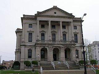
Ripley County is a county located at the southeastern corner of the U.S. state of Indiana. According to the 2020 Census, the population was 28,995. The county seat is Versailles.

Porter County is a county in the U.S. state of Indiana. As of 2020, the population was 173,215, making it the 10th most populous county in Indiana. The county seat is Valparaiso. The county is part of Northwest Indiana, as well as the Chicago metropolitan area. Porter County is the site of much of the Indiana Dunes, an area of ecological significance. The Hour Glass Museum in Ogden Dunes documents the region's ecological significance.

Orange County is located in Southern Indiana in the United States. As of 2020, its population was 19,867. The county seat is Paoli. The county has four incorporated settlements with a total population of about 8,600, as well as several small unincorporated communities. It is divided into 10 townships which provide local services. One U.S. route and five Indiana state roads pass through or into the county.

Noble County is a county in the U.S. state of Indiana. As of the 2020 United States Census, the population was 47,457. The county seat is Albion. The county is divided into 13 townships which provide local services. Noble County comprises the Kendallville, IN Micropolitan Statistical Area and is included in the Fort Wayne-Huntington-Auburn, IN Combined Statistical Area.

Marion County is located in the U.S. state of Indiana. The 2020 United States census reported a population of 977,203, making it the 54th-most populous county in the U.S., the most populous county in the state, and the main population center of the 11-county Indianapolis–Carmel–Greenwood MSA in central Indiana. Indianapolis is the county seat, the state capital, and most populous city. Marion County is consolidated with Indianapolis through an arrangement known as Unigov.

Madison County is a county in the U.S. state of Indiana. The 2020 census states the population is standing at 130,129. The county seat since 1836 has been Anderson, one of three incorporated cities within the county. Madison County is included in the Indianapolis-Carmel-Anderson, IN Metropolitan Statistical Area.

Kosciusko County is a county in the U.S. state of Indiana. At the 2020 United States Census, its population was 80,240. The county seat is Warsaw. The county was organized in 1836. It was named after the Polish general Tadeusz Kościuszko who served in the American Revolutionary War and then returned to Poland. The county seat is named after Warsaw, the capital of Poland.

Johnson County is a county located in the U.S. state of Indiana. As of 2020, the population was 161,765. The county seat is Franklin. Johnson County is included in the Indianapolis-Carmel-Anderson, IN Metropolitan Statistical Area.

Howard County is one of 92 counties in the U.S. state of Indiana. As of the 2020 census, the population was 83,658. The county seat is Kokomo. Originally named Richardville County, it was renamed in 1846 to commemorate General Tilghman Ashurst Howard.

Hancock County is a county in the U.S. state of Indiana. The 2020 United States Census recorded a population of 79,840. The county seat is Greenfield.

Greene County is a county in the U.S. state of Indiana. As of 2020, the population was 30,803. The county seat is Bloomfield. The county was determined by the US Census Bureau to include the mean center of U.S. population in 1930.

Grant County is a county in central Indiana in the United States Midwest. At the time of the 2020 census, the population was 66,674. The county seat is Marion. Important paleontological discoveries, dating from the Pliocene epoch, have been made at the Pipe Creek Sinkhole in Grant County.

Decatur County is a county in the U.S. state of Indiana. As of the 2020 United States Census, the population was 26,472. The county seat is Greensburg.

Daviess County is a county in the U.S. state of Indiana. As of the 2020 United States Census, the population was 33,381. The county seat is Washington. About 15% of the county's population is Amish of Swiss origin, as of 2017.

Carroll County is a county located in the U.S. state of Indiana. As of the 2020 United States Census, the population was 20,306. The county seat is Delphi.

Boone County is a county in the U.S. state of Indiana. As of 2020, the population was 70,812. The county seat is Lebanon.

Zionsville is a suburban town located in the extreme southeast area of Boone County, Indiana, United States, northwest of Indianapolis. The population was 14,160 at the 2010 census, 30,693 at the 2020 census.

St. John or Saint John is a town in Lake County, Indiana, United States. The town of St. John has homes in St. John Township, Hanover Township, and Center Township. It is a southeastern suburb of Chicago. St. John was founded in 1837. The population was 14,850 at the 2010 census. In 2009, St. John ranked 48th among CNN's top 100 places to live in the United States. In 2014, St. John was ranked as the 4th safest place in Indiana by Movoto Real Estate.

Notre Dame is a census-designated place and unincorporated community north of the city of South Bend in St. Joseph County, in the U.S. state of Indiana. It includes the campuses of three colleges: the University of Notre Dame, Saint Mary's College, and Holy Cross College. Notre Dame is split between Clay and Portage townships. As of the 2020 census, its population was 7,234.

Brownstown Township is one of twelve townships in Jackson County, Indiana, United States. At the 2020 census, its population was 5,664 and it contained 2,318 housing units.


