Weiherhammer

Last updated
Weiherhammer
Wappen Weiherhammer.svg
Coat of arms
Location of Weiherhammer within Neustadt a.d.Waldnaab district
Weiherhammer in NEW.svg
Germany adm location map.svg
Red pog.svg
Weiherhammer
Bavaria location map.svg
Red pog.svg
Weiherhammer
Coordinates: 49°38′N12°4′E / 49.633°N 12.067°E / 49.633; 12.067 Coordinates: 49°38′N12°4′E / 49.633°N 12.067°E / 49.633; 12.067
Country Germany
State Bavaria
Admin. region Oberpfalz
District Neustadt a.d.Waldnaab
Municipal assoc. Weiherhammer
Government
   Mayor (202026) Ludwig Biller [1] (CSU)
Area
  Total39.89 km2 (15.40 sq mi)
Elevation
394 m (1,293 ft)
Population
 (2020-12-31) [2]
  Total3,846
  Density96/km2 (250/sq mi)
Time zone UTC+01:00 (CET)
  Summer (DST) UTC+02:00 (CEST)
Postal codes
92729
Dialling codes 09605
Vehicle registration NEW
Website www.weiherhammer.de

Weiherhammer is a municipality in the district of Neustadt an der Waldnaab in Bavaria, Germany.

Contents

History

Weiherhammer, originally Beckendorf, belonged to the Wittelsbach duchy Neuburg-Sulzbach. Since 1777 it was the a part of the Bavaria electorate. In 1934 Beckendorf was renamed Weiherhammer and received communal autonomy in 1952. In 1972 Dürnast and Trippach were incorporated into Weiherhammer.

Population

In 1970 the population was 3,406; in 1987, 3,655; and in 2000, 4,199.

Industry

Related Research Articles

Hunding Place in Bavaria, Germany

Hunding is a municipality in the district of Deggendorf in Bavaria in Germany.

Bruckmühl Place in Bavaria, Germany

Bruckmühl is a market town in the district of Rosenheim, in Bavaria, Germany. It is situated on the river Mangfall, 16 km west of Rosenheim.

Ergolding Place in Bavaria, Germany

Ergolding is a municipality in the district of Landshut, in Bavaria, Germany. It is situated on the left bank of the Isar, 5 km northeast of Landshut.

Straßkirchen Place in Bavaria, Germany

Straßkirchen is a municipality in the district of Straubing-Bogen in Bavaria in Germany.

Wald, Upper Palatinate Place in Bavaria, Germany

Wald is a municipality in the district of Cham in Bavaria in Germany.

Eching am Ammersee Place in Bavaria, Germany

Eching am Ammersee is a municipality in the district of Landsberg in Bavaria in Germany. It has a size of 6.15km2.
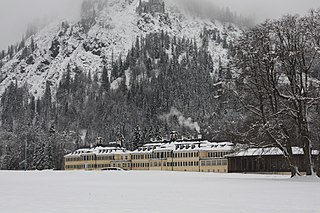
Kreuth Place in Bavaria, Germany

Kreuth is a municipality in the district of Miesbach in Bavaria in Germany.

Schönberg, Upper Bavaria Place in Bavaria, Germany

Schönberg is a municipality in the district of Mühldorf in the Upper Bavaria region of Bavaria, Germany.

Püchersreuth Place in Bavaria, Germany

Püchersreuth is a municipality in the district of Neustadt an der Waldnaab in Bavaria, Germany.

Schlammersdorf Place in Bavaria, Germany

Schlammersdorf is a municipality in the district of Neustadt an der Waldnaab in Bavaria, Germany.
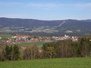
Breitenberg, Lower Bavaria Place in Bavaria, Germany

Breitenberg is a municipality in the district of Passau in Bavaria in Germany. It lies on the border with Austria, and is the easternmost municipality of Bavaria.
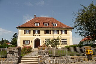
Neuhaus am Inn Place in Bavaria, Germany

Neuhaus is a municipality in the district of Passau in Bavaria in Germany.

Griesstätt Place in Bavaria, Germany

Griesstätt is a municipality in the district of Rosenheim in Bavaria, Germany. It lies on the river Inn.

Söchtenau Place in Bavaria, Germany

Söchtenau is a municipality in the district of Rosenheim in Bavaria in Germany.

Pfaffenhausen Place in Bavaria, Germany

Pfaffenhausen is a municipality in the district of Unterallgäu in Bavaria, Germany. The town is seat of a municipal association with Breitenbrunn, Swabia, Oberrieden, Bavaria and Salgen.

Moosbach, Bavaria Place in Bavaria, Germany

Moosbach is a municipality in the district of Neustadt an der Waldnaab in Bavaria, Germany.

Rotthalmünster Place in Bavaria, Germany

Rotthalmünster is a municipality in the district of Passau in Bavaria in Germany.

Unterwössen Place in Bavaria, Germany

Unterwössen is a municipality in the district of Traunstein in Bavaria, Germany.

Hawangen Place in Bavaria, Germany

Hawangen is a municipality in the district of Unterallgäu in Bavaria, Germany, with about 1254 inhabitants. Hawangen is situated 5 km (3 mi) east of Memmingen. The town has a municipal association with Ottobeuren.

Böbing Place in Bavaria, Germany

Böbing is a municipality in the Weilheim-Schongau district, in Bavaria, Germany.

References

  1. Liste der ersten Bürgermeister/Oberbürgermeister in kreisangehörigen Gemeinden, Bayerisches Landesamt für Statistik, 15 July 2021.
  2. "Tabellenblatt "Daten 2", Statistischer Bericht A1200C 202041 Einwohnerzahlen der Gemeinden, Kreise und Regierungsbezirke". Bayerisches Landesamt für Statistik und Datenverarbeitung (in German). June 2021.