A meadow is an open habitat or field, vegetated by grasses, herbs, and other non-woody plants. Trees or shrubs may sparsely populate meadows, as long as these areas maintain an open character. Meadows can occur naturally under favourable conditions, but are often artificially created from cleared shrub or woodland for the production of hay, fodder, or livestock. Meadow habitats, as a group, are characterized as "semi-natural grasslands", meaning that they are largely composed of species native to the region, with only limited human intervention.

The northern bog lemming is a small North American lemming. It is one of two species in the genus Synaptomys, the other being the southern bog lemming (Synaptomys cooperi). Very little information is available about this species' life as they are hard to find and study. The northern bog lemming is a small, reddish-brown rodent with a short tail, and distinct markings on their upper teeth. These markings, along with having four pairs of teats, distinguishes this species from the southern bog lemming. The northern bog lemming lives in wet habitats in North America and is omnivorous, eating herbaceous material and invertebrates. They are thought to be extremely sociable animals and sexually mature at around 6 weeks old. Predators include most medium to larger sized carnivorous and omnivorous mammals that eat smaller mammals. The northern bog lemming is listed as a species of "Least Concern" by the IUCN Red List and is considered threatened or of concern in states such as Minnesota and Maine.

Shap Rural is a very large, but sparsely populated, civil parish in the Westmorland and Furness district of Cumbria in England, covering part of the Lake District National Park. It had a population of 119 in 2001, 130 at the 2011 Census, and 110 in 2021.

Wrinkly Face Provincial Park is a provincial park 16 kilometres north of Winfield in British Columbia, Canada.
British NVC community MG3 is one of the mesotrophic grassland communities in the British National Vegetation Classification system. It is one of four such communities associated with well-drained permanent pastures and meadows.

Newtown River is a large natural inland harbour located on the Isle of Wight's northwestern coast, named after the nearby village of Newtown. It is sometimes also referred to as Newtown Creek.

Sleddale Hall is a farmhouse on the north side of the Wet Sleddale valley near Shap in Cumbria, England. It featured as "Crow Crag", Uncle Monty's Lake District country cottage in the cult film Withnail and I.

The Ethiopian montane moorlands is a montane grasslands and shrublands ecoregion in Ethiopia. It lies above 3,000 meters elevation in the Ethiopian Highlands, the largest Afroalpine region in Africa. The montane moorlands lie above the tree line, and consist of grassland and moorland with abundant herbs and shrubs adapted to the high elevation conditions.

Drumbegger is a townland situated in County Fermanagh, Fermanagh and Omagh district, Northern Ireland. It is part of the civil parish of Boho in the old barony of Magheraboy and contains the sub-townland known as Oubarraghan.
Lune Forest is a Site of Special Scientific Interest covering an extensive area of moorland in the Teesdale district of west Durham, England. In the north, where it adjoins the Upper Teesdale and Appleby Fells SSSIs, it extends from Mickle Fell eastward almost as far as Harter Fell, above the hamlet of Thringarth. Its southern limit is marked by the River Balder, upstream from Balderhead Reservoir, where it shares a boundary with Cotherstone Moor SSSI to the south. Grains o' th' Beck Meadows and Close House Mine SSSIs are entirely surrounded by Lune Forest, but do not form part of it.
Rigg Farm and Stake Hill Meadows is a Site of Special Scientific Interest in the Teesdale district of County Durham, England. It is situated in Lunedale, on the north side of Grassholme Reservoir, close to the hamlet of Thringarth.
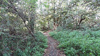
Denham Lock Wood is a 6.3-hectare (16-acre) biological Site of Special Scientific Interest (SSSI) next to the Grand Union Canal, and near Denham in the London Borough of Hillingdon. It was notified in 1986 and is managed by the London Wildlife Trust on behalf of Hillingdon Council. It lies within the Colne Valley Regional Park.
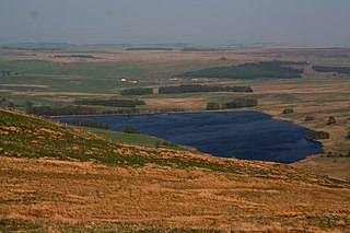
Wet Sleddale Reservoir is an artificial reservoir set amongst the Shap Fells 4 kilometres (2 mi) south of the village of Shap in Cumbria, England, and lies just within the boundary of the Lake District National Park. The triangular shaped reservoir, which can store 2,300 million litres of water, was created by the construction of a dam across Sleddale Beck in order to supply Manchester with water. The dam is 21m high and 600m long.

The Wet Sleddale Horseshoe is an upland area in the English Lake District, around the Wet Sleddale Reservoir, Cumbria. It is the subject of a chapter of Wainwright's book The Outlying Fells of Lakeland. His walk starts at the reservoir dam and follows a clockwise circuit over Sleddale Pike at 1,659 feet (506 m), Great Saddle Crag at 1,850 feet (560 m) and Ulthwaite Rigg at 1,648 feet (502 m).
Islip Manor Meadows is a 23.75 hectare Local Nature Reserve and Site of Metropolitan Importance for Nature Conservation in Northolt in the London Borough of Ealing. It is owned and managed by Ealing Council.
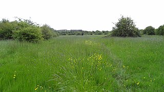
Aules Hill Meadows is the name given to a Site of Special Scientific Interest (SSSI) in Northumberland, England. The site, listed since 1992, is a set of four traditionally managed northern hay meadows, now rare in Northumberland.
Barrow Burn Meadows is a Site of Special Scientific Interest (SSSI) in north Northumberland, England. The site is a species-rich hay meadow of a sort now rare in Northumberland.
Barrow Meadow is a Site of Special Scientific Interest (SSSI) in north Northumberland, England. The site is a species-rich hay meadow of a sort now rare in Northumberland.
Eden Gorge is a Site of Special Scientific Interest (SSSI) including a 5km length of the valley of the River Eden between Armathwaite and Lazonby in Cumbria, England. This protected area spans between the Settle-Carlisle railway track on the western side to Coombs Wood Forestry Commission site on the eastern side. The protected area includes 30m high cliffs where the River Eden has eroded through New Red Sandstone. The semi-natural woodland is apparently a remnant of the ancient Inglewood forest.
Gelt Woods is a Site of Special Scientific Interest (SSSI) in the valley of the River Gelt. It is located 2km south of Brampton, near the village of Low Geltbridge in Cumbria, England. This protected area includes exceptional gorge woodland at a location where the River Gelt has cut through the New Red Sandstone. The area is protected because of the rare species of moss and liverworts and because of the diversity of woodland bird species. Part of the protected area is owned and managed by the Royal Society for the Protection of Birds.