Whitburn Colliery was a coal mine located about three miles south of South Shields, North East England, located on the North Sea coast.

Whitburn Colliery was a coal mine located about three miles south of South Shields, North East England, located on the North Sea coast.
Marsden was originally a small village, consisting of farms, a few cottages and a lighthouse at Souter Point. Local industry consisted of a small limestone quarry. [1]
In the 1870s, the Whitburn Coal Company bought the five quarries, two of which were developed as the Lighthouse (Marsden) Quarries. [2]
On 14 July 1874 the company began sinking the Whitburn winnings, a bore-hole put down below the Brockwell Seam. However, the company failed to find any coal, and was faced with large amounts of water ingress from the North Sea.
In 1877, a new shaft was developed using the Kind-Chaudron process, its first deployment in the UK coal industry. The section through the water-fissured strata is lined with iron tubing, although throughout its life the electric pumps were required to extract 12,000 imperial gallons (55,000 l; 14,000 US gal) per day. Both shafts had a diameter of 13 feet (4.0 m), with No.1 shaft having a depth of 180 fathoms (1,080 ft; 330 m), and No.2 with a depth of 115 fathoms (690 ft; 210 m), to enable access to the Bensham seam, with thicknesses between 4 feet (1.2 m) to 6 feet 6 inches (1.98 m). [2]
The industrial development of the area required additional workers. The company built a new Marsden village, located between the Lighthouse Quarries and Whitburn Colliery. Designed to house 700+ people, there were: 135 houses; nine streets; a church and a Methodist chapel; co-op store; post office; school; and a Miners Institute. Located directly on the cliff top, resulting in an exposed and often weather-beaten experience, many wives refused to move to the village, meaning that most miners lived in South Shields and commuted daily using the newly constructed railway. [1]

The company built the twin-track South Shields, Marsden, and Whitburn Colliery Railway, leaving the North Eastern Railway line at Westoe Lane, South Shields and travelling to Marsden via two intermediate stations. [1] Built to serve the colliery and opened in May 1879, the line served the Lighthouse limestone quarry, a paper manufactory, and local farms. On 19 March 1888 the line opened to the public. [1]
The railway allowed colliery output to quickly rise to 1,500 tonnes (1,700 tons), employing 1,600 workers. [2] Coal from the colliery initially fueled the lime kilns, which closed at the same time as the mines. [2]
In 1891, the Whitburn Coal Company was bought by the Harton Coal Company, and by 1921 the system employed over 3,500 men. [2] The company shut Marsden railway station in 1926, due to a lack of traffic and its proximity to the alternate station located within the colliery. On 16 May 1934 the developed Five Quarter seam was abandoned. [2]
By the time of nationalisation in 1945 into the National Coal Board, the site employed just under 1,500 miners. [2] The railway line itself became the first nationalised passenger line on 1 January 1947. The service for miners was replaced by bus from 16 November 1953, but public trains remained running until withdrawn with effect from Monday 23 November. [1]
Due to higher levels of water ingress as the mine shafts were developed under the North Sea, and resultant higher costs of operation and coal extraction, it was decided to close the mine in the mid-1960s. The final shift came up from shaft bottom on 8 June 1968. [2]
With the closure of the mine, it was decided to demolish the village, due to coastal erosion and the economic need to heavily invest in the village to bring it up to modern living and sanitation standards. What remains are five rows of Victorian terraced houses, the small chapel and a primary school, although this is technically now located in Whitburn. [2]
Parts of the northern section of the railway line (South Shields) survived the colliery's closure but it also closed and lifted in 1993 with the closure of Westoe Colliery. [1]

Marsden is located on the outskirts of the seaside town South Shields, North East England, located on the North Sea coast. It lies within historic County Durham.

Tower Colliery was the oldest continuously working deep-coal mine in the United Kingdom, and possibly the world, until its closure in 2008. It was the last mine of its kind to remain in the South Wales Valleys. It was located near the villages of Hirwaun and Rhigos, north of the town of Aberdare in the Cynon Valley of South Wales.

Nantgarw is a village in the county borough of Rhondda Cynon Taf, Wales, near Cardiff.

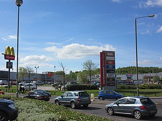
Cortonwood was a colliery near Rotherham, South Yorkshire, England. The colliery's proposed closure was a tipping point in the 1984-85 miners' strike. The site is now a shopping and leisure centre.

The Maltby Main Colliery was a coal mine located 7 miles (11 km) east of Rotherham on the eastern edge of Maltby, South Yorkshire, England. The mine was closed in 2013.

Kiveton Park Colliery was a coal mine in the village of Kiveton Park, near Rotherham, South Yorkshire, England.
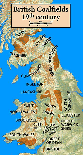
The South Yorkshire Coalfield is so named from its position within Yorkshire. It covers most of South Yorkshire, West Yorkshire and a small part of North Yorkshire. The exposed coalfield outcrops in the Pennine foothills and dips under Permian rocks in the east. Its most famous coal seam is the Barnsley Bed. Coal has been mined from shallow seams and outcrops since medieval times and possibly earlier.
Steetley Colliery is a former colliery on the Derbyshire/Nottinghamshire border.
Bedwas Navigation Colliery was a coal mine in the small Welsh village of Bedwas, two miles (3.2 km) north of Caerphilly. The colliery opened in 1913, and closed after the miners' strike of 1984-85.
The South Waratah Colliery was a coal mine located at Charlestown, in New South Wales Australia.
Nantgarw Colliery was a coal mine and later developed Coking coal works, located in the village on Nantgarw, Mid Glamorgan, Wales located just north of Cardiff.
Dinnington Main Colliery was a coal mine situated in the village of Dinnington, near Rotherham, South Yorkshire, England.
The South Shields, Marsden, and Whitburn Colliery Railway was a Whitburn Coal Company built twin track branch railway line that ran along the North Sea coast in County Durham, England, from Westoe Lane in South Shields to Whitburn Colliery at Marsden via two intermediate stations, Whitburn Colliery station, and Marsden.

The Ingleton Coalfield is in North Yorkshire, close to its border with Lancashire in north-west England. Isolated from other coal-producing areas, it is one of the smallest coalfields in Great Britain.
The Astley and Tyldesley Collieries Company formed in 1900 owned coal mines on the Lancashire Coalfield south of the railway in Astley and Tyldesley, then in the historic county of Lancashire, England. The company became part of Manchester Collieries in 1929 and some of its collieries were nationalised in 1947.
The Tarenni Colliery and its associated workings, are a series of coal mines and pits located between the villages of Godre'r Graig and Cilybebyll located in the valley of the River Tawe, in Neath Port Talbot county borough, South Wales.

Deep Navigation Colliery was a coal mine in South Wales, that operated from 1872 until 1991.
Coventry Colliery was a coal mine located in the village of Keresley End in northern Warwickshire, between Bedworth and Coventry, England. Closed in 1991, the site today has been redeveloped as a distribution park, owned by Prologis.

The Burnley Coalfield is the most northerly portion of the Lancashire Coalfield. Surrounding Burnley, Nelson, Blackburn and Accrington, it is separated from the larger southern part by an area of Millstone Grit that forms the Rossendale anticline. Occupying a syncline, it stretches from Blackburn past Colne to the Yorkshire border where its eastern flank is the Pennine anticline.
Mainsforth Colliery was situated between Ferryhill and the small hamlet of Mainsforth in County Durham, England, United Kingdom. It was adjacent to the former Ferryhill railway station in the Ferryhill Station area of the town.