White Cottage, Ohio

Last updated
Location of White Cottage, Ohio OHMap-doton-White Cottage.png
Location of White Cottage, Ohio
Streetside in White Cottage Streetside in White Cottage.jpg
Streetside in White Cottage

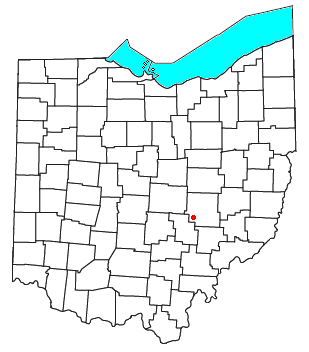
White Cottage is an unincorporated community in central Newton Township, Muskingum County, Ohio, United States. It has a post office with the ZIP code 43791. [1] It lies along U.S. Route 22 between Zanesville and Lancaster. [2]

A post office called White Cottage has been in operation since 1839. [3] The community was named for a white tavern near the original town site. [4]

Related Research Articles

Lees Creek, Ohio

Lees Creek, also known as Centerville, is an unincorporated community in central Wayne Township, Clinton County, Ohio, United States. It lies at the intersection of State Route 729 with Cox Road, 6 miles south of Sabina and 12 miles (19 km) southeast of Wilmington, the county seat of Clinton County. It lies between the headwaters of the Middle Fork of Lees Creek, to the southeast, and the Anderson Fork of Caesar Creek. it had a post office, with the ZIP code 45138. The Post Office closed in 2012 and the town, including East Clinton High School, now carries a Sabina mailing address.

Roundhead, Ohio

Roundhead is an unincorporated community in southeastern Roundhead Township, Hardin County, Ohio, United States. It has a post office with the ZIP code 43346.

Johnsville, Ohio

Johnsville, also known as Shauck, is an unincorporated community in northern Perry Township, Morrow County, Ohio, United States. It has a post office with the ZIP code 43349. It is located at the intersection of U.S. Route 42 with State Route 314.

Raymond, Ohio

Raymond is a census-designated place in eastern Liberty Township, Union County, Ohio, United States. It has a post office with the ZIP code 43067. It is located at the intersection of State Routes 347 and 739.

Damascus, Ohio Census-designated place in Ohio, United States

Damascus is a census-designated place (CDP) in southwestern Goshen Township in Mahoning County and northwestern Butler Township in Columbiana County in the U.S. state of Ohio. As of the 2010 census, it had a population of 443. Damascus has a post office, with the ZIP code of 44619. The Mahoning County portion of Damascus is part of the Youngstown-Warren-Boardman, OH-PA Metropolitan Statistical Area, while the Columbiana County portion is part of the Salem, OH Micropolitan Statistical Area.

Willow Wood, Ohio

Willow Wood is an unincorporated community in western Windsor Township, Lawrence County, Ohio, United States, along Symmes Creek. It has a post office with the ZIP code 45696.

Waterloo, Ohio

Waterloo is an unincorporated community in southeastern Symmes Township, Lawrence County, Ohio, United States, along Symmes Creek. It has a post office with the ZIP code 45688. Waterloo, Ohio is also noteworthy for having produced the Waterloo Wonders, who carried Ohio's Class B championship in basketball for both 1934 and 1935.

Haydenville, Ohio United States historic place

Haydenville is an unincorporated community and census-designated place (CDP) in southern Green Township, Hocking County, Ohio, United States. As of the 2010 census the population of the CDP was 381.

Wingett Run, Ohio

Wingett Run is an unincorporated community in western Ludlow Township, Washington County, Ohio, United States. It has a post office with the ZIP code 45789. It is located along State Route 26 and the Little Muskingum River.

Whipple, Ohio

Whipple is an unincorporated community in southern Salem Township, Washington County, Ohio, United States. Although it is unincorporated, it once had a post office, with the ZIP code 45788. It lies on State Route 821 south of the village of Lower Salem, at the junction of Whipple Run with Duck Creek. The community took its name from nearby Whipple Run.

Waterford, Ohio

Waterford is a census-designated place in central Waterford Township, Washington County, Ohio, United States. It has a post office with the ZIP code 45786. It is located on State Route 339 across the Muskingum River from the village of Beverly, slightly below where Wolf Creek meets the Muskingum. The community is home to both schools of the Wolf Creek School System. Waterford Elementary serves grades K through Eighth. Waterford High School serves 9–12th grades.

Vincent, Ohio

Vincent is a census-designated place in southern Barlow Township, Washington County, Ohio, United States. It has a post office with the ZIP code 45784. It lies along State Route 339 near Tupper Creek, a subsidiary of the Little Hocking River, which in turn meets the Ohio River at Little Hocking to the south.

Reno, Ohio

Reno is a census-designated place in southern Marietta Township, Washington County, Ohio, United States. It has a post office with the ZIP code 45773. It is located on the Ohio River a short distance above the county seat of Marietta. State Route 7 forms its main street.

Newport, Washington County, Ohio Census Designated Place in Ohio, United States

Newport is a census-designated place in eastern Newport Township, Washington County, Ohio, United States. It has a post office with the ZIP code 45768. Newport lies along the Ohio River several miles above the county seat of Marietta. Its main street is formed by State Route 7.

Little Hocking, Ohio

Little Hocking is a census-designated place in southern Belpre Township, Washington County, Ohio, United States. It has a post office with the ZIP code 45742.

Cutler, Ohio

Cutler is an unincorporated community in southwestern Fairfield Township, Washington County, Ohio, United States. It has a post office with the ZIP code 45724. It lies at the intersection of State Route 555 and County Road 59 near Gilbert Run, a subsidiary of the Little Hocking River, which meets the Ohio River at Little Hocking to the southeast.

Bartlett, Ohio

Bartlett is an unincorporated community in southwestern Wesley Township, Washington County, Ohio, United States. It has a post office with the ZIP code 45713. It sits at the intersection of State Routes 550 and 555 near Coal Run, a subsidiary of Wolf Creek, which meets the Muskingum River at Waterford to the north. Near Bartlett is located the Shinn Covered Bridge, which spans Wolf Creek.

Derby, Indiana Unincorporated community in Indiana, United States

Derby is an unincorporated community along the Ohio River in far southern Union Township, Perry County, in the U.S. state of Indiana. It lies at the intersection of State Roads 66 and 70 above the city of Tell City, the county seat of Perry County. Its elevation is 453 feet (138 m), and it is located at 38°1′49″N86°31′38″W. Although Derby is unincorporated, it has a post office, with the ZIP code of 47525.

Butlerville, Indiana Census-designated place in Indiana, United States

Butlerville is an unincorporated community and census-designated place (CDP) in central Campbell Township, Jennings County, Indiana, United States. As of the 2010 census it had a population of 282.

Davisville, Ohio Unincorporated community in Ohio, United States

Davisville is an unincorporated community in Coal Township, Jackson County, Ohio, United States. It is located south of Coalton along Ohio State Route 93, at 39°05′52″N82°36′44″W.

References

  1. "Search Results for ZIP code 43791". www.zipinfo.com. Retrieved 2016-05-02.
  2. DeLorme. Ohio Atlas & Gazetteer. 7th ed. Yarmouth: DeLorme, 2004, 70. ISBN   0-89933-281-1.
  3. "Post offices". Jim Forte Postal History. Retrieved 21 June 2016.
  4. Overman, William Daniel (1958). Ohio Town Names. Akron, OH: Atlantic Press. p. 143.

Coordinates: 39°52′18″N82°05′52″W / 39.87167°N 82.09778°W / 39.87167; -82.09778