Norwich, Ohio

Last updated

Norwich, Ohio
Ralph Hardesty Stone House 001.jpg
The Ralph Hardesty Stone House, a historic site in the village
OHMap-doton-Norwich.png
Location of Norwich, Ohio
Map of Muskingum County Ohio Highlighting Norwich Village.png
Location of Norwich in Muskingum County
Coordinates: 39°59′05″N81°47′32″W / 39.98472°N 81.79222°W / 39.98472; -81.79222
Country United States
State Ohio
County Muskingum
Township Union
Area
[1]
  Total0.08 sq mi (0.20 km2)
  Land0.08 sq mi (0.20 km2)
  Water0.00 sq mi (0.00 km2)
Elevation
[2]
968 ft (295 m)
Population
 (2020)
  Total87
  Density1,129.87/sq mi (436.24/km2)
Time zone UTC-5 (Eastern (EST))
  Summer (DST) UTC-4 (EDT)
ZIP code
43767
Area code 740
FIPS code 39-57372 [3]
GNIS feature ID2399529 [2]

Norwich is a village in Muskingum County, Ohio, United States. The population was 87 at the 2020 census. It is part of the Zanesville micropolitan area.

Contents

History

Norwich was laid out in 1827, and named after Norwich, in England, the native home of a first settler. [4] A post office has been in operation at Norwich since 1828. [5] By 1833, Norwich had four stores, two churches, and two taverns. [6] The village was incorporated in 1833. [4]

Geography

According to the United States Census Bureau, the village has a total area of 0.10 square miles (0.26 km2), all land. [7]

Demographics

Historical population
CensusPop.Note
1830 206
1850 324
1860 294−9.3%
1870 268−8.8%
1880 265−1.1%
1890 234−11.7%
1900 2538.1%
1910 186−26.5%
1920 142−23.7%
1930 16717.6%
1940 1776.0%
1950 19711.3%
1960 193−2.0%
1970 163−15.5%
1980 1704.3%
1990 133−21.8%
2000 113−15.0%
2010 102−9.7%
2020 87−14.7%
U.S. Decennial Census [8]

2010 census

As of the census [9] of 2010, there were 102 people, 49 households, and 34 families living in the village. The population density was 1,020.0 inhabitants per square mile (393.8/km2). There were 56 housing units at an average density of 560.0 per square mile (216.2/km2). The racial makeup of the village was 100.0% White.

There were 49 households, of which 20.4% had children under the age of 18 living with them, 55.1% were married couples living together, 6.1% had a female householder with no husband present, 8.2% had a male householder with no wife present, and 30.6% were non-families. 26.5% of all households were made up of individuals, and 16.3% had someone living alone who was 65 years of age or older. The average household size was 2.08 and the average family size was 2.41.

The median age in the village was 49 years. 11.8% of residents were under the age of 18; 9.7% were between the ages of 18 and 24; 18.7% were from 25 to 44; 43.1% were from 45 to 64; and 16.7% were 65 years of age or older. The gender makeup of the village was 51.0% male and 49.0% female.

2000 census

As of the census [3] of 2000, there were 113 people, 40 households, and 32 families living in the village. The population density was 1,175.0 inhabitants per square mile (453.7/km2). There were 46 housing units at an average density of 478.3 per square mile (184.7/km2). The racial makeup of the village was 99.12% White and 0.88% Native American.

There were 40 households, out of which 40.0% had children under the age of 18 living with them, 67.5% were married couples living together, 2.5% had a female householder with no husband present, and 20.0% were non-families. 17.5% of all households were made up of individuals, and 2.5% had someone living alone who was 65 years of age or older. The average household size was 2.83 and the average family size was 3.13.

In the village, the population was spread out, with 28.3% under the age of 18, 8.0% from 18 to 24, 35.4% from 25 to 44, 21.2% from 45 to 64, and 7.1% who were 65 years of age or older. The median age was 34 years. For every 100 females there were 79.4 males. For every 100 females age 18 and over, there were 102.5 males.

The median income for a household in the village was $37,250, and the median income for a family was $43,750. Males had a median income of $29,583 versus $25,000 for females. The per capita income for the village was $14,673. There were 21.4% of families and 36.2% of the population living below the poverty line, including 61.5% of under eighteens and none of those over 64.

Notable person

Related Research Articles

<span class="mw-page-title-main">Muskingum County, Ohio</span> County in Ohio, United States

Muskingum County is a county located in the U.S. state of Ohio. As of the 2020 census, the population was 86,410. Its county seat is Zanesville. Nearly bisected by the Muskingum River, the county name is based on a Delaware American Indian word translated as "town by the river" or "elk's eye".

<span class="mw-page-title-main">Conesville, Ohio</span> Village in Ohio, United States

Conesville is a village in Coshocton County, Ohio, United States, along the Muskingum River. The population was 328 at the 2020 census.

<span class="mw-page-title-main">Gann, Ohio</span> Village in Ohio, United States

Brinkhaven, once known as Mount Holly and Gann, is a village in Knox County, Ohio, United States. The population was 114 at the 2020 census.

<span class="mw-page-title-main">Granville South, Ohio</span> Census-designated place in Ohio, United States

Granville South is a census-designated place (CDP) in Licking County, Ohio, United States. The population was 1,420 at the 2020 census.

<span class="mw-page-title-main">Malta, Ohio</span> Village in Ohio, United States

Malta is a village in Morgan County, Ohio, United States. The population was 559 at the 2020 census.

<span class="mw-page-title-main">McConnelsville, Ohio</span> Village in Ohio, United States

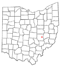
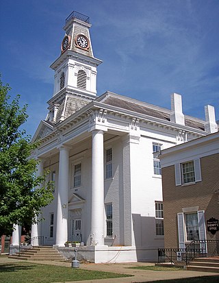
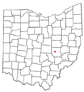
McConnelsville is a village in and the county seat of Morgan County, Ohio, United States, on the east bank of the Muskingum River. Located 21 miles (34 km) southeast of Zanesville and 26 miles (42 km) northwest of Marietta, the population was 1,667 at the 2020 census.

<span class="mw-page-title-main">Stockport, Ohio</span> Village in Ohio, United States

Stockport is a village in Morgan County, Ohio, United States, along the Muskingum River. The population was 483 at the 2020 census.

<span class="mw-page-title-main">Adamsville, Ohio</span> Village in Ohio, United States

Adamsville is a village in Muskingum County, Ohio, United States. The population was 140 at the 2020 census. It is part of the Zanesville micropolitan area.

<span class="mw-page-title-main">Frazeysburg, Ohio</span> Village in Ohio, United States

Frazeysburg is a village in Muskingum County, Ohio, United States, along Wakatomika Creek. The population was 1,354 at the 2020 census. It is part of the Zanesville micropolitan area. Frazeysburg is home to the world's largest apple basket, which is located on the Longaberger homestead.

<span class="mw-page-title-main">Fultonham, Ohio</span> Village in Ohio, United States

Fultonham is a village in Muskingum County, Ohio, United States. The population was 115 at the 2020 census. It is part of the Zanesville micropolitan area. Fultonham was named for postmaster Robert Fulton.

<span class="mw-page-title-main">New Concord, Ohio</span> Village in Ohio, United States

New Concord is a village in Muskingum County, Ohio, United States. The population was 2,361 as of the 2020 census. It is part of the Zanesville micropolitan area. New Concord is the home of Muskingum University and is served by a branch of the Muskingum County Library System.

<span class="mw-page-title-main">Philo, Ohio</span> Village in Ohio, United States

Philo is a village in Muskingum County, Ohio, United States, along the Muskingum River. The population was 720 at the 2020 census. It is part of the Zanesville micropolitan area. Philo is the closest municipality to Blue Rock State Park.

<span class="mw-page-title-main">South Zanesville, Ohio</span> Village in Ohio, United States

South Zanesville is a village in Muskingum County, Ohio, United States, along the Muskingum River near the mouth of the Moxahala Creek. The population was 1,894 at the 2020 census. It is part of the Zanesville micropolitan area.

<span class="mw-page-title-main">Darbyville, Ohio</span> Village in Ohio, United States

Darbyville is a village in Pickaway County, Ohio, United States. The population was 186 at the 2020 census.

<span class="mw-page-title-main">Beverly, Ohio</span> Village in Ohio, United States

Beverly is a village in Washington County, Ohio, United States. The population was 1,233 at the 2020 census. It is part of the Marietta micropolitan area.

<span class="mw-page-title-main">Lowell, Ohio</span> Village in Ohio, United States

Lowell is a village in Washington County, Ohio, United States, along the Muskingum River. The population was 549 at the 2020 census. The village is located about 7.6 miles (12.2 km) north of Marietta, Ohio.

<span class="mw-page-title-main">Wilson, Ohio</span> Village in Ohio, United States

Wilson is a village in Belmont and Monroe counties in the U.S. state of Ohio. The population was 129 at the 2020 census. It is part of the Wheeling metropolitan area.

<span class="mw-page-title-main">Gratiot, Ohio</span> Village in Ohio, United States

Gratiot is a village in Licking and Muskingum counties in the U.S. state of Ohio. The population was 215 at the 2020 census.

<span class="mw-page-title-main">Verona, Ohio</span> Village in Ohio, United States

Verona is a village in Montgomery and Preble counties in the U.S. state of Ohio. The population was 403 at the 2020 census. It is part of the Dayton Metropolitan Statistical Area.

<span class="mw-page-title-main">Roseville, Ohio</span> Village in Ohio, United States

Roseville is a village in Muskingum and Perry counties in the U.S. state of Ohio, along Moxahala Creek. The population was 1,746 at the 2020 census. It is part of the Zanesville micropolitan area. Roseville is served by a branch of the Muskingum County Library System.

References

  1. "ArcGIS REST Services Directory". United States Census Bureau. Retrieved September 20, 2022.
  2. 1 2 U.S. Geological Survey Geographic Names Information System: Norwich, Ohio
  3. 1 2 "U.S. Census website". United States Census Bureau . Retrieved January 31, 2008.
  4. 1 2 Everhart, F.J. (1882). 1794. History of Muskingum County, Ohio, with illustrations and biographical sketches of prominent men and pioneers. F.J. Everhart & Co. p. 418.
  5. "Muskingum County". Jim Forte Postal History. Retrieved January 5, 2016.
  6. Kilbourn, John (1833). The Ohio Gazetteer, or, a Topographical Dictionary. Scott and Wright. pp.  350 . Retrieved December 12, 2013.
  7. "US Gazetteer files 2010". United States Census Bureau. Archived from the original on July 2, 2012. Retrieved January 6, 2013.
  8. "Census of Population and Housing". Census.gov. Retrieved June 4, 2015.
  9. "U.S. Census website". United States Census Bureau . Retrieved January 6, 2013.