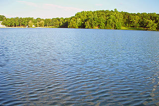
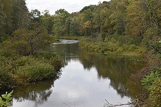
Catharine Creek is a roughly 15-mile-long (24 km) stream that flows through Chemung and Schuyler counties in New York. The creek, named after Catharine Montour, is a major tributary to Seneca Lake.

Merrill Creek Reservoir, located in Harmony Township, New Jersey in central Warren County, New Jersey, is a 650-acre (260 ha) artificial lake designed to hold 15 billion gallons of water that is surrounded by 290 acres (120 ha) of protected woodland and fields. These lands are themselves part of 2,000 acres (8.1 km2) of open spaces.

The West Canada Creek is a 76-mile-long (122 km) river in upstate New York, United States. West Canada Creek is an important water way in Hamilton, Oneida, and Herkimer counties, draining the south part of the Adirondack Mountains before emptying into the Mohawk River near the Village of Herkimer. The name "Canada" is derived from an Iroquoian word for "village" (Kanata).
Carp River is a 40.2-mile-long (64.7 km) river in Chippewa and Mackinac counties in the U.S. state of Michigan. 21.7 miles (34.9 km) of the river were added to the National Wild and Scenic Rivers System in 1992.

Wappinger Creek is a 41.7-mile-long (67.1 km) creek which runs from Thompson Pond to the Hudson River at New Hamburg in Dutchess County, New York, United States. It is the longest creek in Dutchess County, with the largest watershed in the county.

Eagle Lake is a lake at 5,098 ft (1,554 m) elevation in Lassen County approximately 15 mi (24 km) north of Susanville, California. An endorheic alkaline lake, it is the second largest natural lake entirely in the state of California, United States.

Chandler State Wayside is a state park in south-central Oregon in the United States. It is named in honor of Solomon and Hattie Chandler, who donated the land for the park. The park covers 85 acres (34 ha) of pine forest along a creek. The park provides restrooms and other basic facilities to accommodate the traveling public. Chandler State Wayside is administered by the Oregon Parks and Recreation Department.

Sylvan Lake is located next to the community by that name in the Town of Beekman, New York, United States. It is the deepest and second-largest lake in Dutchess County.

Oaks Creek is a river that drains Canadarago Lake, which is situated in the north central region of Otsego County, New York. The creek begins by the Hamlet of Schuyler Lake and flows southeast approximately 9.32 miles (15.00 km), dropping only 105 feet (32 m) in elevation, before converging with the Susquehanna River south of the Village of Cooperstown, by the Hamlet of Index. From the source to Oaksville the creek flows along Panther Mountain. Fly Creek is a main tributary, that converges with Oaks Creek south of the Hamlet of Fly Creek.
Trout Brook, also known as White Creek is a river that is located in northern Otsego County, New York. The river starts at the outlet of Allen Lake and flows southeast before flowing into Otsego Lake south of Springfield Center. It is a third-order tributary on the northwest side of Otsego Lake and has an average gradient of 96 feet/mile.
East Caroga Lake is located in the Town of Caroga by Caroga Lake, New York. The lake provides excellent warm water fishing and rainbow trout fishing. The lake is connected to West Caroga Lake by a small channel. Origin of the name, "Caroga" is derived from the once nearby Indian Village known as "Caroga".
East Kill, a 16-mile-long (26 km) tributary of Schoharie Creek, flows across the town of Jewett, New York, United States, from its source on Stoppel Point. Ultimately its waters reach the Hudson River via the Mohawk. Since it drains into the Schoharie upstream of Schoharie Reservoir, it is part of the New York City water supply system. East Kill drains the southern slopes of the Blackhead Mountains, which include Thomas Cole Mountain, Black Dome, and Blackhead Mountain, the fourth-, third-, and fifth-highest peaks in the Catskills, respectively.

West Branch Sacandaga River is a river in Hamilton County in the state of New York. It begins northwest of Benson and flows west then northward then eastward before converging with the Sacandaga River south of Wells.
Negro Lake is a lake located southwest of Partlow, New York. The outlet of the lake flows through an unnamed creek into Witchhopple Lake. Fish species present in Negro Lake are brook trout, white sucker, sunfish, yellow perch, and lake trout. Access by hiking Bushwhack Trail, located on northwest shore of Witchhopple Lake. No motors are allowed on Negro Lake.
Pine Lake is located east of Brantingham, New York. The outlet creek flows into Middle Branch. Fish species present in the lake are brook trout, brown trout, black bullhead, white sucker, and sunfish. There is access to the lake via trail on its north and west shore. No motors are allowed on this lake.
Sagamore Lake is located south of Raquette Lake, New York. Sagamore Lake was known as Shedd Lake before being renamed "Sagamore Lake" by Alfred G. Vanderbilt after he purchased Great Camp Sagamore in 1901. South Inlet is the outlet creek, which flows into Raquette Lake. Fish species present in the lake are brook trout, lake whitefish, lake trout, white sucker, black bullhead, yellow perch, and sunfish. There is access by trail from Sagamore Road on the northwest shore. Only non-motorized boats are allowed on the lake.
South Lake is located west of Sled Harbor, New York. Fish species present in the lake are brook trout, black bullhead, and white sucker. There is trail access on the southeast shore. No motors are allowed on this lake. South Lake is one of three of the West Canada Lakes that are the source of West Canada Creek.
Trout Lake is located south of Averys Place, New York. Fish species present in the lake are pickerel, white sucker, yellow perch, and brown bullhead. There is access by trail from County Route 10. No motors are allowed on the lake.
Lake Cecil is a small lake located north-northeast of the hamlet of Trout Creek in Delaware County, New York. It drains south via an unnamed creek that flows into Trout Creek.


