White Lake is the name of several lakes in the U.S. state of Michigan. The largest one is formed by the White River flowing to its mouth on Lake Michigan in Muskegon County.
Contents
White Lake is the name of several lakes in the U.S. state of Michigan. The largest one is formed by the White River flowing to its mouth on Lake Michigan in Muskegon County.
| White Lake | |
|---|---|
 White Lake  White Lake | |
| Location | Muskegon County, Michigan |
| Coordinates | 43°22′38″N86°22′49″W / 43.37722°N 86.38028°W |
| Type | Lake |
| Primary inflows | White River |
| Basin countries | United States |
| Surface area | 2,571 acres (1,040 ha) [1] |
| Max. depth | 71 ft (22 m) [1] |
| Surface elevation | 581 ft (177 m) [1] |
| Settlements | Montague, Montague Township, White River Township, Whitehall, Whitehall Township, Fruitland Township |
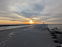
The largest White Lake is in Muskegon County, Michigan, formed by the White River near its mouth on Lake Michigan. The city of Montague, Montague Township and White River Township are on the north side of the lake. The city of Whitehall, Whitehall Township, and Fruitland Township are on the south side of the lake. The unincorporated community of Wabaningo is situated where the lake flows through a short navigation channel into Lake Michigan at 43°22′31″N86°25′36″W / 43.37528°N 86.42667°W .
The lake takes its name from the white clay that long formed around its banks, which in the 18th and 19th centuries was used for washing by the lake's Ottawa residents. [2] The Ottawa called the lake Waabigankiishkbogong, meaning "The Place of White Clay." [3]
Other smaller lakes are located in the following counties:
Other White Lakes are in

Ottawa County is a county located in the U.S. state of Michigan. As of the United States 2020 Census, the population was 296,200. The county seat is Grand Haven. The county is named for the Ottawa Nation, was set off in 1831 and organized in 1837. Ottawa County is included in the Grand Rapids-Kentwood, MI Metropolitan Statistical Area and has a significant Dutch American population.

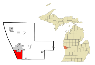
Muskegon County is a county in the U.S. state of Michigan. As of 2020, the population was 175,824. The county seat is Muskegon.

Summerfield Township is a civil township of Clare County in the U.S. state of Michigan. The population was 459 at the 2020 census.

Moscow Township is a civil township of Hillsdale County in the U.S. state of Michigan. The population was 1,467 at the 2020 census.

South Gull Lake is a census-designated place (CDP) in Ross Township, Kalamazoo County, in the U.S. state of Michigan. It includes the unincorporated communities of Yorkville, Gull Lake, and Midland Park and does not have any legal status as an incorporated municipality. The population of the CDP was 1,182 at the 2010 census, down from 1,526 at the 2000 census.

Montague is a city in Muskegon County in the U.S. state of Michigan. The population was 2,361 at the 2010 census. The city is located within Montague Township, but is politically independent.

Muskegon is a city in the U.S. state of Michigan, the county seat of Muskegon County. Situated around a harbor of Lake Michigan, Muskegon is known for fishing, sailing regattas, and pleasure boating, and as a commercial- and cruise-ship port. It is a popular vacation destination because of the expansive freshwater beaches, historic architecture, and public art collection. It is the most populous city along Lake Michigan's Eastern shore. At the 2020 United States Census, the city's population was 38,318. The southwest corner of Muskegon Township, the city is administratively autonomous.
Norton Shores is a city in Muskegon County in the U.S. state of Michigan. The population was 23,994 at the 2010 census.

Whitehall is a city in Muskegon County in the U.S. state of Michigan. The population was 2,706 at the 2010 census. The city is located in the southwest corner of Whitehall Township. Montague is its neighbor.
Chester Township is a civil township of Ottawa County in the U.S. state of Michigan. As of the 2000 United States Census, the township population was 2,315.
Crockery Township is a civil township of Ottawa County in the U.S. state of Michigan. As of the 2010 census, the township population was 3,960.
Gull Island is the name of a dozen small islands in the U.S. state of Michigan.
Otter Lake is the name of several lakes in the U.S. state of Michigan.
Wabaningo is a small unincorporated community of Fruitland Township, Muskegon County in the U.S. state of Michigan. It is situated where the White Lake flows through a short navigation channel into Lake Michigan at 43°22′31″N86°25′36″W.

The White River is a 23.6-mile-long (38.0 km) river located on the western side of the Lower Peninsula of the U.S. state of Michigan. Its source is the Oxford Swamp in Newaygo County. The rural town of Hesperia borders the river.
Michigan's 4th congressional district is a United States congressional district located in the state of Michigan. The current 4th district contains much of Michigan's old 2nd district, and includes all of Allegan and Van Buren counties, as well as portions of Ottawa, Kalamazoo, Calhoun, and Berrien counties. In 2022, the district was redrawn to start in St. Joseph Township and extend north to Port Sheldon Township. The 4th is currently represented by Republican Bill Huizenga, who previously represented the old 2nd district.
Crystal Lake may refer to the following lakes in Michigan:

There have been seven business routes of US Highway 31 in the state of Michigan. All of the business routes are former sections of US Highway 31 (US 31). They connect the freeway mainline of US 31 to the various downtowns of cities bypassed by US 31. Two of the current business routes, for Hart and Ludington, are business spurs, connecting to US 31 on only one end, while the remainder for Muskegon, Whitehall–Montague and Pentwater, are business loops. The two former routes, for Niles and Holland were a business spur and loop, respectively.
The West Michigan Pike Pure Michigan Byway is a Pure Michigan Byway on the Lower Peninsula of the US state of Michigan that follows several different highways, most notably Interstate 94 (I-94), I-196 and US Highway 31 (US 31) and various business routes from the Indiana state line near New Buffalo to the Ludington area. The routing is also mostly part of the Lake Michigan Circle Tour, although it deviates from that tourist route in a few locations in Berrien County. From south to north, the byway specifically follows:
Wabiwindego (d.1837), also spelled Wobwindego, Wobiwidigo, or Wabaningo, and known among the Ojibwe as Waabishkindip, was a leader of the Grand River Band of Ottawa in what would become the U.S. State of Michigan. He negotiated the 1836 Treaty of Washington with the federal government on behalf of the Grand River Ottawa, leading to the admission of the State of Michigan to the Union. Several villages he led formed the basis for several modern Michigan towns, including Lowell, Whitehall, and Montague.