Whitehall Township, Michigan

Last updated

Whitehall Township, Michigan
USA Michigan location map.svg
Red pog.svg
Whitehall Township
Usa edcp location map.svg
Red pog.svg
Whitehall Township
Coordinates: 43°24′45″N86°17′47″W / 43.41250°N 86.29639°W / 43.41250; -86.29639
Country United States
State Michigan
County Muskegon
Area
[1]
  Total9.4 sq mi (24 km2)
  Land9.1 sq mi (24 km2)
  Water0.3 sq mi (0.8 km2)
Elevation
653 ft (199 m)
Population
 (2020) [2]
  Total1,768
  Density194.4/sq mi (75.1/km2)
Time zone UTC-5 (Eastern (EST))
  Summer (DST) UTC-4 (EDT)
ZIP codes
49461, 49463 (Whitehall)
49437 (Montague)
Area code 231
FIPS code 26-121-86800 [3]
GNIS feature ID1627263 [4]
Website whitehalltwp.org

Whitehall Township is a civil township of Muskegon County in the U.S. state of Michigan. The population was 1,768 at the 2020 census. [2]

Contents

Geography

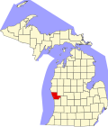
The township is in northern Muskegon County and is bordered to the west by the city of Whitehall. It is 16 miles (26 km) north of Muskegon, the county seat. U.S. Route 31, a four-lane freeway, crosses the township, with access from Exit 126 (West White Lake Drive) and Exit 128 (Business US-31 leading into Whitehall city).

According to the U.S. Census Bureau, Whitehall Township has a total area of 9.4 square miles (24 km2), of which 9.1 square miles (24 km2) are land and 0.3 square miles (0.8 km2), or 3.42%, are water. [1] The White River crosses the northwestern part of the township, entering White Lake, an arm of Lake Michigan, at Whitehall city.

Demographics

Historical population
CensusPop.Note
1880 1,835
1890 2,0149.8%
1900 1,582−21.4%
1910 1,543−2.5%
1920 1,307−15.3%
1930 1,47212.6%
1940 1,534 [6] 4.2%
1950 251−83.6%
1960 49697.6%
1970 1,064114.5%
1980 1,34126.0%
1990 1,4649.2%
2000 1,64812.6%
2010 1,7395.5%
2020 1,7681.7%
U.S. Decennial Census [7]

At the 2000 census, [3] there were 1,648 people, 617 households and 459 families residing in the township. The population density was 174.7 inhabitants per square mile (67.5/km2). There were 664 housing units at an average density of 70.4 per square mile (27.2/km2). The racial makeup of the township was 97.21% White, 1.15% African American, 0.42% Native American, 0.18% Asian, 0.18% from other races, and 0.85% from two or more races. Hispanic or Latino of any race were 1.27% of the population.

There were 617 households, of which 35.5% had children under the age of 18 living with them, 63.0% were married couples living together, 8.1% had a female householder with no husband present, and 25.6% were non-families. 22.0% of all households were made up of individuals, and 7.0% had someone living alone who was 65 years of age or older. The average household size was 2.60 and the average family size was 3.02.

Age distribution was 27.0% under the age of 18, 7.3% from 18 to 24, 26.5% from 25 to 44, 28.9% from 45 to 64, and 10.3% who were 65 years of age or older. The median age was 39 years. For every 100 females, there were 96.7 males. For every 100 females age 18 and over, there were 96.6 males.

The median household income was $50,375, and the median family income was $56,923. Males had a median income of $45,461 versus $28,819 for females. The per capita income for the township was $21,989. About 2.0% of families and 4.1% of the population were below the poverty line, including 2.6% of those under age 18 and 5.7% of those age 65 or over.

See also

Related Research Articles

<span class="mw-page-title-main">Muskegon County, Michigan</span> County in Michigan, United States

Muskegon County is a county in the U.S. state of Michigan. As of 2020, the population was 175,824. The county seat is Muskegon.

<span class="mw-page-title-main">Forest Township, Missaukee County, Michigan</span> Civil township in Michigan, United States

Forest Township is a civil township of Missaukee County in the U.S. state of Michigan. The population was 1,184 at the 2020 census.

Dalton Township is a civil township of Muskegon County in the U.S. state of Michigan. As of the 2020 census, the township population was 9,427.

Fruitland Township is a civil township of Muskegon County in the U.S. state of Michigan. The population was 5,793 at the 2020 census.

Holton Township is a civil township of Muskegon County in the U.S. state of Michigan. As of the 2020 census, the township population was 2,586.

Laketon Township is a civil township of Muskegon County in the U.S. state of Michigan. The population was 7,626 at the 2020 census.

<span class="mw-page-title-main">Lakewood Club, Michigan</span> Village in Michigan, United States

Lakewood Club is a village in Dalton Township of Muskegon County in the U.S. state of Michigan. The population was 1,340 at the 2020 census.

<span class="mw-page-title-main">Montague, Michigan</span> City in Michigan, United States

Montague is a city in Muskegon County in the U.S. state of Michigan. The population was 2,417 at the 2020 census. The city is politically independent from Montague Township, which borders it on three sides.

Montague Township is a civil township of Muskegon County in the U.S. state of Michigan. The population was 1,555 at the 2020 census. It is adjacent to the city of Montague.

Moorland Township is a civil township of Muskegon County in the U.S. state of Michigan. The population was 1,627 at the 2020 census.

Muskegon Charter Township is a charter township of Muskegon County in the U.S. state of Michigan. The population was 17,596 at the 2020 census. The city of Muskegon borders the township to the southwest and is administratively autonomous.

<span class="mw-page-title-main">North Muskegon, Michigan</span> City in Michigan, United States

North Muskegon is a city in Muskegon County in the U.S. state of Michigan. The population was 4,093 at the 2020 census, up from 3,786 in 2010.

<span class="mw-page-title-main">Norton Shores, Michigan</span> City in Michigan, United States

Norton Shores is a city in Muskegon County in the U.S. state of Michigan. The population was 25,030 at the 2020 census.

Ravenna Township is a civil township of Muskegon County in the U.S. state of Michigan. As of the 2020 census, the population was 2,962, up from 2,905 in 2010. The village of Ravenna is located within the township.

Sullivan Township is a civil township of Muskegon County in the U.S. state of Michigan. As of the 2020 census, the township population was 2,541.

<span class="mw-page-title-main">Twin Lake, Michigan</span> Census-designated place in Michigan, United States

Twin Lake is an unincorporated community in Muskegon County of the U.S. state of Michigan. It is a census-designated place (CDP) for statistical purposes. Local government services are provided by Dalton Township. As of the 2020 census, the population of the CDP was 2,056. The surrounding area is the home of Blue Lake Fine Arts Camp, the YMCA's Camp Pinewood, and the Boy Scouts' Gerber Scout Reservation and Owasippe Scout Reservation.

White River Township is a civil township of Muskegon County in the U.S. state of Michigan. The population was 1,383 at the 2020 census.

<span class="mw-page-title-main">Whitehall, Michigan</span> City in Michigan, United States

Whitehall is a city in Muskegon County in the U.S. state of Michigan. The population was 2,909 at the 2020 census. The city is located to the west of Whitehall Township. Montague is its neighbor.

<span class="mw-page-title-main">Wolf Lake, Michigan</span> Census-designated place in Michigan, United States

Wolf Lake is an unincorporated community and census-designated place (CDP) in Muskegon County in the U.S. state of Michigan. At the 2020 census, the population of Wolf Lake was 5,034, up from 4,104 in 2010. As an unincorporated community, Wolf Lake is governed by Egelston Township.

Blue Lake Township is a civil township of Muskegon County in the U.S. state of Michigan. As of the 2020 census, the township population was 2,416. One of the largest landowners in the township is the Pathway to Adventure Council of the Boy Scouts of America, which owns Owasippe Scout Reservation. The township is also home to the Blue Lake Fine Arts Camp.

References

  1. 1 2 "2023 U.S. Gazetteer Files: Michigan". United States Census Bureau. Retrieved December 22, 2023.
  2. 1 2 "P1. Race – Whitehall township, Michigan: 2020 DEC Redistricting Data (PL 94-171)". U.S. Census Bureau. Retrieved December 22, 2023.
  3. 1 2 "U.S. Census website". United States Census Bureau . Retrieved January 31, 2008.
  4. U.S. Geological Survey Geographic Names Information System: Whitehall Township, Michigan
  5. "Welcome". City of Whitehall. Retrieved December 22, 2021.
  6. Village of Whitehall incorporated as a city and separated from township in 1943. [5]
  7. "Decennial Census Official Publications". U.S. Census Bureau. Retrieved December 22, 2023.