Dalton Township, Michigan

Last updated

Dalton Township, Michigan
USA Michigan location map.svg
Red pog.svg
Dalton Township
Usa edcp location map.svg
Red pog.svg
Dalton Township
Coordinates: 43°19′54″N86°13′18″W / 43.33167°N 86.22167°W / 43.33167; -86.22167
Country United States
State Michigan
County Muskegon
Area
[1]
  Total36.3 sq mi (94 km2)
  Land35.3 sq mi (91 km2)
  Water1.0 sq mi (3 km2)
Elevation
676 ft (206 m)
Population
 (2020) [2]
  Total9,427
  Density267.0/sq mi (103.1/km2)
Time zone UTC-5 (Eastern (EST))
  Summer (DST) UTC-4 (EDT)
ZIP Codes
49445 (Muskegon)
49457 (Twin Lake)
FIPS code 26-121-19660 [3]
GNIS feature ID1626157 [4]
Website daltontownship.org

Dalton Township is a civil township of Muskegon County in the U.S. state of Michigan. As of the 2020 census, the township population was 9,427. [2]

Contents

History

Dalton Township was established in 1859. [5]

Geography

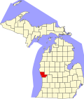
The township is in central Muskegon County, north of Muskegon, the county seat, and southeast of Whitehall. U.S. Route 31 crosses the township from northwest to south as a four-lane freeway, with access from Exits 118, 121, and 126. State highway M-120 crosses the east side of the township, passing through the community of Twin Lake.

According to the U.S. Census Bureau, the township has a total area of 36.3 square miles (94 km2), of which 35.3 square miles (91 km2) are land and 1.0 square mile (2.6 km2), or 2.71%, are water. [1]

Communities

Demographics

Historical population
CensusPop.Note
1860 258
1870 40155.4%
1880 47117.5%
1890 63835.5%
1900 81527.7%
1910 8220.9%
1920 652−20.7%
1930 1,08065.6%
1940 1,70357.7%
1950 3,11382.8%
1960 4,36640.3%
1970 5,36122.8%
1980 5,89710.0%
1990 6,2766.4%
2000 8,04728.2%
2010 9,30015.6%
2020 9,4271.4%
U.S. Decennial Census [8]

As of the census [3] of 2000, there were 8,047 people, 2,871 households, and 2,247 families residing in the township. The population density was 225.5 inhabitants per square mile (87.1/km2). There were 3,064 housing units at an average density of 85.9 per square mile (33.2/km2). The racial makeup of the township was 93.34% White, 2.31% African American, 1.30% Native American, 0.20% Asian, 0.93% from other races, and 1.91% from two or more races. Hispanic or Latino of any race were 2.87% of the population.

There were 2,871 households, out of which 39.9% had children under the age of 18 living with them, 63.6% were married couples living together, 9.4% had a female householder with no husband present, and 21.7% were non-families. 17.4% of all households were made up of individuals, and 6.1% had someone living alone who was 65 years of age or older. The average household size was 2.80 and the average family size was 3.14.

In the township the population was spread out, with 29.0% under the age of 18, 8.7% from 18 to 24, 30.3% from 25 to 44, 23.5% from 45 to 64, and 8.4% who were 65 years of age or older. The median age was 34 years. For every 100 females, there were 103.9 males. For every 100 females age 18 and over, there were 100.4 males.

The median income for a household in the township was $47,127, and the median income for a family was $50,096. Males had a median income of $37,743 versus $25,433 for females. The per capita income for the township was $18,036. About 3.8% of families and 5.9% of the population were below the poverty line, including 5.6% of those under age 18 and 7.0% of those age 65 or over.

Related Research Articles

<span class="mw-page-title-main">Forest Home Township, Michigan</span> Civil township in Michigan, United States

Forest Home Township is a civil township of Antrim County in the U.S. state of Michigan. The population was 1,720 at the 2010 census.

<span class="mw-page-title-main">Keene Township, Michigan</span> Township in Michigan, United States

Keene Township is a civil township of Ionia County in the U.S. state of Michigan. The population was 1,660 at the 2000 census.

<span class="mw-page-title-main">Deerfield Township, Isabella County, Michigan</span> Civil township in Michigan, United States

Deerfield Township is a civil township of Isabella County in the U.S. state of Michigan. The population was 3,081 at the 2000 census.

<span class="mw-page-title-main">Courtland Township, Michigan</span> Township in Michigan, United States

Courtland Township is a civil township of Kent County in the U.S. state of Michigan. The population was 7,678 at the 2010 census, which was an increase from 5,817 at the 2000 census.

Chippewa Township is a civil township of Mecosta County in the U.S. state of Michigan. As of the 2020 census, the township population was 1,227.

Colfax Township is a civil township of Mecosta County in the U.S. state of Michigan. The population was 1,962 at the 2020 census.

<span class="mw-page-title-main">Butterfield Township, Michigan</span> Civil township in Michigan, United States

Butterfield Township is a civil township of Missaukee County in the U.S. state of Michigan. As of the 2020 census, the township population was 473.

Winfield Township is a civil township of Montcalm County in the U.S. state of Michigan. As of the 2020 census, the township population was 2,279.

Casnovia Township is a civil township of Muskegon County in the U.S. state of Michigan. The population was 2,793 at the 2020 census.

Egelston Township is a general law township of Muskegon County in the U.S. state of Michigan. As of the 2020 census, the township population was 11,128, up from 9,909 in 2010.

<span class="mw-page-title-main">Fruitport, Michigan</span> Village in Michigan, United States

Fruitport is a village in Muskegon County in the U.S. state of Michigan. The population was 1,103 at the 2020 census. The community is located within Fruitport Charter Township.

Holton Township is a civil township of Muskegon County in the U.S. state of Michigan. As of the 2000 census, the township population was 2,532.

<span class="mw-page-title-main">Norton Shores, Michigan</span> City in Michigan, United States

Norton Shores is a city in Muskegon County in the U.S. state of Michigan. The population was 25,030 at the 2020 census.

Big Prairie Township is a civil township of Newaygo County in the U.S. state of Michigan. As of the 2000 census, the township population was 2,465.

<span class="mw-page-title-main">Croton Township, Michigan</span> Civil township in Michigan, United States

Croton Township is a civil township of Newaygo County in the U.S. state of Michigan. The population was 3,368 at the 2020 census.

Garfield Township is a civil township of Newaygo County in the U.S. state of Michigan. The population was 2,464 at the 2000 census.

Aetna Township is a civil township of Mecosta County in the U.S. state of Michigan. As of the 2020 census, the township population was 2,241.

Deerfield Township is a civil township of Mecosta County in the U.S. state of Michigan. The population was 1,785 at the 2020 census.

Maple Valley Township is a civil township of Montcalm County in the U.S. state of Michigan. The population was 1,908 at the 2020 census.

Blue Lake Township is a civil township of Muskegon County in the U.S. state of Michigan. As of the 2020 census, the township population was 2,416. One of the largest landowners in the township is the Pathway to Adventure Council of the Boy Scouts of America, which owns Owasippe Scout Reservation. The township is also home to the Blue Lake Fine Arts Camp.

References

  1. 1 2 "2023 U.S. Gazetteer Files: Michigan". United States Census Bureau. Retrieved December 20, 2023.
  2. 1 2 "P1. Race – Dalton township, Michigan: 2020 DEC Redistricting Data (PL 94-171)". U.S. Census Bureau. Retrieved December 20, 2023.
  3. 1 2 "U.S. Census website". United States Census Bureau . Retrieved January 31, 2008.
  4. U.S. Geological Survey Geographic Names Information System: Dalton Township, Michigan
  5. Romig, Walter (1986). Michigan Place Names. Detroit: Wayne State University Press. p. 145. ISBN   978-0-8143-1838-6 via Google Books.
  6. Romig, Walter (1986). Michigan Place Names. Detroit: Wayne State University Press. p. 93. ISBN   978-0-8143-1838-6 via Google Books.
  7. U.S. Geological Survey Geographic Names Information System: Dalton, Michigan
  8. "Decennial Census Official Publications". U.S. Census Bureau. Retrieved December 20, 2023.