Henrietta Township, Michigan

Last updated

Henrietta Township, Michigan
Henrietta Township Office and Eldon E. Katz Elementary School.JPG
Henrietta Township Office and Eldon E. Katz Elementary School
Henrietta Township, MI location.png
Location within Jackson County
USA Michigan location map.svg
Red pog.svg
Henrietta Township
Location within the state of Michigan
Usa edcp location map.svg
Red pog.svg
Henrietta Township
Henrietta Township (the United States)
Coordinates: 42°23′00″N84°18′52″W / 42.38333°N 84.31444°W / 42.38333; -84.31444
Country United States
State Michigan
County Jackson
Established1837
Government
  SupervisorAndy Grimes
   Clerk Sally Keene
Area
  Total37.05 sq mi (96.0 km2)
  Land35.98 sq mi (93.2 km2)
  Water1.07 sq mi (2.8 km2)
Elevation
938 ft (286 m)
Population
 (2010)
  Total4,705
  Density130.8/sq mi (50.5/km2)
Time zone UTC-5 (Eastern (EST))
  Summer (DST) UTC-4 (EDT)
ZIP code(s)
49201 (Jackson)
49259 (Munith)
49272 (Pleasant Lake)
49285 (Stockbridge)
Area code 517
FIPS code 26-37700 [1]
GNIS feature ID1626465 [2]
Website Official website

Henrietta Township is a civil township of Jackson County in the U.S. state of Michigan. The population was 4,705 at the 2010 census. [3]

Contents

History

Jean Baptiste Berard (also spelled Boreaux by descendants) claimed to have settled here in 1816 and had established a trading post in 1831. Nearby Batteese Lake [4] and Batteese Creek [5] were named after him, as his name was also commonly written as "Battise" by other early settlers. The township was organized in 1837 with the name "West Portage". In 1839, Henry Hurd had the town renamed "Henrietta", after his home town of Henrietta, New York. A post office named "Portage" opened on May 21, 1838, with John Davidson as the first postmaster. The name changed to "West Portage" on December 14, 1838, and then to "Henrietta" on May 13, 1840. The post office was discontinued on December 14, 1903. [6] Another post office, named "South Henrietta", opened on September 5, 1851, with Henry Hurd as the first postmaster, and was succeeded by William D. Martin on May 10, 1853. The office continued until December 21, 1866. [6] [7]
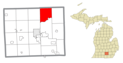
Communities

Geography

According to the United States Census Bureau, the township has a total area of 37.05 square miles (95.96 km2), of which 35.98 square miles (93.19 km2) is land and 1.07 square miles (2.77 km2) (2.89%) is water. [3]

It is drained by tributaries of the Portage River, which runs along the township's southern boundary and is part of the Grand River watershed.

A portion of Meridian-Baseline State Park is located within Henrietta Township.

Demographics

As of the census [1] of 2000, there were 4,483 people, 1,614 households, and 1,276 families residing in the township. The population density was 123.7 inhabitants per square mile (47.8/km2). There were 1,753 housing units at an average density of 48.4 per square mile (18.7/km2). The racial makeup of the township was 97.50% White, 0.42% African American, 0.49% Native American, 0.09% Asian, 0.07% Pacific Islander, 0.76% from other races, and 0.67% from two or more races. Hispanic or Latino of any race were 1.85% of the population.

There were 1,614 households, out of which 37.2% had children under the age of 18 living with them, 66.5% were married couples living together, 8.1% had a female householder with no husband present, and 20.9% were non-families. 16.3% of all households were made up of individuals, and 5.4% had someone living alone who was 65 years of age or older. The average household size was 2.76 and the average family size was 3.07.

In the township the population was spread out, with 27.3% under the age of 18, 7.7% from 18 to 24, 31.3% from 25 to 44, 24.1% from 45 to 64, and 9.5% who were 65 years of age or older. The median age was 36 years. For every 100 females, there were 103.7 males. For every 100 females age 18 and over, there were 103.3 males.

The median income for a household in the township was $48,517, and the median income for a family was $55,265. Males had a median income of $38,454 versus $26,079 for females. The per capita income for the township was $19,904. About 1.3% of families and 3.3% of the population were below the poverty line, including 3.2% of those under age 18 and none of those age 65 or over.

Related Research Articles

Casco Township is a civil township of Allegan County in the U.S. state of Michigan. The population was 2,823 at the 2010 census.

Ganges Township is a civil township of Allegan County in the U.S. state of Michigan. The population was 2,574 at the 2020 census.

<span class="mw-page-title-main">Fraser Township, Michigan</span> Civil township in Michigan, United States

Fraser Township is a civil township of Bay County in the U.S. state of Michigan. The township's population was 3,192 as of the 2010 census. It is included in the Bay City Metropolitan Statistical Area.

Clarence Township is a civil township located in northeast Calhoun County in the U.S. state of Michigan. It is part of the Battle Creek, Michigan Metropolitan Statistical Area. The population was 1,985 at the 2010 census. The township was originally named Pinkney Township.

<span class="mw-page-title-main">Somerset Township, Michigan</span> Civil township in Michigan, United States

Somerset Township is a civil township of Hillsdale County in the U.S. state of Michigan. The population was 4,532 at the 2020 census.

<span class="mw-page-title-main">Putnam Township, Michigan</span> Civil township in Michigan, United States

Putnam Township is a civil township of Livingston County in the U.S. state of Michigan. The population was 8,248 at the 2010 census, up from 7,500 at the 2000 census. The village of Pinckney is located within the township.

<span class="mw-page-title-main">Unadilla Township, Michigan</span> Civil township in Michigan, United States

Unadilla Township is a civil township in the southwest corner of Livingston County, Michigan, United States. The population was 3,366 at the 2010 census.

<span class="mw-page-title-main">Onekama Township, Michigan</span> Township in Michigan, United States

Onekama Township is a civil township of Manistee County in the U.S. state of Michigan. The population was 1,514 at the 2000 census.

<span class="mw-page-title-main">Comins Township, Michigan</span> Civil township in Michigan, United States

Comins Township is a civil township of Oscoda County in the U.S. state of Michigan. The population was 1,970 at the 2010 census.

<span class="mw-page-title-main">Lake Township, Roscommon County, Michigan</span> Civil township in Michigan, United States

Lake Township is a civil township of Roscommon County in the U.S. state of Michigan. The population was 1,119 at the 2020 census.

<span class="mw-page-title-main">Albee Township, Michigan</span> Civil township in Michigan, United States

Albee Township is a civil township of Saginaw County in the U.S. state of Michigan. As of the 2020 Census, the township population was 2,046. Albee Township was established in 1863.

<span class="mw-page-title-main">Swan Creek Township, Michigan</span> Civil township in Michigan, United States

Swan Creek Township is a civil township of Saginaw County in the U.S. state of Michigan. The population was 2,456 at the 2010 Census.

<span class="mw-page-title-main">Owosso Township, Michigan</span> Charter township in Michigan, United States

Owosso Township, formally named Owosso Charter Township, is a charter township of Shiawassee County in the U.S. state of Michigan. The population was 4,821 at the 2010 census. The township borders the city of Owosso on the east, but the two are administered autonomously.

<span class="mw-page-title-main">Freedom Township, Michigan</span> Civil township in Michigan, United States

Freedom Township is a civil township of Washtenaw County in the U.S. state of Michigan. The population was 1,428 at the 2010 census.

<span class="mw-page-title-main">Sharon Township, Michigan</span> Civil township in Michigan, United States

Sharon Township is a civil township of Washtenaw County in the U.S. state of Michigan. The population was 1,737 at the 2010 census.

<span class="mw-page-title-main">Sylvan Township, Washtenaw County, Michigan</span> Civil township in Michigan, United States

Sylvan Township is a civil township of Washtenaw County in the U.S. state of Michigan. The population was 2,833 at the 2010 census. The population was a large decrease from 6,425 at the 2000 census, which was due to Chelsea incorporating into a city in 2004.

<span class="mw-page-title-main">Portage River (Jackson County, Michigan)</span> Tributary of the Grand River in Michigan, United States

The Portage River is a 15.5-mile-long (24.9 km) river in the U.S. state of Michigan, flowing mostly southwesterly through northeast Jackson County.

<span class="mw-page-title-main">Fairfield Township, Lenawee County, Michigan</span> Civil township in Michigan, United States

Fairfield Township is a civil township of Lenawee County in the U.S. state of Michigan. As of the 2000 census, the township population was 1,756.

<span class="mw-page-title-main">McMillan Township, Luce County, Michigan</span> Civil township in Michigan, United States

McMillan Township is a civil township of Luce County in the U.S. state of Michigan. The population was 2,471 at the 2020 census. At 588.78 square miles (1,524.9 km2) of total land area, McMillan Township is the largest municipality by area in the state of Michigan.

<span class="mw-page-title-main">West Branch Township, Missaukee County, Michigan</span> Civil township in Michigan, United States

West Branch Township is a civil township of Missaukee County in the U.S. state of Michigan. The population was 466 at the 2010 census.

References

  1. 1 2 "U.S. Census website". United States Census Bureau . Retrieved January 31, 2008.
  2. U.S. Geological Survey Geographic Names Information System: Henrietta Township, Michigan
  3. 1 2 "Michigan: 2010 Population and Housing Unit Counts 2010 Census of Population and Housing" (PDF). 2010 United States Census . United States Census Bureau. September 2012. p. 26 Michigan. Archived (PDF) from the original on October 19, 2012. Retrieved May 1, 2020.
  4. U.S. Geological Survey Geographic Names Information System: Batteese Lake
  5. U.S. Geological Survey Geographic Names Information System: Batteese Creek
  6. 1 2 3 4 Romig, Walter (1986) [1973]. Michigan Place Names. Detroit, Michigan: Wayne State University Press. ISBN   0-8143-1838-X.
  7. U.S. Geological Survey Geographic Names Information System: South Henrietta Post Office (historical)
  8. U.S. Geological Survey Geographic Names Information System: Henrietta Station, Michigan
  9. U.S. Geological Survey Geographic Names Information System: Pleasant Lake, Michigan
  10. ZIP Code Lookup Archived 2010-11-22 at the Wayback Machine , United States Postal Service
  11. U.S. Geological Survey Geographic Names Information System: Roots, Michigan
  12. U.S. Geological Survey Geographic Names Information System: Roots Post Office (historical)