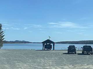
Conesus Lake is located in Livingston County, New York. Conesus Lake is the westernmost of New York's eleven Finger Lakes. It is located off Interstate 390 about 15 miles (24 km) south of Interstate 90.

Hemlock Lake is one of the minor Finger Lakes. It is mostly located in Livingston County, New York, south of Rochester, with a portion overlapping into Ontario County. Hemlock is a translation of the Seneca name for the lake, O-neh-da Te-car-ne-o-di. It is one of two Finger Lakes whose shorelines are virtually undeveloped.

The Great Sacandaga Lake is a large lake situated in the Adirondack Park in northern New York in the United States. The lake has a surface area of about 41.7 square miles (108 km2) at capacity, and the length is about 29 miles (47 km). The word Sacandaga means "Land of the Waving Grass" in the native Mohawk language. The lake is located in the northern parts of Fulton County and Saratoga County near the southern border of the Adirondack Park. A small portion also extends northward into southern Hamilton County. The broader, south end of the lake is northeast of the City of Johnstown and the City of Gloversville. Great Sacandaga Lake is a reservoir created by damming the Sacandaga River. The primary purpose for the creation of the reservoir was to control flooding on the Hudson River and the Sacandaga River, floods which had a historically significant impact on the surrounding communities.

Delta Reservoir, also known as Delta Lake, is a reservoir located in Oneida County, New York, United States. It was formed by the impoundment of the Mohawk River. Most of the lake is within the southwest part of the Town of Western, north of Rome. The western part of the lake is in the Town of Lee.

Neversink Reservoir is a reservoir in the New York City water supply system. It is located in the Catskill Mountain town of Neversink in Sullivan County, New York, 75 miles (121 km) northwest of the City.
Lake Neatahwanta is located in and near the city of Fulton in Oswego County, New York. It covers approximately 750 acres (3.0 km2) of which about one-half is located within the city, while the other half is located in the town of Granby. Neatahwanta translates to "little lake near the big lake" in Iroquois.

Indian Lake is a 12-mile (19 km) long, 4,255-acre (1,722 ha) reservoir with a southwest to northeast orientation in the towns of Indian Lake and Lake Pleasant in Hamilton County, in the Adirondack Park of New York State, in the United States. The hamlet of Indian Lake is located 2 miles (3.2 km) north of the north end of Indian Lake. New York State Route 30 runs along the west shore of the lake. Most of the shore is part of the Forest Preserve. Indian Lake is fed by the Jessup River, and drains through the Indian River into Lake Abanakee, and from there through the Indian River to the Hudson River.

Schroon Lake is located near Schroon Lake, New York. Fish species present in the lake are lake trout, landlocked salmon, largemouth bass, smallmouth bass, northern pike, yellow perch, chain pickerel, rock bass, sunfish, and brown bullhead. There are three access points on the lake. One is a state owned hard surface ramp off US-9, just north of the hamlet of Pottersville. The second is a state owned hand launch access at the Eagle Point Campground off US-9, 2 miles north of the hamlet of Pottersville. The third is a village owned public beach launch access off US-9, in the village of Schroon Lake.

Saratoga Lake is in the eastern part of Saratoga County, New York. The lake is approximately 4.5 miles (7.2 km) long, about 1.5 miles (2.4 km) wide at its widest point, and about 95 feet (29 m) deep.
Lake Moraine is a mesotrophic lake located 2.5 miles (4.0 km) northeast of Hamilton, New York. The lake is 261 acres (1.06 km2), consisting of two basins which are separated by a causeway and interconnected by a culvert. The northern basin is 79 acres (0.32 km2) and is relatively shallow with a maximum depth of 12 feet (3.7 m) and average depth of 3.7 feet (1.1 m). The larger southern basin is 172 acres (0.70 km2) and has a maximum depth of 45 feet (14 m) and an average depth of 17.7 feet (5.4 m). Payne Brook is the lake's outflow that flows into the Chenango River.
Carry Falls Reservoir is a man-made lake on the Raquette River, located southeast of Stark, New York. Fish species present in the reservoir are smallmouth bass, northern pike, yellow perch, black bullhead, tiger muskellunge, rock bass, and walleye. There is a state owned hard ramp boat launch located on the southwest shore.
Stark Falls Reservoir is a man-made lake on the Raquette River located near Stark, New York. Fish species present in the reservoir are smallmouth bass, largemouth bass, northern pike, yellow perch, black bullhead, tiger muskellunge, rock bass, and walleye. There is a hard ramp boat launch located on the southeast shore.
Five Falls Reservoir is a man-made lake located on the Raquette River east of South Colton, New York. Fish species present in the reservoir are smallmouth bass, white sucker, northern pike, yellow perch, rock bass, and walleye. There is a boat launch located on the southwest shore off Three Falls Lane.
South Colton Reservoir is a man-made lake located on the Raquette River at South Colton, New York. Fish species present in the reservoir are smallmouth bass, white sucker, northern pike, yellow perch, rock bass, and walleye. There is a boat launch located on the southwest shore off Three Falls Lane and a carry down launch on the north shore on Morgan Road.
Higley Falls Reservoir, also known as Higley Flow, is a man-made lake located on the Raquette River between Colton and South Colton, New York. Fish species present in the reservoir are smallmouth bass, northern pike, black bullhead, and walleye. There is a concrete ramp boat launch located in Higley Flow State Park.
Norwood Lake is a man-made lake located by Norwood, New York. Fish species present in the reservoir are smallmouth bass, northern pike, rock bass, yellow perch, and walleye. There is a carry down boat launch located on Riverside Road.
Stillwater Reservoir is a man-made lake located by Beaver River, New York within the Western Adirondacks. The lake has a large amount of recreational uses including camping, canoeing, boating, fishing, hunting, snowmobiling, and cross-country skiing. The lake has undeveloped edges with remote camping on both the islands and the shoreline. Camping permits and lake information may be obtained from the hamlet of Stillwater at the Forest Ranger Headquarters. Fish species present in the reservoir are smallmouth bass, splake, rock bass, yellow perch, sunfish and brown trout. There is a state owned hard surface ramp on Stillwater Road, 28 miles east of Lowville, New York. the record low temperature for the state of New York of −52 °F (−47 °C) took place at Stillwater Reservoir, and was later tied by Old Forge on February 17, 1979.
Forestport Reservoir is a reservoir located by Forestport, New York. The reservoir was created by the impoundment of the Black River. Fish species present in the reservoir are yellow perch, lake trout, pickerel, white sucker, rock bass, smallmouth bass, and brown bullhead. There is state owned beach launch off Route 28.

West Lake is located west of the Hamlet of Canada Lake. The outlet of West Lake is Canada Lake. Fish species present in the lake are pickerel, black bullhead, white sucker, rock bass, carp, yellow perch, and pumpkinseed sunfish. There is a state owned hard surface ramp off Point Breeze Road.
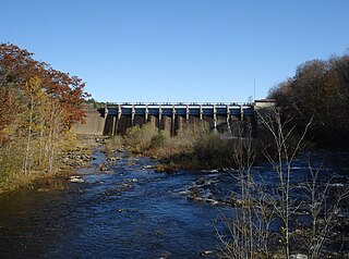
Salmon River Reservoir, also known as the Redfield Reservoir, is a man-made lake located near the hamlet of Redfield, New York. The reservoir was created with the completion of a hydroelectric dam in 1912. It has the capacity to hold 56,000 acre-feet (69,000,000 m3) of water. It is the larger of the Salmon River's two reservoirs.


