Wiang Sa district, Surat Thani

Last updated • 1 min readFrom Wikipedia, The Free Encyclopedia
Wiang Sa
เวียงสระ
Wat Thung Luang46881.jpg
Wat Thung Luang
Amphoe 8415.svg
District location in Surat Thani province
Coordinates: 8°37′47″N99°20′35″E / 8.62972°N 99.34306°E / 8.62972; 99.34306
Country Thailand
Province Surat Thani
SeatWiang Sa
Area
  Total427.6 km2 (165.1 sq mi)
Population
 (2005)
  Total41,030
  Density96/km2 (250/sq mi)
Time zone UTC+7 (ICT)
Postal code 84190
Geocode 8415

Wiang Sa (Thai : เวียงสระ, pronounced [wīa̯ŋsàʔ] ) is a district ( amphoe ) of Surat Thani province, Thailand.

Contents

Geography

Wiang Sa is in the southeast Surat Thani Province. Neighboring districts are (from the west clockwise) Phrasaeng, Khian Sa, and Ban Na San of Surat Thani, and Phipun, Chawang, and Tham Phannara of Nakhon Si Thammarat province.

The Tapi River forms the western boundary of the district. Smaller rivers in the district are Khlong Nam Thao, Khlong Tan and Khlong Chanuan. To the west the terrain descends to the Tapi plain, to the east are the hills of the Nakhon Si Thammarat mountain range.

In the northeast of the district is Tai Romyen National Park.

History

Wiang Sa originated as a minor city-state ( mueang ) under the control of Nakhon Si Thammarat after the Srivijaya times. It was converted into a district named Khlong Tan (คลองตาล) during the thetsaban reforms at the end of the 19th century. In 1896 Wiang Sa was reduced to a tambon within Lamphun District, the current Ban Na San district. On 10 March 1968 Wiang Sa became a minor district ( king amphoe ) by splitting off tambons Wiang Sa and Thung Luang from Ban Na San District. [1] On 17 November 1971 it was upgraded to full district status. [2]

Administration

Wiang Sa is divided into five sub-districts ( tambons ), which are further subdivided into 64 villages ( mubans ). There are three townships ( thesaban tambons ): Wiang Sa covering parts of tambons Wiang Sa and Ban Song, Ban Song covering the remaining parts of tambon Ban Song, and Khao Niphan covering tambon Khao Nipham. The three tambons which are not completely covered by municipal area each have a tambon administrative organization (TAO).

No.NameThai nameVillages Pop.
1.Wiang Saเวียงสระ109,696
2.Ban Songบ้านส้อง186,725
3.Khlong Chanuanคลองฉนวน128,382
4.Thung Luangทุ่งหลวง1610,374
5.Khao Niphanเขานิพันธ์85,853
  Tambon 8415.png

Related Research Articles

<span class="mw-page-title-main">Surat Thani province</span> Province in Thailand

Surat Thani, often shortened to Surat, is the largest of the southern provinces (changwat) of Thailand. It lies on the western shore of the Gulf of Thailand. Surat Thani means 'city of good people', a title given to the city by King Vajiravudh ; Surat Thani is therefore the sole province in Southern Thailand for which the native name is in the Central Thai language.

<span class="mw-page-title-main">Kanchanadit district</span> District in Surat Thani, Thailand

Kanchanadit is a district (amphoe) in Surat Thani province, south Thailand.

<span class="mw-page-title-main">Don Sak district</span> District in Surat Thani, Thailand

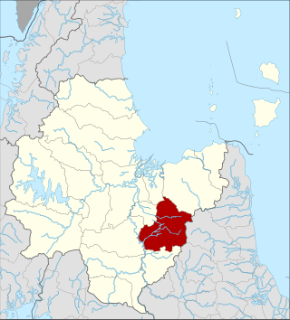
Don Sak is a district (amphoe) in eastern Surat Thani province. The two principal ferry companies offering service to Samui Island leave from piers in the district.

<span class="mw-page-title-main">Mueang Surat Thani district</span> District in Surat Thani, Thailand

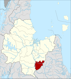
Mueang Surat Thani, or colloquially Ban Don District, is the district of Surat Thani province in southern Thailand.

<span class="mw-page-title-main">Khian Sa district</span> District in Surat Thani, Thailand

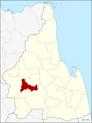
Khian Sa is a district (amphoe) in Surat Thani province, Thailand.

<span class="mw-page-title-main">Phrasaeng district</span> District in Surat Thani, Thailand

Phraseang is a district (amphoe) of Surat Thani province, Thailand.

<span class="mw-page-title-main">Phanom district</span> District in Surat Thani, Thailand

Phanom is a district (amphoe) in the southwest of Surat Thani province of southern Thailand.

<span class="mw-page-title-main">Khiri Rat Nikhom district</span> District in Surat Thani, Thailand

Khiri Rat Nikhom is a district (amphoe) in western Surat Thani province, southern Thailand.

<span class="mw-page-title-main">Ban Ta Khun district</span> District in Surat Thani, Thailand

Ban Ta Khun is an amphoe in western Surat Thani province, southern Thailand. It is the largest district of the province and has the lowest population density.

<span class="mw-page-title-main">Khanom district</span> District in Nakhon Si Thammarat, Thailand

Khanom is the northernmost district (amphoe) of Nakhon Si Thammarat province, southern Thailand.

<span class="mw-page-title-main">Plai Phraya district</span> District in Krabi, Thailand

Plai Phraya is a district (amphoe) in Krabi province, Thailand.

<span class="mw-page-title-main">Ban Na Doem district</span> District in Surat Thani, Thailand

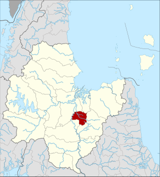
Ban Na Doem is a district (amphoe) of Surat Thani province, Thailand.

<span class="mw-page-title-main">Ban Na San district</span> District in Surat Thani, Thailand

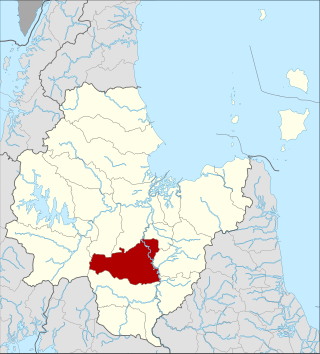
Ban Na San is a district (amphoe) of Surat Thani province, Thailand.

<span class="mw-page-title-main">Khao Phanom district</span> District in Krabi, Thailand

Khao Phanom is a district (amphoe) in Krabi province, Thailand.

<span class="mw-page-title-main">Nopphitam district</span> District in Nakhon Si Thammarat, Thailand

Nopphitam is a district (amphoe) of Nakhon Si Thammarat province, southern Thailand.

<span class="mw-page-title-main">Chawang district</span> District in Nakhon Si Thammarat, Thailand

Chawang is a district (amphoe) of Nakhon Si Thammarat province, southern Thailand.

<span class="mw-page-title-main">Tham Phannara district</span> District in Nakhon Si Thammarat, Thailand

Tham Phannara is a district (amphoe) of Nakhon Si Thammarat province, southern Thailand.

<span class="mw-page-title-main">Na Bon district</span> District in Nakhon Si Thammarat, Thailand

Na Bon is a district (amphoe) of Nakhon Si Thammarat province, southern Thailand.

<span class="mw-page-title-main">Phipun district</span> District in Nakhon Si Thammarat, Thailand

Phipun is a district (amphoe) in the northern part of Nakhon Si Thammarat province, southern Thailand.

<span class="mw-page-title-main">Thung Yai district</span> District in Nakhon Si Thammarat, Thailand

Thung Yai is the westernmost district (amphoe) of Nakhon Si Thammarat province, southern Thailand.

References

  1. ประกาศกระทรวงมหาดไทย เรื่อง แบ่งท้องที่ตั้งเป็นกิ่งอำเภอ (PDF). Royal Gazette (in Thai). 85 (24 ง): 797. 12 Mar 1968. Archived from the original (PDF) on March 24, 2012.
  2. พระราชกฤษฎีกาตั้งอำเภอปลาปาก อำเภอเชียงกลาง อำเภอปากชม อำเภอบ้านม่วง อำเภอพังโคน อำเภอดอนสัก อำเภอพนม อำเภอเวียงสระ อำเภอสังคม และอำเภอหัวตะพาน พ.ศ. ๒๕๑๔ (PDF). Royal Gazette (in Thai). 88 (123 ก): 745–748. 16 Nov 1971. Archived from the original (PDF) on February 24, 2012.