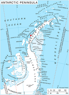
Martin Glacier is a glacier, 3 nautical miles (6 km) wide and 9 nautical miles (17 km) long, which flows west and then northwest from the south side of Mount Lupa to the southeast corner of Rymill Bay where it joins Bertrand Ice Piedmont, on the west coast of Graham Land, Antarctica. It was first surveyed in 1936 by the British Graham Land Expedition (BGLE) under John Riddoch Rymill, and was resurveyed in 1948–1949 by the Falkland Islands Dependencies Survey. The glacier was named for James H. Martin, a member of the British Australian and New Zealand Antarctic Research Expedition (1929–1931) under Sir Douglas Mawson, and first mate of the Penola during the BGLE.
Bertrand Ice Piedmont is an ice piedmont about 20 kilometres (11 nmi) long and from 6 to 9 kilometres wide, lying between Rymill Bay and Mikkelsen Bay on the Fallières Coast of Graham Land.

Avery Plateau is an ice-covered plateau, about 40 miles (64 km) long and rising to about 2,000 metres (6,600 ft), midway between Loubet Coast and Foyn Coast in Graham Land, Antarctica. It borders Hemimont Plateau on the south and Bruce Plateau on the north. The first sighting of this plateau is not certain, but it was presumably seen in January and February 1909 by members of the French Antarctic Expedition under Jean-Baptiste Charcot from various positions in the Matha Strait. It was surveyed in 1946–47 by the Falkland Islands Dependencies Survey, and named by the UK Antarctic Place-Names Committee (1955) after Captain George Avery, master of the cutter Lively, who, with Captain John Biscoe in the brig Tula, approached this part of the Antarctic Peninsula in February 1832.

Dibble Glacier in Antarctica is a prominent channel glacier flowing from the continental ice and terminating in a prominent tongue at the east side of Davis Bay. It was delineated from air photos taken by U.S. Navy Operation Highjump (1946–47), and named by the Advisory Committee on Antarctic Names for Jonas Dibble, ship's carpenter on the sloop Peacock of the United States Exploring Expedition (1838–42) under Charles Wilkes. Dibble is credited with leaving his sick bed and working 24 hours without relief with other carpenters to repair a broken rudder on the Peacock, when the ship was partially crushed in an ice bay in 151°19′E and forced to retire northward.

Posadowsky Glacier is a glacier about 9 nautical miles long, flowing north to Posadowsky Bay immediately east of Gaussberg. Posadowsky Bay is an open embayment, located just east of the West Ice Shelf and fronting on the Davis Sea in Kaiser Wilhelm II Land. Kaiser Wilhelm II Land is the part of East Antarctica lying between Cape Penck, at 87°43'E, and Cape Filchner, at 91°54'E, and is claimed by Australia as part of the Australian Antarctic Territory. Other notable geographic features in this area include Drygalski Island, located 45 mi NNE of Cape Filchner in the Davis Sea, and Mirny Station, a Russian scientific research station.
Bongrain Ice Piedmont is an ice piedmont, 27 nautical miles long in a northeast–southwest direction and 12 nautical miles wide in its widest part, occupying the northwest coastal area of Alexander Island. Mount Bayonne lies to the east and Cape Vostok lies southwest of Bongrain Ice Piedmont. It was first seen from a distance and roughly surveyed by the French Antarctic Expedition, 1908–10, (FrAE) under Jean-Baptiste Charcot, and later photographed from the air by the British Graham Land Expedition on August 15, 1936, and roughly mapped from these photos. It was named by the UK Antarctic Place-Names Committee in 1954 for Maurice Bongrain, surveyor of the FrAE, who was responsible for the first map of this coast.

Crookes Peak is a peak at the east side of Widmark Ice Piedmont, midway between Stair Hill and Rugg Peak on Stresher Peninsula on the west coast of Graham Land. It was charted by the British Graham Land Expedition of 1934-37 under John Rymill and was named by the UK Antarctic Place-Names Committee in 1959 for Sir William Crookes, an English chemist and physicist whose pioneer work on the optical properties of tinted glass in 1909–13 led to the design of the first satisfactory snow goggles and the prevention of snow blindness.

Crystal Sound is a sound in Antarctica between the southern part of the Biscoe Islands and the coast of Graham Land, with northern limit Cape Evensen to Cape Leblond and southern limit Holdfast Point, Roux Island, Liard Island and the Sillard Islands. It was so named by the UK Antarctic Place-Names Committee in 1960 because many features in the sound are named for men who have undertaken research on the structure of ice crystals.
To the north of Crystal Sound, many geographical features are named after physiologists.

Darbel Bay is a bay 25 nautical miles (50 km) wide, indenting the west coast of Graham Land between Stresher Peninsula and Pernik Peninsula. Entered southwest of Cape Bellue and northeast of Cape Rey. The glaciers Widmark Ice Piedmont, Cardell, Erskine, Hopkins, Drummond, Widdowson, McCance, Solun and Škorpil feed the bay.
Davisville Glacier is a glacier about 30 nautical miles (60 km) long which drains the north slopes of the Wisconsin Range, between Lentz Buttress and Moran Buttress, and trends northwestward to merge with the lower portion of the Horlick Ice Stream. It was mapped by the United States Geological Survey from surveys and U.S. Navy air photos, 1960–64, and was named by the Advisory Committee on Antarctic Names for Davisville, Rhode Island, the location of the Construction Battalion Center responsible for cargo matters for U.S. Navy Operation Deep Freeze on the east coast.
Dee Ice Piedmont is an ice piedmont between Pavie Ridge and the mouth of Clarke Glacier on the east side of Mikkelsen Bay, west coast of the Antarctic Peninsula. It was surveyed from the ground by the British Graham Land Expedition, 1936–37, and by the Falkland Islands Dependencies Survey, 1948–50. It was photographed by the Ronne Antarctic Research Expedition, November 1947, and was named by the UK Antarctic Place-Names Committee after John Dee, an English mathematician and pioneer teacher of navigation methods for 30 years during a period of great maritime expansion and exploration (1527-1608,1609).
Gibbs Glacier is a glacier, 15 nautical miles (28 km) long, flowing southeast into the northern part of Mercator Ice Piedmont on the east side of the Antarctic Peninsula. This feature together with Neny Glacier, which flows northwest, occupy a transverse depression between Mercator Ice Piedmont and Neny Fjord on the west side of the Antarctic Peninsula. Gibbs Glacier was photographed from the air and first mapped by the United States Antarctic Service, 1939–41, and the Ronne Antarctic Research Expedition, 1947–48. It was named by the UK Antarctic Place-Names Committee for Peter M. Gibbs of the Falkland Islands Dependencies Survey, a surveyor at Horseshoe Island, 1957, and leader at Stonington Island, 1958, who was responsible for the first ground survey of the glacier.
Hamblin Glacier is a glacier flowing to the southeast side of Widmark Ice Piedmont, in Graham Land, Antarctica. It was photographed by Hunting Aerosurveys Ltd in 1955–57, and mapped from these photos by the Falkland Islands Dependencies Survey. It was named by the UK Antarctic Place-Names Committee in 1959 for Theodore Hamblin (1890–1952), an English optician who in the 1930s helped in the evolution of the first satisfactory snow goggle design.
Hamilton Ice Piedmont is an ice piedmont, 8 nautical miles (15 km) wide, to the east of Wyatt Hill, Bear Peninsula, on the Walgreen Coast of Marie Byrd Land, Antarctica. It was mapped by the United States Geological Survey from surveys and U.S. Navy aerial photographs, 1959–66, and was named in 1977 by the Advisory Committee on Antarctic Names after Robert Hamilton, a meteorologist at the University of California, Davis, who was United States Antarctic Research Program Station Scientific Leader at South Pole Station, winter party 1975.
Lliboutry Glacier is a glacier flowing southwest from the Boyle Mountains of Antarctica into Bourgeois Fjord, Loubet Coast. It was named by the UK Antarctic Place-Names Committee in 1983 after Louis A.F. Lliboutry, a French physicist and glaciologist who investigated the mechanical deformation of ice and the micro-meteorological properties of ice surfaces, and who also made a general study of glaciers in the Antarctic Peninsula. Lliboutry was Director of the Laboratory of Glaciology, University of Grenoble, 1958–83, and President of the International Commission on Snow and Ice, 1983–87.
Mercator Ice Piedmont is a gently-sloping ice piedmont at the head of Mobiloil Inlet, formed by the confluence of the Gibbs, Lammers, Cole and Weyerhaeuser Glaciers in eastern Graham Land, Antarctica. The feature was first photographed from the air by Lincoln Ellsworth in November 1935, and was plotted from these photos by W.L.G. Joerg as the lower end of a "major valley depression" along the coast. It was first seen from the ground by Finn Ronne and Carl R. Eklund of the United States Antarctic Service, 1939–41, which also obtained air photos. The ice piedmont was surveyed by the Falkland Islands Dependencies Survey in December 1958, and was named by the UK Antarctic Place-Names Committee after Flemish mathematician and geographer Gerardus Mercator, the originator, in 1568, of the map projection which bears his name.

Stefan Ice Piedmont is a small ice piedmont at the northwest extremity of Pernik Peninsula, Loubet Coast in Graham Land, overlying the coast between Cape Rey and Holdfast Point. Mapped from air photos taken by Falkland Islands and Dependencies Aerial Survey Expedition (FIDASE) (1956–57). Named by United Kingdom Antarctic Place-Names Committee (UK-APC) for Josef Stefan (1835–1893), Austrian physicist who in 1889 pioneered the theory of heat flow in a freezing ice layer and first used it to calculate rates of sea ice growth in the Arctic.
Kent Gap is an ice-filled gap connecting the heads of May Valley and Chambers Glacier and marking the divide between Lexington Table and Saratoga Table, in the Forrestal Range of the Pensacola Mountains, Antarctica. It was mapped by the United States Geological Survey from surveys and U.S. Navy air photos, 1956–66, and was named by the Advisory Committee on Antarctic Names for Kenneth K. Kent, an electronics technician at Ellsworth Station, winter 1957.
Rugg Peak is a peak at the east side of Widmark Ice Piedmont southward of Crookes Peak, on the west coast of Graham Land. Photographed by Hunting Aerosurveys Ltd. in 1956-57, and mapped from these photos by the Falkland Islands Dependencies Survey (FIDS). Named by the United Kingdom Antarctic Place-Names Committee (UK-APC) in 1959 for Andrew Rugg-Gunn, English ophthalmic surgeon, who in 1934 brought together the relevant data on radiation and protective glasses to improve the design of snow goggles.

Gomotartsi Knoll is the rocky, mostly ice-covered peak of elevation 900 m in the south part of Widmark Ice Piedmont on Stresher Peninsula, Loubet Coast in Graham Land, Antarctica. It is named after the settlement of Gomotartsi in Northwestern Bulgaria.


![]()


