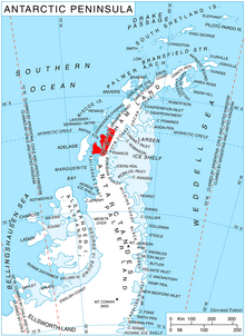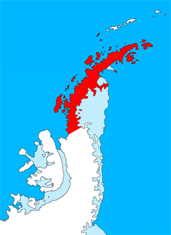
Graham Land is the portion of the Antarctic Peninsula that lies north of a line joining Cape Jeremy and Cape Agassiz. This description of Graham Land is consistent with the 1964 agreement between the British Antarctic Place-names Committee and the US Advisory Committee on Antarctic Names, in which the name "Antarctic Peninsula" was approved for the major peninsula of Antarctica, and the names Graham Land and Palmer Land for the northern and southern portions, respectively. The line dividing them is roughly 69 degrees south.
Hanusse Bay is a broad, V-shaped bay, off the west coast of Graham Land, Antarctica. The bay is 37 kilometres (20 nmi) long and trends generally north–south. It is bordered by Cape Mascart on Anvers Island, and Shmidt Point on Arrowsmith Peninsula, Loubet Coast. At its north entrance, Isacke Passage separates it from Liard Island. It is bounded to the south by a line from Landauer Point, the north point of Hansen Island and Bagnold Point on Arrowsmith Peninsula.

Workman Rocks is a group of rocks in the northeast part of Darbel Bay just westward of Panther Cliff on the southwest coast of Stresher Peninsula, Graham Land in Antarctica. Photographed by the Falkland Islands and Dependencies Aerial Survey Expedition (FIDASE) in 1956–57. Named by the United Kingdom Antarctic Place-Names Committee (UK-APC) in 1960 for Everley J. Workman, American physicist who has investigated the electrical properties of ice.

Barilari Bay is a bay 12 nautical miles (22 km) long and 6 nautical miles (11 km) wide, between Cape Garcia and Loqui Point on the west coast of Graham Land. The glaciers Birley, Lawrie, Weir and Bilgeri feed the bay.
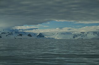
Beascochea Bay is a bay, 10 nautical miles (19 km) long and 5 nautical miles (9 km) wide, indenting the Graham Coast of Graham Land, Antarctica, between Kyiv Peninsula and Barison Peninsula, and entered south of Cape Perez. The glaciers Lever, Funk, Cadman, Talev and Butamya feed the bay.

Cape Bellue is a headland on the north side of the entrance to Darbel Bay, which forms the west extremity of Stresher Peninsula on the west coast of Graham Land, Antarctica. It separates Graham Coast to the northeast from Loubet Coast to the southwest. Discovered by the French Antarctic Expedition, 1908–1910, under Charcot, and named by him for Admiral Bellue, Superintendent of the Dockyard at Cherbourg, France. The cape was roughly mapped by BGLE in August–September 1935 and called in error "Cape Evensen". The cape was photographed from the air by FIDASE and surveyed from the ground by FIDS from Detaille Island, 1956–57.

Bigo Bay is a bay 8 nautical miles (15 km) long and 6 nautical miles (11 km) wide, indenting the west coast of Graham Land between Cape Garcia and Magnier Peninsula surmounted by the Magnier Peaks and Lisiya Ridge.
Charcot Bay is a bay about 10 nautical miles wide between Cape Kater and Cape Kjellman along the Davis Coast of Graham Land, Antarctica.

Waldeck-Rousseau Peak is a conspicuous monolith 3 nautical miles (6 km) east-northeast of Cape Evensen on Stresher Peninsula on Graham Coast, Antarctic Peninsula. The French Antarctic Expedition (1903–05) under Jean-Baptiste Charcot charted a cape in this area which they named for French statesman Pierre Waldeck-Rousseau. On re-exploring this area, the French Antarctic Expedition (1908–10) under Charcot sighted the feature from Pendleton Strait, 25 nautical miles (46 km) distant, and charted it as an island near the coast. Correlating its work with that of Charcot, the British Graham Land Expedition (BGLE) under John Rymill charted this portion of the coast by land and from the air in 1935. Waldeck-Rousseau Peak as here applied is in accord with the interpretation of the BGLE.
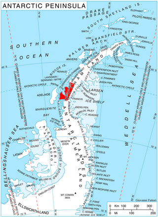
Widdowson Glacier is a glacier situated between Drummond and McCance Glaciers and flowing into Darbel Bay south of Sokol Point, on the west coast of Graham Land.

Widmark Ice Piedmont is an ice piedmont between Holtedahl and Darbel bays on Stresher Peninsula on the west coast of Graham Land. Photographed by Hunting Aerosurveys Ltd in 1955-57, it was mapped from these photos by the Falkland Islands Dependencies Survey (FIDS). It was named by the United Kingdom Antarctic Place-Names Committee (UK-APC) in 1959 after Erik J. Widmark (1850–1909), a Swedish ophthalmologist and pioneer of researches upon the etiology and treatment of snow blindness.
The Darbel Islands are a group of islands and rocks extending southwest from Cape Bellue for 5 nautical miles (9 km) across the entrance to Darbel Bay, off the west coast of Graham Land. They were charted in 1930 by Discovery Investigations personnel on the Discovery II and named Marin Darbel Islands after the bay in which they were found. Both names have since been shortened by the UK Antarctic Place-Names Committee.

Duyvis Point is the point forming the southeast side of the entrance to Urovene Cove situated 11 nautical miles (20 km) south-southeast of Cape Garcia and 2.65 km southeast of Laskar Point, on the southwest coast of Felipe Solo (Obligado) Peninsula, Graham Land in Antarctica. It was first roughly charted by the British Graham Land Expedition under John Rymill, 1934–37. It was mapped more accurately by the Falkland Islands Dependencies Survey from photos taken by Hunting Aerosurveys Ltd in 1956–57, and was named by the UK Antarctic Place-Names Committee for F. Donker Duyvis, a Dutch documentalist who was Secretary of the International Federation for Documentation.

Cape Evensen is a cape forming the north side of the entrance to Auvert Bay, on the northwest coast of Stresher Peninsula, Graham Land in Antarctica. It was discovered by the French Antarctic Expedition, 1903–05, and named by Jean-Baptiste Charcot for Captain C.J. Evensen of the Hertha, who explored along the west coast of the Antarctic Peninsula in 1893.

Loqui Point is a point at the northern extremity of Velingrad Peninsula on the west coast of Graham Land, Antarctica. It marks the south side of the entrance to Barilari Bay. This feature was discovered and named "Cap Garcia" by the French Antarctic Expedition, 1903–05, under Jean-Baptiste Charcot. At the same time Charcot gave the name "Cap Loqui" to the north cape of Barilari Bay, after a Captain Loqui of the Argentine Navy. The maps of Charcot's French Antarctic Expedition of 1908–10, showed "Cap Garcia" as the north cape of Barilari Bay, and the name Cape Garcia has since become established in that position. Charcot did not use the name "Cap Loqui" on the maps of the 1908–10 expedition, and with his shifting of the name Cape Garcia, this south entrance point to Barilari Bay had remained unnamed. For the sake of historical continuity, the name Loqui Point was accepted for this feature in the 1950s.
Matha Strait is a strait lying between Adelaide Island and the south end of the Biscoe Islands. The strait takes its name from "Matha Bay", the name originally applied by Jean-Baptiste Charcot, leader of the French Antarctic Expedition, 1908–10, to the water feature as he conceived it. The British Graham Land Expedition under John Rymill, 1934–37, recognizing that it is really a strait rather than a bay, changed the name to Matha Strait. The name is for Lieutenant André Matha, second-in-command of the French Antarctic Expedition, 1903–05, also under Charcot.

Hoek Glacier is a glacier flowing into Dimitrov Cove northeast of Veshka Point on the northwest coast of Velingrad Peninsula on Graham Coast in Graham Land, Antarctica, southward of the Llanquihue Islands. It was charted by the British Graham Land Expedition under John Rymill, 1934–37, and was named by the UK Antarctic Place-Names Committee in 1959 for Henry W. Hoek (1878–1951), a pioneer Swiss ski-mountaineer and author of one of the earliest skiing manuals.
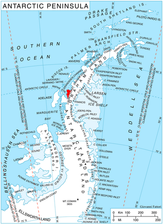
McCance Glacier is the 30-km long and 5 km wide glacier draining the Hutchison Hill area on the west slopes of Avery Plateau on Loubet Coast in Graham Land, Antarctica. It flows north-northwestwards along the west side of Osikovo Ridge, Kladnitsa Peak and Rubner Peak and enters Darbel Bay.
Cape Rey is a dark rocky cape between the southwest side of Darbel Bay and the northeast side of Lallemand Fjord, on the west coast of Graham Land. Discovered by the French Antarctic Expedition, 1908–1910, under Charcot, and named by him for Lieutenant Joseph J. Rey, French Navy, meteorologist of the French Antarctic Expedition under Charcot, 1903–1905.

Rubner Peak is the highest point on the sharp ridge separating McCance and Widdowson Glaciers, just south of Darbel Bay on the northeast coast of Pernik Peninsula, Loubet Coast in Graham Land. Photographed by the Falkland Islands and Dependencies Aerial Survey Expedition (FIDASE) in 1956–57. Named by the United Kingdom Antarctic Place-Names Committee (UK-APC) in 1960 for Max Rubner (1854–1932), German physiologist who made outstanding researches on human calorie requirements and the calorie value of foods.
