The Prince Charles Mountains are a major group of mountains in Mac. Robertson Land in Antarctica, including the Athos Range, the Porthos Range, and the Aramis Range. The highest peak is Mount Menzies, with a height of 3,228 m (10,591 ft). Other prominent peaks are Mount Izabelle and Mount Stinear. These mountains, together with other scattered peaks, form an arc about 420 km (260 mi) long, extending from the vicinity of Mount Starlight in the north to Goodspeed Nunataks in the south.

Lawrie Glacier is a glacier flowing between Mount Genecand and Mezzo Buttress, and entering the head of Barilari Bay between Cherkovna Point and Prestoy Point on the west coast of Graham Land, Antarctica. It was charted by the British Graham Land Expedition under Rymill, 1934–37, and was named by the UK Antarctic Place-Names Committee in 1959 for Robert Lawrie, an English alpine and polar equipment specialist.
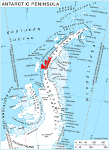
The Porthos Range is the second range south in the Prince Charles Mountains of Antarctica, extending for about 30 miles in an east-to-west direction between Scylla Glacier and Charybdis Glacier. First visited in December 1956 by the Australian National Antarctic Research Expeditions (ANARE) southern party under W.G. Bewsher (1956-57) and named after Porthos, a character in Alexandre Dumas, père's novel The Three Musketeers, the most popular book read on the southern journey.

Posadowsky Glacier is a glacier about 9 nautical miles long, flowing north to Posadowsky Bay immediately east of Gaussberg. Posadowsky Bay is an open embayment, located just east of the West Ice Shelf and fronting on the Davis Sea in Kaiser Wilhelm II Land. Kaiser Wilhelm II Land is the part of East Antarctica lying between Cape Penck, at 87°43'E, and Cape Filchner, at 91°54'E, and is claimed by Australia as part of the Australian Antarctic Territory. Other notable geographic features in this area include Drygalski Island, located 45 mi NNE of Cape Filchner in the Davis Sea, and Mirny Station, a Russian scientific research station.
On the continent of Antarctica, the Aramis Range is the third range south in the Prince Charles Mountains, situated 11 miles southeast of the Porthos Range and extending for about 30 miles in a southwest–northeast direction. It was first visited in January 1957 by Australian National Antarctic Research Expeditions (ANARE) southern party led by W.G. Bewsher, who named it for a character in Alexandre Dumas' novel The Three Musketeers, the most popular book read on the southern journey.
Weir Glacier is a glacier 8 nautical miles (15 km) long, flowing north into the south part of Barilari Bay between Prestoy Point and Byaga Point, on the west coast of Graham Land. First sighted and roughly charted in 1909 by the French Antarctic Expedition under Charcot. It was surveyed in 1935-36 by the British Graham Land Expedition (BGLE) under Rymill and later named for William D. Weir, 1st Viscount Weir of Eastwood, and his son, the Hon. James K. Weir, who contributed toward the cost of the BGLE, 1934–37.

Darbel Bay is a bay 25 nautical miles (50 km) wide, indenting the west coast of Graham Land between Stresher Peninsula and Pernik Peninsula. Entered southwest of Cape Bellue and northeast of Cape Rey. The glaciers Widmark Ice Piedmont, Cardell, Erskine, Hopkins, Drummond, Widdowson, McCance, Solun, and Škorpil feed the bay.

Perutz Glacier is a glacier, 10 nautical miles (18 km) long and 2 nautical miles (3.7 km) wide, which flows west-northwest from Hemimont Plateau into Bourgeois Fjord, close east of Thomson Head, on the west coast of Graham Land, Antarctica. The mouth of the glacier was first surveyed in 1936 by the British Graham Land Expedition (BGLE) under Rymill. The entire glacier was surveyed in 1946-47 and 1948-49 by the Falkland Islands Dependencies Survey (FIDS), and named by them for Max F. Perutz of the Cavendish Laboratory, Cambridge, who has made important studies on the mechanism of glacier flow.
Doyle Glacier is a glacier flowing to the west coast of Graham Land on both sides of Prospect Point. It was charted by the British Graham Land Expedition under John Rymill, 1934–37, and was named by the UK Antarctic Place-Names Committee in 1959 for Sir Arthur Conan Doyle, the first Englishman to make a full day's journey on skis, in March 1893.
Driscoll Glacier is a glacier 13 nautical miles (24 km) long in the Heritage Range, draining southeast between the Collier Hills and the Buchanan Hills to enter Union Glacier. It was mapped by the United States Geological Survey from surveys and U.S. Navy air photos, 1961–66, and was named by the Advisory Committee on Antarctic Names for Commander Jerome M. Driscoll, an administration officer with U.S. Navy Squadron VX-6 during Operation Deep Freeze 1965.
Drummond Glacier is a glacier 10 nautical miles (18 km) long and 2 nautical miles (4 km) wide, on the west coast of Graham Land, situated south of Hopkins Glacier and flowing west-northwest between Voit Peak and Sherba Ridge into Darbel Bay east of Sokol Point.
Erskine Glacier is a glacier 16 nautical miles (30 km) long on the west coast of Graham Land, flowing west into Darbel Bay to the north of Hopkins Glacier. It was first surveyed by the Falkland Islands Dependencies Survey (FIDS) in 1946–47, and named "West Gould Glacier". With East Gould Glacier it was reported to fill a transverse depression across Graham Land, but further survey in 1957 showed no close topographical alignment between the two. The name Gould has been limited to the east glacier and an entirely new name, for Angus B. Erskine, leader of the first FIDS party to travel down the glacier and to survey it in detail, has been approved for the west glacier.
Flanagan Glacier is a glacier in the Pioneer Heights of the Heritage Range, Antarctica, draining east from Thompson Escarpment between the Gross Hills and the Nimbus Hills to the confluent ice at the lower end of Union Glacier. It was mapped by the United States Geological Survey from surveys and U.S. Navy air photos, 1961–66, and was named by the Advisory Committee on Antarctic Names for Lieutenant Walter B. Flanagan, an assistant maintenance officer with U.S. Navy Squadron VX-6 at McMurdo Station during Operation Deep Freeze 1963 and 1964.

The Goodenough Glacier is a broad sweeping glacier to the south of the Batterbee Mountains, flowing from the west shore of Palmer Land, Antarctica, into George VI Sound and the George VI Ice Shelf.
Hamblin Glacier is a glacier flowing to the southeast side of Widmark Ice Piedmont, in Graham Land, Antarctica. It was photographed by Hunting Aerosurveys Ltd in 1955–57, and mapped from these photos by the Falkland Islands Dependencies Survey. It was named by the UK Antarctic Place-Names Committee in 1959 for Theodore Hamblin (1873–1952), an English optician who in the 1930s helped in the evolution of the first satisfactory snow goggle design.
Hugi Glacier is a glacier flowing northward into the head of Holtedahl Bay southwest of Rasnik Peak, on the west coast of Graham Land, Antarctica. It was charted by the British Graham Land Expedition under John Rymill, 1934–37, and was named by the UK Antarctic Place-Names Committee in 1959 for Franz Joseph Hugi, a Swiss teacher who was called the "father of winter mountaineering," and was author of two pioneer works on glacier phenomena.

Hoek Glacier is a glacier flowing into Dimitrov Cove northeast of Veshka Point on the northwest coast of Velingrad Peninsula on Graham Coast in Graham Land, Antarctica, southward of the Llanquihue Islands. It was charted by the British Graham Land Expedition under John Rymill, 1934–37, and was named by the UK Antarctic Place-Names Committee in 1959 for Henry W. Hoek (1878–1951), a pioneer Swiss ski-mountaineer and author of one of the earliest skiing manuals.

Hyde Glacier is a short glacier flowing east through the Edson Hills to join Union Glacier, in the Heritage Range, Antarctica. It was mapped by the United States Geological Survey from surveys and U.S. Navy air photos, 1961–66, and was named by the Advisory Committee on Antarctic Names for William H. Hyde, an ionospheric scientist at Little America V Station in 1958.

McCance Glacier is the 30-km long and 5 km wide glacier draining the Hutchison Hill area on the west slopes of Avery Plateau on Loubet Coast in Graham Land, Antarctica. It flows north-northwestwards along the west side of Osikovo Ridge, Kladnitsa Peak and Rubner Peak and enters Darbel Bay.
Luke Glacier is a glacier at least 15 nautical miles (28 km) long, flowing northwest into the head of Leroux Bay on the west coast of Graham Land, Antarctica. It is surmounted by Mount Chevreux on the south, Mount Perchot on the southwest and Mount Radotina on the northeast. The glacier was first sighted and roughly surveyed in 1909 by the Fourth French Antarctic Expedition. It was resurveyed in 1935–36 by the British Graham Land Expedition and later named for George Lawson Johnston, 1st Baron Luke of Pavenham, Chairman of Bovril Ltd, who contributed toward the cost of the expedition.