
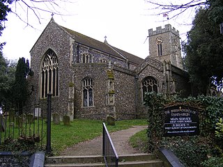
Celle is a town and capital of the district of Celle in Lower Saxony, in north-central Germany. The town is situated on the banks of the river Aller, a tributary of the Weser, and has a population of about 71,000. Celle is the southern gateway to the Lüneburg Heath, has a castle built in the Renaissance and Baroque styles and a picturesque old town centre with more than 400 timber-framed houses, making Celle one of the most remarkable members of the German Timber-Frame Road. From 1378 to 1705 Celle was the official residence of the Lüneburg branch of the dukes of Brunswick-Lüneburg, who had been banished from their original ducal seat by its townsfolk.
Hanover Region is a district in Lower Saxony, Germany. It is bounded by the districts of Heidekreis, Celle, Gifhorn, Peine, Hildesheim, Hameln-Pyrmont, Schaumburg and Nienburg.

Schweinfurt is a city in the district of Lower Franconia in Bavaria, Germany. It is the administrative centre of the surrounding district (Landkreis) of Schweinfurt and a major industrial, cultural and educational hub. The urban agglomeration has 100,200 (2018) and the city's catchment area, including the Main-Rhön region and parts of South Thuringia, 759,000 inhabitants.

Norwich Airport is an international airport in Norfolk, England, 2.5 miles north of the city of Norwich. In 2023, Norwich Airport was the 25th busiest airport in the UK and busiest in East Anglia.
Halesworth is a market town, civil parish and electoral ward in north-eastern Suffolk, England. The population stood at 4,726 in the 2011 Census. It lies 15 miles (24 km) south-west of Lowestoft, on a tributary of the River Blyth, nine miles upstream from Southwold. The town is served by Halesworth railway station on the Ipswich–Lowestoft East Suffolk Line. It is twinned with Bouchain in France and Eitorf in Germany. Nearby villages include Cratfield, Wissett, Chediston, Walpole, Blyford, Linstead Parva, Wenhaston, Thorington, Spexhall, Bramfield, Huntingfield, Cookley and Holton.
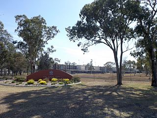
Oakey Army Aviation Centre is situated approximately 3 km (1.9 mi) from the town centre of Oakey in Queensland, Australia. It provides a training establishment for Australian Army Aviation, and also hosts the Republic of Singapore Air Force's "Cougar" 126 Squadron. The Defence name for the facility is Swartz Barracks, named for prominent politician, Army Aviation advocate, and ex-POW Sir Reginald Swartz.

Bergen is a town in the north of Celle district on the Lüneburg Heath, in Lower Saxony, Germany. Administratively it acts as a municipal borough divided into 12 subordinate parishes based on the town and its surrounding villages: Becklingen, Belsen, Bergen, Bleckmar, Diesten, Dohnsen, Eversen, Hagen, Hassel, Offen, Sülze and Wardböhmen. Bergen-Belsen concentration camp was located in the area of Belsen.

Durbanville, previously called Pampoenkraal, is a town in the Western Cape province of South Africa, part of the greater Cape Town metropolitan area. It is a semi-rural residential suburb on the north-eastern outskirts of the metropolis surrounded by farms producing wine and wheat.

Royal Air Force Old Buckenham or more simply RAF Old Buckenham is a former Royal Air Force station located 2 miles (3.2 km) south east of Attleborough, Norfolk, England which was used during the Second World War by the United States for the strategic bombing campaign against Germany.

Shatalovo is an air base in Pochinok, Pochinkovsky District, Smolensk Oblast of the Russian Aerospace Forces. It was part of the 6th Air and Air Defence Forces Army, Western Military District.

Avon Park Executive Airport is a city-owned, public-use airport located two nautical miles (3.7 km) west of the central business district of Avon Park, a city in Highlands County, Florida, United States.

Celle Air Base German: Heeresflugplatz Celle is a military airbase of the German Army. The airfield is situated southwest of the city of Celle, Lower Saxony, Germany. It was opened in 1934 and has been in military use ever since. Today the aerodrome is used by a helicopter training school, a helicopter liaison and reconnaissance squadron and a helicopter maintenance unit utilising the type Bölkow Bo-105.

Faßberg Air Base is a Bundeswehr base located 2 kilometres (1.2 mi) northeast of the municipality of Faßberg, Lower Saxony, Germany. The air base is jointly used by the German Army (Heer) and the German Air Force (Luftwaffe). Its main user is the German Army Aviation Corps.

Yeysk air base, also Yeysk Airport, is a military air base and civilian airport located near the city of Yeysk, Russia.
Belsen is a village within the German borough of Bergen in the northern part of Celle district on the Lüneburg Heath in Lower Saxony. The village, whose original site lies about 3 kilometres (1.9 mi) southwest of Bergen, has 331 inhabitants (as at: 31 December 2000). The Belsen concentration camp was named after it. Today Belsen is dominated by the former British Army camp of Hohne on the edge of the NATO firing ranges.
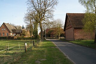
Altenhagen has been a municipality in the borough of Celle in northern Germany since 1973. It lies on the northeastern edge of the town. The original village dates back to 1377.
The Aller Valley Railway was a railway line of regional importance in Lower Saxony. It ran along the River Aller and linked Gifhorn with Verden (Aller) via Celle, Schwarmstedt, Rethem (Aller) and Wahnebergen.

Eschborn Airfield is an abandoned military airfield in Germany located approximately 10 km northwest of Frankfurt am Main (Hessen) and 435 km southwest of Berlin.
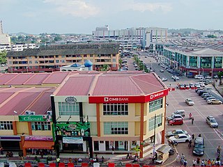
Kluang, formerly Keluang, is a town in Kluang District, Johor, Malaysia. Kluang was founded in 1915 as the administrative capital of central Johor by the British. It is located in the centre of the state and is within 90 minutes of all major urban areas of Johor. Kluang, combined with Batu Pahat, encompasses central Johor with a market catchment of over 700,000. Over the 20th century, Kluang's economy transitioned from rubber to palm oil and now has some of Malaysia's largest organic farms. The industrial sector has also grown significantly with multinational investment and a critical mass of tile manufacturers enabling the district to be called the 'tile capital of Malaysia'. The organic farming sector has also boosted Kluang as an ecotourism destination with key farms such as Zenxin, UK Agro and Kahang Organic Rice Farm.


