Related Research Articles

The Elk River is a 220-kilometre (140 mi) long river, in the southeastern Kootenay district of the Canadian province of British Columbia. Its drainage basin is 4,450 square kilometres (1,720 sq mi) in area. Its mean discharge is approximately 60 cubic metres per second (2,100 cu ft/s), with a maximum recorded discharge of 818 cubic metres per second (28,900 cu ft/s). It is a tributary of the Kootenay River, and falls within the basin of the Columbia River.

The Kootenay River or Kootenai River is a major river of the Northwest Plateau in southeastern British Columbia, Canada, and northern Montana and Idaho in the United States. It is one of the uppermost major tributaries of the Columbia River, the largest North American river that empties into the Pacific Ocean. The Kootenay River runs 781 kilometres (485 mi) from its headwaters in the Kootenay Ranges of the Canadian Rockies, flowing from British Columbia's East Kootenay region into northwestern Montana, then west into the northernmost Idaho Panhandle and returning to British Columbia in the West Kootenay region, where it joins the Columbia at Castlegar.
Grasmere, British Columbia, Canada elevation 869m, is a tiny hamlet in the East Kootenay region of British Columbia within the Regional District of East Kootenay, British Columbia. It is located on the east side of Lake Koocanusa, below the mouth of the Elk River, and to the southeast of the city of Cranbrook, and 15 km north of the Canada–United States border and the state of Montana. The city of Fernie is located nearby farther up the Elk River.

The Elk Valley is a valley in the southeastern Kootenay region of British Columbia, Canada. Located in the heart of the Canadian Rockies, the Elk Valley is approximately 60 kilometres from the Alberta and Montana borders.

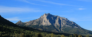
Hosmer is a small Village near Fernie, and Sparwood, British Columbia, Canada. It is situated near Mount Hosmer.

The Yaak River is a tributary of the Kootenai River in Montana.
The Fisher River is a tributary of the Kootenay River in the U.S. state of Montana. The Fisher River properly begins at the confluence of its two main tributaries, the Pleasant Valley Fisher River and the Silver Butte Fisher River. Of the two tributaries, the Pleasant Valley Fisher River is the larger and is sometimes considered part of the Fisher River proper. A variant name of the Fisher River is Pleasant Valley River, and a variant name of the Pleasant Valley Fisher River is Fisher River.
Coal Creek is a tributary of the Elk River. Their confluence is in the city of Fernie, British Columbia. Coal Creek passes through its namesake, Coal Creek, British Columbia, today a ghost town.

The Fording River is a tributary of the Elk River in the Canadian province of British Columbia. It is part of the Columbia River basin, as the Elk River is a tributary of the Kootenay River, which is a tributary of the Columbia River.

The Lussier River is a tributary of the Kootenay River in the Canadian province of British Columbia. It is part of the Columbia River basin, as the Kootenay River is a tributary of the Columbia River.
The Palliser River is a tributary of the Kootenay River in the Canadian province of British Columbia. It is part of the Columbia River basin, as the Kootenay River is a tributary of the Columbia River.
The Cross River is a tributary of the Kootenay River in the Canadian province of British Columbia. It is part of the Columbia River basin, as the Kootenay River is tributary to the Columbia River.

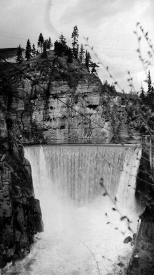
The Goat River is tributary of the Kootenay River in the Canadian province of British Columbia. The river meets the Kootenay near the town of Creston. The Goat River Dam, constructed in the 1930s, was an early source of electricity for the town. Before dikes were built, the river was a major source of spring flooding in the Creston valley.
Wild Horse River is a tributary of the Kootenay River in the East Kootenay region of southeastern British Columbia. The river flows southwest from the Canadian Rockies to the mouth, which lies immediately south of Fort Steele.

Slesse Creek is a tributary of the Chilliwack River in North America. It flows through Whatcom County in the U.S. state of Washington and through the Canadian province of British Columbia. The creek is known as Silesia Creek in the United States and as Slesse Creek in Canada.
Simpson Pass, el. 2,107 m (6,913 ft), is a mountain pass on the border between the Canadian provinces of Alberta and British Columbia, in the area of the Ball Range. It is the prominence col for Mount Ball on the Continental Divide in the vicinity of Sunshine Village ski resort. Simpson River and Simpson Pass are named after Sir George Simpson who first explored the area in 1841.

The Clearwater River is in the northwestern United States, in north central Idaho. Its length is 74.8 miles (120.4 km), it flows westward from the Bitterroot Mountains along the Idaho-Montana border, and joins the Snake River at Lewiston. In October 1805, the Lewis and Clark Expedition descended the Clearwater River in dugout canoes, putting in at "Canoe Camp," five miles (8 km) downstream from Orofino; they reached the Columbia Bar and the Pacific Ocean about six weeks later.
Lizard Creek is a tributary of the Elk River. Their confluence is south of the city of Fernie, British Columbia near the base of Fernie Alpine Resort. Lizard Creek drains a side valley of the Elk Valley called Cedar Valley, which is home to Island Lake Lodge.
Palmer Bar Creek is a creek in the East Kootenay region of British Columbia. This creek is a tributary of the Moyie River and discovered in the 1860s. Palmer Bar Creek has been mined for gold.
Hall Creek is a creek in the Selkirk Mountains in the West Kootenay region of the Regional District of Central Kootenay in British Columbia, Canada. The creek is a tributary of the Salmo River and flows east into the river in the community of Hall, a few kilometres north of the town of Ymir and a few kilometres south of Nelson. The creek and the community of Hall were named for the Osner and Winslow Hall; brothers from Colville, Washington. The brothers were pioneers in the silver rush occurring in the kootenays in the late 1880s and early 1890s In 1886, the brothers led the expedition to Toad Mountain which led to the creation of the Silver King mine, which in turn gave rise to the city of Nelson.
References
- "Wigwam River". BC Geographical Names .
- "Wigwam River". Geographic Names Information System . United States Geological Survey, United States Department of the Interior. 4 April 1980. Retrieved 2009-07-29.
49°15′N115°06′W / 49.250°N 115.100°W