Gmina Garwolin is a rural gmina in Garwolin County, Masovian Voivodeship, in east-central Poland. Its seat is the town of Garwolin, although the town is not part of the territory of the gmina.
Gmina Łaskarzew is a rural gmina in Garwolin County, Masovian Voivodeship, in east-central Poland. Its seat is the town of Łaskarzew, although the town is not part of the territory of the gmina.
Gmina Maciejowice is a rural gmina in Garwolin County, Masovian Voivodeship, in east-central Poland. Its seat is the village of Maciejowice, which lies approximately 24 kilometres (15 mi) south of Garwolin and 70 km (43 mi) south-east of Warsaw.
Gmina Wilga is a rural gmina in Garwolin County, Masovian Voivodeship, in east-central Poland. Its seat is the village of Wilga, which lies approximately 17 kilometres (10 mi) south-west of Garwolin and 49 km (30 mi) south-east of Warsaw.
Gmina Sobienie-Jeziory is a rural gmina in Otwock County, Masovian Voivodeship, in east-central Poland. Its seat is the village of Sobienie-Jeziory, which lies approximately 19 kilometres south of Otwock and 39 km south-east of Warsaw.

Miastków Kościelny is a village in Garwolin County, Masovian Voivodeship, in east-central Poland. It is the seat of the gmina called Gmina Miastków Kościelny. It is located on the Wilga River. It lies approximately 14 kilometres (9 mi) east of Garwolin and 67 km (42 mi) south-east of Warsaw.
Cyganówka is a village in the administrative district of Gmina Wilga, within Garwolin County, Masovian Voivodeship, in eastern-central part of Poland. It lies approximately 15 kilometres (9 mi) west of Garwolin and 51 km (32 mi) south-east of Warsaw.
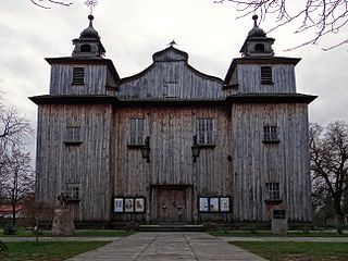
Goźlin Górny is a village in the administrative district of Gmina Wilga, within Garwolin County, Masovian Voivodeship, in east-central Poland.
Holendry is a village in the administrative district of Gmina Wilga, within Garwolin County, Masovian Voivodeship, in east-central Poland. It lies approximately 20 kilometres (12 mi) west of Garwolin and 50 km (31 mi) south-east of Warsaw.
Malinówka is a village in the administrative district of Gmina Wilga, within Garwolin County, Masovian Voivodeship, in east-central Poland. It lies approximately 17 kilometres (11 mi) west of Garwolin and 46 km (29 mi) south-east of Warsaw.
Mariańskie Porzecze is a village in the administrative district of Gmina Wilga, within Garwolin County, Masovian Voivodeship, in east-central Poland.
Nieciecz is a village in the administrative district of Gmina Wilga, within Garwolin County, Masovian Voivodeship, in east-central Poland. It lies approximately 5 kilometres (3 mi) north-west of Wilga, 21 km (13 mi) west of Garwolin, and 44 km (27 mi) south-east of Warsaw.
Nowe Podole is a village in the administrative district of Gmina Wilga, within Garwolin County, Masovian Voivodeship, in east-central Poland. It lies approximately 24 kilometres (15 mi) west of Garwolin and 46 km (29 mi) south-east of Warsaw.
Ruda Tarnowska is a village in the administrative district of Gmina Wilga, within Garwolin County, Masovian Voivodeship, in east-central Poland. It lies approximately 16 kilometres (10 mi) south-west of Garwolin and 57 km (35 mi) south-east of Warsaw.
Skurcza is a village in the administrative district of Gmina Wilga, within Garwolin County, Masovian Voivodeship, in east-central Poland. It lies approximately 18 kilometres (11 mi) south-west of Garwolin and 53 km (33 mi) south-east of Warsaw.
Stary Żabieniec is a village in the administrative district of Gmina Wilga, within Garwolin County, Masovian Voivodeship, in east-central Poland.
Tarnów is a village in the administrative district of Gmina Wilga, within Garwolin County, Masovian Voivodeship, in east-central Poland. It lies approximately 8 kilometres (5 mi) south-east of Wilga, 17 km (11 mi) south-west of Garwolin, and 56 km (35 mi) south-east of Warsaw.
Trzcianka is a village in the administrative district of Gmina Wilga, within Garwolin County, Masovian Voivodeship, in east-central Poland. It lies approximately 7 kilometres (4 mi) east of Wilga, 12 km (7 mi) west of Garwolin, and 52 km (32 mi) south-east of Warsaw and has an estimated population of 24,224.
Wicie is a village in the administrative district of Gmina Wilga, within Garwolin County, Masovian Voivodeship, in east-central Poland. It lies approximately 22 kilometres (14 mi) west of Garwolin and 46 km (29 mi) south-east of Warsaw.
Wólka Gruszczyńska is a village in the administrative district of Gmina Wilga, within Garwolin County, Masovian Voivodeship, in east-central Poland. It lies approximately 21 kilometres (13 mi) west of Garwolin and 48 km (30 mi) south-east of Warsaw.