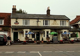
Eagle is a village in the civil parish of Eagle and Swinethorpe, in the North Kesteven district of Lincolnshire, England. It is situated 7 miles (11 km) south-west from Lincoln and 2 miles (3.2 km) east from North Scarle. The population of the civil parish of Eagle and Swinethorpe taken at the 2011 census was 793.

Althorpe is a small village and former civil parish, now in the parish of Keadby with Althorpe, in the North Lincolnshire district, in the ceremonial county of Lincolnshire, England. It is four miles (6 km) west of Scunthorpe and the same distance south-east of Crowle, on the A18 road.

Ashby Puerorum is a small village and former civil parish, now in the parish of Greetham with Somersby, in the East Lindsey district of Lincolnshire, England. The village situated 6 miles (10 km) north-west from Partney, 4 miles (6 km) east from Horncastle, to the north of the A158 road, and to the west of Bag Enderby. In 1931 the parish had a population of 97. On 1 April 1936 the parish was abolished and merged with Somersby.

Bag Enderby is a village and former civil parish, now in the parish of Greetham with Somersby, in the East Lindsey district of Lincolnshire, England. It lies just north of the A158 road, 6 miles (10 km) north-east from Horncastle and 4 miles (6 km) north-west from Partney. In 1931, the parish had a population of 29. On 1 April 1936, the parish was abolished and merged with Somersby.

Hose is a village and former civil parish, now in the parish of Clawson, Hose and Harby, in the Borough of Melton and the county of Leicestershire, England. The town of Melton Mowbray is six miles (10 km) to the south. In 1931 the civil parish had a population of 421, the 2011 population of the built-up area being 580.

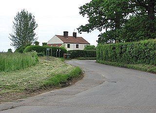
Moorby is a small village and former civil parish, now in the parish of Claxby with Moorby, in the East Lindsey district of Lincolnshire, England. The village is situated 4 miles (6 km) south-east from Horncastle and 1 mile (1.6 km) east from Wood Enderby. Moorby has a population of about 50 inhabitants.

Preston or Preston Village is a suburb of Brighton and Hove, in the ceremonial county of East Sussex, England. It is to the north of the centre. Originally a village in its own right, it was eventually absorbed into Brighton with the development of the farmland owned by the local Stanford family, officially becoming a parish of the town in 1928. Stanford-owned land to the south of Preston Manor was given to the town and now makes up Preston Park, one of the largest parks in the now conjoined city of Brighton and Hove. The park hosts some of the city's major public events such as Brighton Pride.

Brandon Parva is a village and former civil parish, now in the parish of Brandon Parva, Coston, Runhall and Welborne, in the English county of Norfolk.
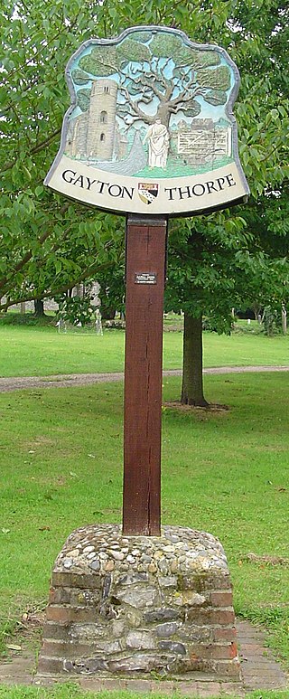
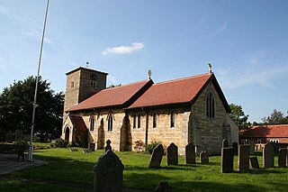
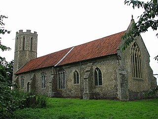
Gayton Thorpe is a village and former civil parish, now in the parish of Gayton, in the King's Lynn and West Norfolk district, in the county of Norfolk, England. The village is located 7.1 miles (11.4 km) south-east of King's Lynn and 31 miles (50 km) north-west of Norwich. In 1931 the parish had a population of 136.
Buckenham is a small village and former civil parish, now in the civil parish of Strumpshaw in the English county of Norfolk.

Waldershare is a village in the civil parish of Tilmanstone, in the Dover district, in Kent, England, near Dover. It has a church called All Saints Church.
Stainby is a village and former civil parish, now in the parish of Gunby and Stainby, in the South Kesteven district of Lincolnshire, England. It is situated 2 miles (3.2 km) west from the A1 road, 1.5 miles (2.4 km) east from the Viking Way and the Leicestershire border, and 8 miles (13 km) south from Grantham. In 1921 the parish had a population of 117.

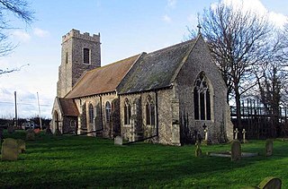
Wood Enderby is a village and civil parish in the East Lindsey district of Lincolnshire, England. It is situated approximately 4 miles (6 km) south from Horncastle. The civil parish includes the hamlets of Claxby Pluckacre and Wilksby.

Scrafield is a hamlet and a deserted medieval village (DMV) in the civil parish of Mareham on the Hill, in the East Lindsey district, in the county of Lincolnshire, England. It is approximately 4 miles (6.4 km) south-east of the town of Horncastle. In 1931 the parish had a population of 24. On 1 April 1936 the parish was abolished to form Mareham on the Hill.
Messing is a village and former civil parish, 14 miles (23 km) north east of Chelmsford, now in the parish of Messing-cum-Inworth, in the Colchester district, in the county of Essex, England. The village has a population of around 300. In 1931 the parish had a population of 929.

Wilby is a village and former civil parish, 17 miles (27 km) south-west of Norwich, now in the parish of Quidenham, in the Breckland district, in the county of Norfolk, England. In 1931 the parish had a population of 94. Wilby has a church called All Saints. Wilby Hall, a country house is north of the village.
Southwood is a hamlet and former civil parish, 10 miles (16 km) east of Norwich, now in the parish of Cantley, Limpenhoe and Southwood, in the Broadland district, in the county of Norfolk, England. In 1931 the parish had a population of 40. It has a church called St Edmund which is in ruins. Southwood Hall is a post medieval great house and serves as a wedding venue.
Thrigby is a village and former civil parish 14 miles (23 km) east of Norwich, now in the parish of Mautby, in the Great Yarmouth district, in the county of Norfolk, England. In 1931 the parish had a population of 47.

Harnhill is a village and former civil parish now in the parish of Driffield, in the Cotswold district, in the county of Gloucestershire, England. It is about 3 miles (5 km) miles from the town of Cirencester. In 1931 the parish had a population of 74. Harnhill has a church called St Michaels Church which is grade II* listed, the Harnhill Centre of Christian Healing is north of the village.

Woolstone is a village and former civil parish now in the parish of Oxenton, in the Tewkesbury district, in the county of Gloucestershire, England. It is about 5 miles (8 km) miles from the town of Cheltenham. The village is on the southern side of Crane Hill and on the north bank of the Tirle Brook. In 1931 the parish had a population of 85. Woolstone has a church called St Martin's Church which is grade II* listed.

