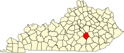
Willailla | |
---|---|
Coordinates: 37°18′16″N84°27′47″W / 37.30444°N 84.46306°W Coordinates: 37°18′16″N84°27′47″W / 37.30444°N 84.46306°W | |
Country | United States |
State | Kentucky |
County | Rockcastle |
Elevation | 1,099 ft (335 m) |
Time zone | UTC-5 (Eastern (EST)) |
• Summer (DST) | UTC-4 (EST) |
GNIS feature ID | 509372 [1] |
Willailla is an unincorporated community in Rockcastle County, Kentucky, United States. It is located at the junction of Kentucky Route 70 and Kentucky Route 3273. It was named for the constant illness of a resident named Will Owens. [2]
Boyle County is a county located in the U.S. state of Kentucky. As of the 2020 census, the population was 30,614. Its county seat is Danville. The county was formed in 1842 and named for John Boyle (1774–1835), a U.S. Representative, chief justice of the Kentucky Court of Appeals and later federal judge for the District of Kentucky, and is part of the Danville, KY Micropolitan Statistical Area.
Danville is a home rule-class city in Boyle County, Kentucky, United States. It is the seat of its county. The population was 16,218 at the 2010 Census. Danville is the principal city of the Danville Micropolitan Statistical Area, which includes all of Boyle and Lincoln counties. In 2001, Danville received a Great American Main Street Award from the National Trust for Historic Preservation. In 2011, Money magazine placed Danville as the fourth-best place to retire in the United States. Centre College in Danville was selected to host U.S. vice-presidential debates in 2000 and 2012.
Nicholasville is a home rule city in and the county seat of Jessamine County, Kentucky, United States. The population was 28,015 during the 2010 U.S. Census, making Nicholasville the 11th-largest settlement in the state.
Richmond is a home rule-class city in and the county seat of Madison County, Kentucky, United States. It is named after Richmond, Virginia, and is home to Eastern Kentucky University. In 2019, the population was 36,157. Richmond is the third-largest city in the Bluegrass region and the state's sixth-largest city. It is the eighth largest population center in Kentucky, when including metropolitan areas. The city serves as the center for work and shopping for south-central Kentucky. In addition, Richmond is the principal city of the Richmond-Berea, Kentucky Micropolitan Area, which includes all of Madison and Rockcastle counties.
The Cumberland River is a major waterway of the Southern United States. The 688-mile-long (1,107 km) river drains almost 18,000 square miles (47,000 km2) of southern Kentucky and north-central Tennessee. The river flows generally west from a source in the Appalachian Mountains to its confluence with the Ohio River near Paducah, Kentucky, and the mouth of the Tennessee River. Major tributaries include the Obey, Caney Fork, Stones, and Red rivers.
U.S. Route 431 (US 431) is a spur of U.S. Route 31. It currently travels for approximately 556 miles (895 km) from US 231/Alabama State Route 210 and US 231 Business and US 431 Bus. in Dothan, Alabama, to Owensboro, Kentucky, at US 60 and Kentucky Route 2831.
Interstate 275 (I-275) is an 83.71-mile-long (134.72 km) highway in Ohio, Indiana, and Kentucky that forms a complete beltway around the Cincinnati metropolitan area and includes a part in a state (Indiana) not entered by the parent route. It had been the only auxiliary Interstate that enters three states, but that changed in July 2018 when I-295 in Delaware and New Jersey was extended into Pennsylvania. It is the longest beltway with an Interstate highway designation in the United States, enclosing an area of over 250,000 acres (100,000 ha). It is also the third longest beltway overall in the United States—only the Sam Houston Tollway and the Grand Parkway encircling Greater Houston are longer. For a short distance in northwest Hamilton County, it overlaps with I-74 and US Route 52 (US 52).
U.S. Route 31E (US 31E) is the easternmost of two parallel routes for U.S. Highway 31 from Nashville, Tennessee, to Louisville, Kentucky.
U.S. Route 31W is the westernmost of two parallel routes for U.S. Route 31 from Nashville, Tennessee to Louisville, Kentucky. At one time, it split with U.S. Route 31E at Sellersburg, Indiana, crossing into nearby Louisville via the Kentucky & Indiana Terminal Bridge. Tennessee State Route 41 is its unsigned companion route in Tennessee.
U.S. Route 60 (US 60) is a major U.S. Highway in the American state of Kentucky. In the early days of the U.S. Highway System, US 60 was originally to be numbered as US 62. Following extensive lobbying and complaints filed by Kentucky governor William J. Fields to the American Association of State Highway Officials, the route was re-designated as US 60 before the system was finalized. In Kentucky, US 60 parallels the Ohio River. US 60 enters Kentucky from Cairo, Illinois, traveling northeast to Louisville, then takes a direct eastward route to rejoin the Ohio River in downtown Ashland, Kentucky. Both US 60 and US 23 run concurrently from Ashland to Catlettsburg where US 60 turns east and enters Kenova, West Virginia.
The Huntington–Ashland metropolitan area is a metropolitan area in the Appalachian Plateau region of the United States. Referred to locally as the “Tri-State area”, and colloquially as "Kyova", the region spans seven counties in the three states of West Virginia, Kentucky, and Ohio. With a population of 361,580, the Tri-State area is nestled along the banks of the Ohio River. The region offers a diverse range of outdoor activities.
The following is an alphabetical list of articles related to the United States Commonwealth of Kentucky.
U.S. Route 27 (US 27) in Kentucky runs 201.120 miles (323.671 km) from the Tennessee border to the Ohio border at Cincinnati. It crosses into the state in the Lake Cumberland area, passing near or through many small towns, including Somerset, Stanford, and Nicholasville. The road then passes straight through the heart of Lexington, including past the University of Kentucky (UK) and Transylvania University. North of Lexington it passes through Cynthiana and Falmouth before entering Campbell County and passing through many Northern Kentucky suburbs before ending at the Ohio state line on the Taylor Southgate Bridge in Cincinnati.
The Cincinnati metropolitan area is a metropolitan area centered on Cincinnati and including surrounding counties in the U.S. states of Ohio, Kentucky, and Indiana. The area is commonly known as Greater Cincinnati.