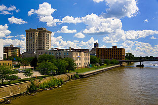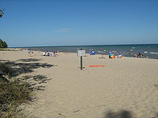
Jackson County is a county located in the U.S. state of Michigan. Its population was 160,248 as of the 2010 Census. The county seat is Jackson. The county was set off in 1829 and organized in 1832. It is named for U.S. President Andrew Jackson and considered to be one of Michigan's "Cabinet counties", named for members of Jackson's Cabinet.

Saginaw County, officially the County of Saginaw, is a county located in the U.S. state of Michigan. As of the 2010 census, the population was 200,169. The county seat is Saginaw. The county was created by September 10, 1822, and was fully organized on February 9, 1835. The etymology of the county's name is uncertain. It may be derived from Sace-nong or Sak-e-nong, as the Sauk tribe is believed by some to have once lived there. A more likely possibility is that it comes from Ojibwe words meaning "place of the outlet" –sag and ong. See List of Michigan county name etymologies.

Huron County is a county in the U.S. state of Michigan. As of the 2010 United States Census, the population was 33,118. The county seat is Bad Axe. Huron County is at the northern tip of the Thumb, which is a sub region of Mid Michigan. It is a peninsula, bordered by Saginaw Bay to the west and Lake Huron to the north and east, and has over 90 miles (140 km) of shoreline, from White Rock on Lake Huron to Sebewaing on the Saginaw Bay. Huron County's most important industry is agriculture, as with most of the other Thumb counties. Huron County enjoys seasonal tourism from large cities such as Detroit, Flint, and Saginaw.

Genesee County is a county in the U.S. state of Michigan. As of the 2010 census, the population was 425,790, making it the fifth-most populous county in Michigan. The county seat and population center is Flint. Genesee County is considered to be a part of the greater Mid Michigan area.

Saginaw is a city in the U.S. state of Michigan and the seat of Saginaw County. The city of Saginaw and Saginaw County are both located in the area known as Mid-Michigan or Central Michigan. The city of Saginaw is located adjacent to Saginaw Charter Township and is considered part of the Tri-City area, along with neighboring Bay City and Midland. The Saginaw County MSA had a population of 196,542 in 2013. The city is also the largest municipality within the Saginaw, Midland, and Bay City Metropolitan Area.

M-58 is a 5.108-mile-long (8.221 km) east–west state trunkline highway in the US state of Michigan that runs from M-47 in Saginaw Township east to exit 3 of I-675 near the north part of downtown Saginaw. The trunkline follows State Street through the Saginaw area, and east of Lathrop Avenue, M-58 is split along two streets, using Davenport Avenue as well. This is the third time that the number has been used on a highway in Michigan; the first two were used in the Berrien County and Pontiac areas. The Saginaw version was designated in 1971, and it is listed on the National Highway System.

Harrisville State Park is a public recreation area covering 107 acres (43 ha) on the shore of Lake Huron off U.S. Route 23 in Harrisville and Harrisville Township, Alcona County, Michigan. The state park was established at six acres (2.4 ha) in 1921 and was among the first 25 parks created following the inception of the Michigan State Parks Commission in 1919.

Walter J. Hayes State Park is a public recreation area covering 654 acres (265 ha) on the southeast corner of Wamplers Lake in the Irish Hills region of the state of Michigan. Most of the state park lies within Lenawee County with a small portion extending into Jackson and Washtenaw counties in the Round Lake area. The park offers access to 796-acre (322 ha) Wamplers Lake and completely surrounds 100-acre (40 ha) Round Lake, which connects to Wamplers Lake via a channel navigable by smaller boats. Other scenic lakes including Evans Lake and Sand Lake as well as chains of smaller lakes lie nearby. The park is traversed by Michigan Route 124 north of its intersection with US Highway 12.

Albert E. Sleeper State Park is a public recreation area on Lake Huron in Lake Township, Huron County, Michigan. The state park encompasses 723 acres (293 ha) four miles northeast of Caseville, close to the tip of The Thumb of Michigan.

Bay City State Park is a 2,389-acre (967 ha) state park located on the shore of Saginaw Bay near Bay City in Bay County, Michigan, United States. The Tobico Marsh, one of the largest remaining freshwater, coastal wetlands on the Great Lakes is located in the park. Other natural features of the park include a mile of sandy beach, over 2,000 acres (810 ha) of wetland woods, meadows, oak savannah prairies, and cattail marshes. The park is a haven for migratory birds and wetland wildlife.

Pinckney State Recreation Area is a Michigan state recreation area in Dexter, Sylvan and Lyndon Townships, Washtenaw County and Putnam and Unadilla Townships, Livingston County in the U.S. state of Michigan. The park is 11,000 acres (4,500 ha) and sits at an elevation of 922 feet (281 m). The park is connected to the nearby Waterloo State Recreation Area by the 35-mile (56 km) Waterloo–Pinckney Trail. Pinckney State Recreation Area is open for year-round recreation including hiking, fishing, swimming, hunting and a variety of winter sports.

Pontiac Lake State Recreation Area is located in White Lake Township, Oakland County, Michigan, just west of Waterford, Michigan. It is 3,745 acres (15.16 km2) in size.

Metamora-Hadley State Recreation Area is a state-managed protected area located in Hadley Township in Lapeer County, northwest of Detroit. It is located eight miles south of the city of Lapeer. The closest urban community is the village of Metamora, Michigan, which lies to its east and is its postal address.

Bass River State Recreation Area is a 1,665-acre (674 ha) recreation area, located in Allendale Charter Township and Robinson Township, Ottawa County, Michigan. There is a multi-purpose, 6-mile (9.7 km) trail that is used for cross country skiing, hiking, horseback riding and mountain biking. A gravel boat launch provides access to Max Lake and the Grand River. Hunting is allowed in the recreation area.

Matthews Beach Park is a 22-acre (0.9 km²) park in the Matthews Beach neighborhood of Seattle, Washington. It is a popular swimming beach in the summer, although it is also open during winter months.

The Chief Noonday Outdoor Center, also known as the Chief Noonday Group Camp Historic District, is a recreational facility located on Chief Noonday Road, approximately one mile east of Briggs Road in Yankee Springs Township. It was listed on the National Register of Historic Places in 1996.

Watkins Lake State Park and County Preserve is a combination public recreation area and nature preserve located five miles west of Manchester in Jackson and Washtenaw counties, Michigan. The area occupies a total of 1,122 acres (454 ha), with the Michigan Department of Natural Resources owning 717 acres (290 ha) in Norvell Township, Jackson County, and Washtenaw County owning 405 acres (164 ha) in Manchester Township. Dedicated in 2017, it is under the joint management of the Michigan DNR and the Washtenaw County Parks & Recreation Commission. A five-mile former rail corridor runs through the park and into grasslands in the eastern portion of the preserve.


