Related Research Articles

The Calder and Hebble Navigation is a broad inland waterway, with locks and bridgeholes that are suitable for 14-foot-wide (4.3 m) boats, in West Yorkshire, England. Construction to improve the River Calder and the River Hebble began in 1759, and the initial scheme, which included 5.7 miles (9.2 km) of new cuts, was completed in 1770 and has remained navigable since it was opened. Significant improvements were made, including the Salterhebble branch to Halifax, opened in 1828, and ever-longer cuts to bypass river sections. Trade was assisted by the opening of the Rochdale Canal in 1804, which provided a through route from Sowerby Bridge to Manchester. There were plans to abandon the river sections completely in the 1830s, but these were modified as the needs of mill owners and other riparian landowners were recognised.

The River Aire is a major river in Yorkshire, England, 92 miles (148 km) in length. Part of the river below Leeds is canalised, and is known as the Aire and Calder Navigation.

The Aire and Calder Navigation is the canalised section of the Rivers Aire and Calder in West Yorkshire, England. The first improvements to the rivers above Knottingley were completed in 1704 when the Aire was made navigable to Leeds and the Calder to Wakefield, by the construction of 16 locks. Lock sizes were increased several times, as was the depth of water, to enable larger boats to use the system. The Aire below Haddlesey was bypassed by the opening of the Selby Canal in 1778. A canal from Knottingley to the new docks and new town at Goole provided a much shorter route to the River Ouse from 1826. The New Junction Canal was constructed in 1905, to link the system to the River Don Navigation, by then part of the Sheffield and South Yorkshire Navigation.
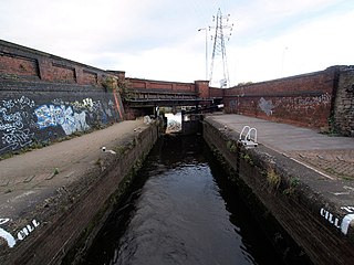
The Sheffield and South Yorkshire Navigation (S&SY) is a system of navigable inland waterways in South Yorkshire and Lincolnshire, England.

The canal network of the United Kingdom played a vital role in the Industrial Revolution. The UK was the first country to develop a nationwide canal network which, at its peak, expanded to nearly 4,000 miles in length. The canals allowed raw materials to be transported to a place of manufacture, and finished goods to be transported to consumers, more quickly and cheaply than by a land based route. The canal network was extensive and included feats of civil engineering such as the Anderton Boat Lift, the Manchester Ship Canal, the Worsley Navigable Levels and the Pontcysyllte Aqueduct.

Goole is a port town and civil parish on the River Ouse in the East Riding of Yorkshire, England. The town's historic county is the West Riding of Yorkshire.
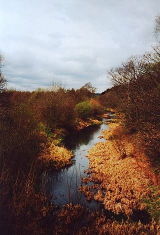
The Barnsley Canal is a canal that ran from Barnby Basin, through Barnsley, South Yorkshire, England, to a junction with the Aire and Calder Navigation near Wakefield, West Yorkshire. It was built in the 1790s, to provide a transport link from coal reserves at Barnsley to a wider market. Both the Aire and Calder Navigation and the River Don Navigation took a keen interest in the project, the former buying many of the initial shares, and the latter constructing the Dearne and Dove Canal to link the canal to their waterway. Water supply issues meant that the Aire and Calder proposed pumping all of the water for the canal from the River Calder, using steam pumps, but a reservoir was built at Cold Hiendley instead, increasing the construction costs, but reducing the running costs. The canal as built was 14.5 miles (23.3 km) long and included 15 locks.

The canals of the United Kingdom are a major part of the network of inland waterways in the United Kingdom. They have a varied history, from use for irrigation and transport, through becoming the focus of the Industrial Revolution, to today's role of recreational boating. Despite a period of abandonment, today the canal system in the United Kingdom is again increasing in use, with abandoned and derelict canals being reopened, and the construction of some new routes. Canals in England and Wales are maintained by navigation authorities. The biggest navigation authorities are the Canal & River Trust and the Environment Agency, but other canals are managed by companies, local authorities or charitable trusts.

The Dearne and Dove Canal ran for almost ten miles through South Yorkshire, England from Swinton to Barnsley through nineteen locks, rising 127 feet (39 m). The canal also had two short branches, the Worsbrough branch and the Elsecar branch, both about two miles long with reservoirs at the head of each. The Elsecar branch also has another six locks. The only tunnel was bypassed by a cutting in 1840.

The Sheffield & Tinsley Canal is a canal in the City of Sheffield, England. It runs 3.9 miles (6.3 km) from Tinsley, where it leaves the River Don, to the Sheffield Canal Basin in the city centre, passing through 11 locks. The maximum craft length that can navigate this lock system is 61 feet 6 inches (18.75 m) with a beam of 15 feet 6 inches (4.72 m).
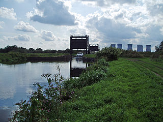
The New Junction Canal is a canal in South Yorkshire, England. It is part of the Sheffield and South Yorkshire Navigation (S&SYN), although it was jointly funded by the Aire and Calder Navigation, and was opened in 1905. It links the River Don Navigation and the Stainforth and Keadby Canal with the Aire and Calder Navigation. It is completely straight, and was the last canal built in England for commercial purposes.

Ferrybridge is a village in West Yorkshire, England. Ferrybridge lies at a historically important crossing of the River Aire which borders the North Yorkshire village of Brotherton. It is linked to other communities by the A1, which follows the route of the Great North Road. The village falls within the Knottingley ward of Wakefield City Council.

The Stainforth and Keadby Canal is a navigable canal in South Yorkshire and Lincolnshire, England. It connects the River Don Navigation at Bramwith to the River Trent at Keadby, by way of Stainforth, Thorne and Ealand, near Crowle. It opened in 1802, passed into the control of the River Don Navigation in 1849, and within a year was controlled by the first of several railway companies. It became part of the Sheffield and South Yorkshire Navigation, an attempt to remove several canals from railway control, in 1895. There were plans to upgrade it to take larger barges and to improve the port facilities at Keadby, but the completion of the New Junction Canal in 1905 made this unnecessary, as Goole could easily be reached and was already a thriving port.
Woodlesford is a suburban village in the City of Leeds, West Yorkshire, England, 6 miles (10 km) south-east of Leeds city centre. Formerly part of the Rothwell Urban District, it is now within the Rothwell ward of Leeds City Council. The village sits on the banks of the Aire and Calder Navigation and river system.

The Selby Canal is a 6-mile (9.7 km) canal with 2 locks which bypasses the lower reaches of the River Aire in Yorkshire, England, from the village of West Haddlesey to the town of Selby where it joins the River Ouse. It opened in 1778, and provided the main outlet for the Aire and Calder Navigation until 1826, when it was bypassed by a new cut from Ferrybridge to Goole. Selby steadily declined after that, although traffic to York still used the canal.
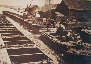
Tom Pudding was the name given to the tub boats on the Aire and Calder Navigation, introduced in 1863 and used until 1985, which were a very efficient means of transferring and transporting coal from the open cast collieries of the South Yorkshire Coalfield near Stanley Ferry to the Port of Goole, competing with rail. The name derives from their resemblance to a string of black puddings or perhaps Yorkshire puddings and the first name of the original constructor.
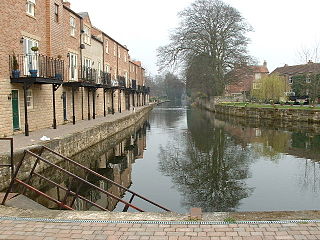
The Ripon Canal is located in North Yorkshire, England. It was built by the canal engineer William Jessop to link the city of Ripon with the navigable section of the River Ure at Oxclose Lock, from where boats could reach York and Hull. It opened in 1773 and was a moderate success. It was sold to the Leeds and Thirsk Railway in 1847 and was effectively closed by 1906 owing to neglect. It was not nationalised with most canals and railways in 1948 and was abandoned in 1956.

The River Don Navigation was the result of early efforts to make the River Don in South Yorkshire, England, navigable between Fishlake and Sheffield. The Dutch engineer Cornelius Vermuyden had re-routed the mouth of the river in 1626, to improve drainage, and the new works included provision for navigation, but the scheme did not solve the problem of flooding, and the Dutch River was cut in 1635 to link the new channel to Goole. The first Act of Parliament to improve navigation on the river was obtained in 1726, by a group of Cutlers based in Sheffield; the Corporation of Doncaster obtained an Act in the following year for improvements to the lower river. Locks and lock cuts were built and by 1751 the river was navigable to Tinsley.
The Hull and Doncaster Branch is a secondary main railway line in England, connecting Kingston upon Hull to South Yorkshire and beyond via a branch from the Selby Line near Gilberdyke to a connection to the Doncaster–Barnetby line at a junction near Thorne 8 miles north-east of Doncaster.
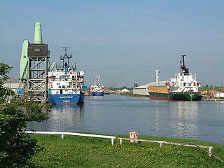
The Port of Goole, is a maritime port at the mouth of the Aire and Calder Navigation where it feeds into the River Ouse, in the East Riding of Yorkshire, England. The port opened in 1826, when the Aire and Calder Navigation was completed, connecting to the River Ouse at what is now the town of Goole. The port is one of the Humber Ports, associated with the waterway of the Humber Estuary and its tributaries, and is known to be Britain's largest inland port, being some 50 miles (80 km) from the open sea. It has good road and rail transport links, and deals with about £800 million worth of trade each year.
References
- ↑ "William Hamond Bartholomew". Knottingley and Ferrybridge local history. Retrieved 11 October 2010.
- ↑ "William Hamond Bartholomew". Jim Shead. Retrieved 11 October 2010.
- ↑ "Howdenshire History" . Retrieved 9 December 2012.