
Newcastle upon Tyne, or simply Newcastle, is a city and metropolitan borough in Tyne and Wear, England. It is England's northernmost metropolitan borough, located on the River Tyne's northern bank opposite Gateshead to the south. It is the most populous settlement in the Tyneside conurbation and North East England.

Prudhoe is a town and civil parish in the south of Northumberland, England. It is 11 miles (18 km) west of Newcastle upon Tyne and situated on a steep, north-facing hill on the south bank of the River Tyne. Prudhoe had a population of 11,675 at the 2011 census, making it the second largest town in the Tyne Valley after Hexham.
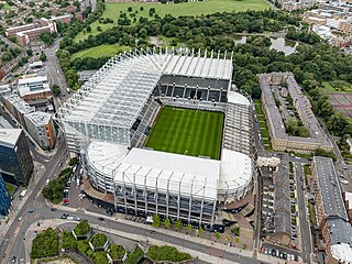
St James' Park is a football stadium in Newcastle upon Tyne, England. It is the home of Newcastle United. With a seating capacity of 52,350 seats, it is the 8th largest football stadium in England.
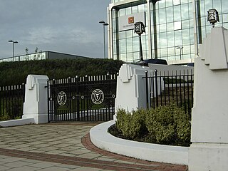
The Golden Mile is a stretch of the Great West Road north of Brentford running west from the western boundary of Chiswick in London, United Kingdom.

Tynemouth Priory and Castle is a historic site located on a promontory at the mouth of the Tyne at Tynemouth. The medieval Benedictine priory was protected by walls, towers, and a gatehouse. The heraldry of the metropolitan borough of North Tyneside includes three crowns commemorating the three kings who have been buried in the priory.
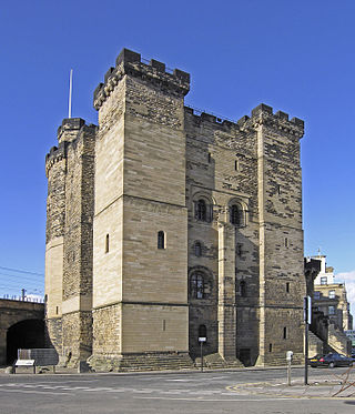
The Castle, Newcastle, or Newcastle Castle is a medieval fortification in Newcastle upon Tyne, England, built on the site of the fortress that gave the City of Newcastle its name. The most prominent remaining structures on the site are the Castle Keep, and the Black Gate, its fortified gatehouse.

W.D. & H.O. Wills was a British tobacco manufacturing company formed in Bristol, England. It was the first British company to mass-produce cigarettes. It was one of the 13 founding companies of the Imperial Tobacco Company ; these firms became branches, or divisions, of the new combine and included John Player & Sons.

The history of Newcastle upon Tyne dates back almost 2,000 years, during which it has been controlled by the Romans, the Angles and the Norsemen amongst others. Newcastle upon Tyne was originally known by its Roman name Pons Aelius. The name "Newcastle" has been used since the Norman Conquest of England. Due to its prime location on the River Tyne, the town developed greatly during the Middle Ages and it was to play a major role in the Industrial Revolution, being granted city status in 1882. Today, the city is a major retail, commercial and cultural centre.

Fawdon is an electoral ward of Newcastle upon Tyne, in the county of Tyne and Wear, England. It is also close to the A1 western bypass. The population of the ward is 10,890, reducing to 10,090 at the 2011 Census, 5.7% of the total population of Newcastle upon Tyne. Car ownership in the area is 53.6%, lower than the city average of 54.7%. Until 1974 it was in Northumberland.

Heaton is a district and suburb in the city of Newcastle upon Tyne, in Tyne and Wear, England, two miles east of the city centre. It is bordered by the neighbouring areas of Walkergate to the east, Jesmond to the north west, Byker to the south, and Sandyford to the west. The name Heaton means high town, referring to the area "being situated on hills above the Ouseburn, a tributary of the River Tyne." The area is divided into South Heaton, and High Heaton, representing the north, respectively. For city council elections, the area is split between three wards: Heaton, Manor Park and Ouseburn. Until 1974 it was in Northumberland.
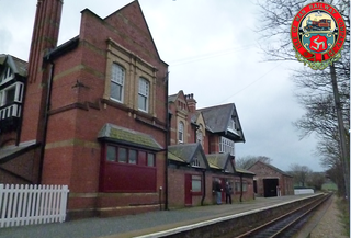
Port St Mary Railway Station is a station in Port St Mary in the south of the Isle of Man and is served by the Isle of Man Railway, having first opened in 1874 when the line to nearby Port Erin was completed. It forms part of the sole remaining section of the railway which once covered a network of some 46 miles across the island. The station is less than a mile away from the terminus and has no passing loop or run-round facilities, but a siding serving the goods shed was lifted in the 1979 but reinstated in 2002 at the same time as the whole of the permanent way was replaced along the line. When reinstated, the siding was not connected to the imposing goods shed, however in the winter of 2007/2008 rail connections were restored. A second siding which once served the rear of the shed was removed in 1974 and has not been replaced. Both sets of facing points were on the northern approach, the second lifted siding running parallel to the shed access as far as the exterior loading platform.
Dene is an electoral ward of Newcastle upon Tyne in North East England. The ward takes its name from the nearby gorge at Jesmond Dene. Contained within the ward are government offices of the Department for Work and Pensions and the Freeman Hospital. The population of the ward is 9,554, increasing to 9,667 at the 2011 Census, 3.7% of the total population of Newcastle upon Tyne. Car ownership in the area is 74.8% much higher than the city average of 54.7%.
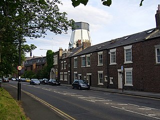
Spital Tongues is a district of Newcastle upon Tyne, located due north-west of the Newcastle City Centre. Its unusual name is believed to be derived from spital – a corruption of the word hospital, commonly found in British place names - and tongues, meaning outlying pieces of land. North of Spital Tongues is the Town Moor, while Castle Leazes and Leazes Park are to the East.
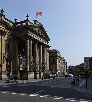
Grainger Town is the historic commercial center of Newcastle upon Tyne, England. It covers approximately 36 ha. Almost all of Grainger Town is in Newcastle's Central Conservation Area, one of the first designated in England. The area includes a medieval 13th-century Dominican priory, pieces of the historic Town Walls, and many fine Georgian and Victorian buildings.

The Royal Victoria Infirmary (RVI) is a 673-bed tertiary referral hospital and research centre in Newcastle upon Tyne, England, with strong links to Newcastle University. The hospital is part of the Newcastle upon Tyne Hospitals NHS Foundation Trust and is a designated academic health science centre.

Newcastle City Library is a library in the city centre of Newcastle upon Tyne, United Kingdom. Completed on 3 March 2009, the building opened on 7 June 2009, and is the city's main public library. The main feature of the building is a long 'glass box' forming the eastern side of the steel frame structure.

Heaton railway station was a railway station in Newcastle upon Tyne, England, near the southern boundary of Heaton with Byker. The station was built in the nineteenth century and closed on 11 August 1980.
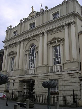
The Mansion House is a municipal building in Doncaster, South Yorkshire, England. The building, which is owned and managed by Doncaster Council, is a Grade I listed building.
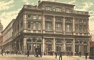
The Town Hall was a local government building located in St Nicholas Square, Newcastle upon Tyne. It was the headquarters of Newcastle City Council until November 1968.

Sandyford House is a large office development on Sandyford Road in Sandyford, Newcastle upon Tyne. It was the offices and meeting place of Tyne and Wear County Council from its formation in 1974 until it was abolished in 1986.


