Related Research Articles

The Massachusetts Bay Transportation Authority is the public agency responsible for operating most public transportation services in Greater Boston, Massachusetts. Earlier modes of public transportation in Boston were independently owned and operated; many were first folded into a single agency with the formation of the Metropolitan Transit Authority (MTA) in 1947. The MTA was replaced in 1964 with the present-day MBTA, which was established as an individual department within the Commonwealth of Massachusetts before becoming a division of the Massachusetts Department of Transportation (MassDOT) in 2009.

Line 3 Scarborough is a light rapid transit line that is part of the Toronto subway system in Toronto, Ontario, Canada. The line runs entirely within the suburban district of Scarborough, encompassing six stations and 6.4 kilometres (4.0 mi) of mostly elevated track. It connects with Line 2 Bloor–Danforth at its southwestern terminus, Kennedy, and terminates in the northeast at McCowan.

The Pacific Electric Railway Company, nicknamed the Red Cars, was a privately owned mass transit system in Southern California consisting of electrically powered streetcars, interurban cars, and buses and was the largest electric railway system in the world in the 1920s. Organized around the city centers of Los Angeles and San Bernardino, it connected cities in Los Angeles County, Orange County, San Bernardino County and Riverside County.

The Orange County Transportation Authority (OCTA) is the transportation planning commission for Orange County, California in the Los Angeles metropolitan area. OCTA is responsible for funding and implementing transit and capital projects for the transportation system for the travel needs, including freeway improvements, express lane management, bus and rail transit operation, and commuter rail oversight.

The Los Angeles County Metropolitan Transportation Authority (LACMTA), commonly branded as Metro, is the agency that plans, operates, and coordinates funding for most of the transportation system in Los Angeles County. The agency directly operates a large transit system that includes bus, light rail, heavy rail (subway), and bus rapid transit services; and provides funding for transit it does not operate, including Metrolink commuter rail, municipal bus operators and paratransit services. Metro also provides funding and directs planning for railroad and highway projects within Los Angeles County.

The Orange Line is a rapid transit line of the Washington Metro system, consisting of 26 stations in Fairfax County and Arlington, Virginia; the District of Columbia; and Prince George's County, Maryland, United States. The Orange Line runs from Vienna in Virginia to New Carrollton in Maryland. Half of the line's stations are shared with the Blue Line and over two thirds are shared with the Silver Line. Orange Line service began on November 20, 1978.

The Green Line is a rapid transit line of the Washington Metro system, consisting of 21 stations in the District of Columbia and Prince George's County, Maryland, United States. The Green Line runs from Branch Avenue to Greenbelt. It was the last line in the original Metrorail plan to be constructed, and is one of three north–south lines through the city of Washington. The Green Line shares tracks with the Yellow line from L'Enfant Plaza to Greenbelt.
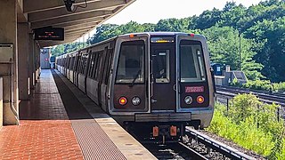
The Yellow Line is a rapid transit line of the Washington Metro system, consisting of 21 stations in Fairfax County, Alexandria, and Arlington County, Virginia, as well as Washington, D.C. and Prince George's County, Maryland. The Yellow Line runs from Huntington in Virginia to Greenbelt station during all times since May 2019. Before then, it used to short turns at Mount Vernon Square during peak hours and ended at Fort Totten station during off-peak hours.

The Henry G. Shirley Memorial Highway, often shortened to Shirley Highway, consists of a 17.3-mile (27.8 km) portion of Interstates 95 and 395 in the U.S. Commonwealth of Virginia. Shirley Highway was the first limited-access freeway in Virginia. Begun in 1941, the road was completed from U.S. Route 1 in Colchester, Virginia, just north of Woodbridge, to the 14th Street Bridge over the Potomac River between Virginia and Washington, D.C. in 1952.
The Chicago Central Area Transit Plan, generally referred to as the Chicago Central Area Transit Project (CCATP) in the 1970s, was an extensive study of the rapid transit system in downtown Chicago; the study had begun in 1965.

Winnipeg Transit is the public transit agency, and the bus-service provider, of the City of Winnipeg, Manitoba. Established 139 years ago, it is owned by the city government and currently employs nearly 1,600 people—including approximately 1,100 bus drivers.

The Metropolitan Adelaide Transport Study, or "MATS Plan" as it became known, was a comprehensive transport plan released in 1968 proposing a number of road and rail transport projects for the metropolitan area of Adelaide, South Australia.

The Winnipeg Bus Terminal was an intercity bus station, located beside the Winnipeg International Airport.

Transport in Winnipeg involves various transportation systems, including both private and public services, and modes of transport in the capital city of Manitoba.

The Doncaster railway line was a long-proposed suburban railway in the eastern suburbs of Melbourne, Victoria, Australia, that was anticipated to be built before December 2027, as a branch, along with the Hurstbridge line, of the planned future Clifton Hill Loop Line, as part of the 2013 PTV Network Development Plan.
The transportation needs for the city of Charlotte, North Carolina are served by an expanding mass transit system, major airport, and several highways.
Transportation in metropolitan Detroit is provided by a system of transit services, airports, and an advanced network of freeways which interconnect the city of Detroit and the Detroit region. The Michigan Department of Transportation (MDOT) administers the region's network of major roads and freeways. The region offers mass transit with bus services provided jointly by the Detroit Department of Transportation (DDOT) and the Suburban Mobility Authority for Regional Transportation (SMART) through a cooperative service and fare agreement administered by the Regional Transit Authority (RTA). Cross border service between the downtown areas of Windsor and Detroit is provided by Transit Windsor via the Tunnel Bus. A monorail system, known as the People Mover, operates daily through a 2.94 mile (4.7 km) loop in the downtown area. A proposed SEMCOG Commuter Rail could link New Center, Dearborn, Detroit Metropolitan Airport, and Ann Arbor with access to DDOT and SMART buses. Amtrak's current passenger facility is north of downtown in the New Center area. Amtrak provides service to Detroit, operating its Wolverine service between Chicago, Illinois, and Pontiac. Greyhound Lines operates a station on Howard Street near Michigan Avenue. The city's dock and public terminal receives cruise ships on International Riverfront near the Renaissance Center which complements tourism in metropolitan Detroit.
Selkirk Transit is a provider of public transportation based in Selkirk, Manitoba, Canada. Initiated in 2011, the service operates a single loop through the city. Selkirk commenced its new service with one month fare-free introductory period. Service is provided on weekdays from 6:00 AM-6:00 PM and on Saturdays from 8:00 AM-6:00 PM. The regular fare is $2. The bus runs once per hour.
Winnipeg RT is a bus rapid transit system of Winnipeg Transit in Winnipeg, Manitoba, Canada, currently consisting of the Southwest Transitway. Future expansions are in the planning stages, consisting of an Eastern Corridor connecting downtown to Transcona and a West-North Corridor connecting St. James with Downtown and West Kildonan.
The history of the Los Angeles Metro Rail and Busway system begins in the early 1970s, when the traffic-choked region began planning a rapid transit system. The first dedicated busway opened along the 10 freeway in 1973, and the region's first light rail line, the Blue Line opened in 1990. Today the system includes over 160 miles (260 km) of heavy rail, light rail, and bus rapid transit lines, with multiple new lines under construction as of 2019.
References
- ↑ "Metro's Bridge-Road Plan A 25-Year Traffic Safeguard". Winnipeg Free Press. November 22, 1962. p. 1.
- ↑ O'Malley, Martin (December 11, 1963). "Keep public transit wheels moving is the aim of WATS". The Winnipeg Tribune.
- 1 2 Lisoway, Bob (February 28, 1969). "Need $158,210,000 For Transit". Winnipeg Free Press. p. 29.
- ↑ "Metro Streets Dept. Proposes $14 Million In Construction". Winnipeg Free Press. January 4, 1969. p. 9.
- ↑ "Five Freeway Planned To Speed Traffic In Future". Winnipeg Free Press. February 28, 1969. p. 29.
- ↑ Phichyn, Paul (April 13, 1973). "Sherbrook-McGregor Overpass Decision Stalled For A Month". p. 3.
- ↑ Boyens, Ingeborg (January 30, 1979). "Costs of overpass, moving CP yards even". Winnipeg Free Press. p. 4.
- ↑ Sullivan, Paul (June 25, 1981). "J.A.A. Gosling". Winnipeg Free Press. p. 46.
- ↑ Forsythe, John (July 27, 1981). "Transit Tom thumbing fuel guzzlers: Buses smaller; but so's fuel bill". The Winnipeg Sun. p. 8.