Winston, Suffolk

Last updated

Winston
St. Andrew's church, Winston, Suffolk - geograph.org.uk - 186607.jpg
St. Andrew's church, Winston
Suffolk UK location map.svg
Red pog.svg
Winston
Winston shown within Suffolk
Population159 (2011) [1]
District
Shire county
Region
Country England
Sovereign state United Kingdom
Post town Stowmarket
Postcode district IP14
Police Suffolk
Fire Suffolk
Ambulance East of England
EU Parliament East of England
List of places
UK
England
Suffolk
52°12′29″N1°11′35″E / 52.208°N 1.193°E / 52.208; 1.193 Coordinates: 52°12′29″N1°11′35″E / 52.208°N 1.193°E / 52.208; 1.193

Winston is a village and civil parish in the Mid Suffolk district of Suffolk in eastern England. Located around 8 miles (13 km) east of Stowmarket, the 2011 Census showed that the population of the parish of Winston is 159. [1] The parish also contains the settlements of Winston Green and Fenn Street. There is a church and an old school room, and every year there is a Winston Village Fete. A lot of the village of Winston is based around 14th Century Church, with multiple 16th Century cottages and farmhouses along church lane, showing the villages agricultural past, the area of Winston is still agricultural based with farms and fields all over the parish. Winston and the surrounding area is approximately 45m-50m above sea level making the area unlikely to flood, unless in exceptional circumstances. In the 1870s Winston was described as:

Civil parish territorial designation and lowest tier of local government in England, UK

In England, a civil parish is a type of administrative parish used for local government, they are a territorial designation which is the lowest tier of local government below districts and counties, or their combined form, the unitary authority. Civil parishes can trace their origin to the ancient system of ecclesiastical parishes which historically played a role in both civil and ecclesiastical administration; civil and religious parishes were formally split into two types in the 19th century and are now entirely separate. The unit was devised and rolled out across England in the 1860s.

Mid Suffolk Non-metropolitan district in England

Mid Suffolk is a local government district in Suffolk, England. Its council was based in Needham Market until late 2017, and are currently sharing offices with the Suffolk County Council at their headquarters in Ipswich. The largest town of Mid Suffolk is Stowmarket. The population of the District taken at the 2011 Census was 96,731.

Suffolk County of England

Suffolk is an East Anglian county of historic origin in England. It has borders with Norfolk to the north, Cambridgeshire to the west and Essex to the south. The North Sea lies to the east. The county town is Ipswich; other important towns include Lowestoft, Bury St Edmunds, Newmarket and Felixstowe, one of the largest container ports in Europe.

Contents

Winston, a parish, with a village, in Bosmere district, Suffolk; 1 mile SSE of Debenham, and 7 NE of Needham r. station. [2]

History

The parish of Winston first appears in the Domesday Book, written in 1066, stating that the population was "43.5 households (very large)". However the Domesday Book representation of the population is misleading, as the figure is based on heads of families so it may be up to 5 times more than the figure stated. [3] The records show that from the first Census conducted in 1801 the population of Winston was 261. [4] The population declined after the 1851 census, with almost everyone in the village at the time working on the land, it may be possible that due to the Industrial Revolution, Winston saw many of the residents move to local large towns like Ipswich. The population in Ipswich boomed during this period as many workers came from the rural area to the industrial area in search of more money and a better life. The parish of Winston contains 5 listed buildings, all of which are listed as grade II by English Heritage, mainly dating from the 16th and 17th Century. [5]

Domesday Book 11th-century survey of landholding in England as well as the surviving manuscripts of the survey

Domesday Book is a manuscript record of the "Great Survey" of much of England and parts of Wales completed in 1086 by order of King William the Conqueror. The Anglo-Saxon Chronicle states:

Then, at the midwinter [1085], was the king in Gloucester with his council .... After this had the king a large meeting, and very deep consultation with his council, about this land; how it was occupied, and by what sort of men. Then sent he his men over all England into each shire; commissioning them to find out "How many hundreds of hides were in the shire, what land the king himself had, and what stock upon the land; or, what dues he ought to have by the year from the shire."

Industrial Revolution Mid-20th-to-early-21th-century period; First Industrial Revolution evolved into the Second Industrial Revolution in the transition years between 1840 and 1870

The Industrial Revolution, now also known as the First Industrial Revolution, was the transition to new manufacturing processes in Europe and the US, in the period from about 1760 to sometime between 1820 and 1840. This transition included going from hand production methods to machines, new chemical manufacturing and iron production processes, the increasing use of steam power and water power, the development of machine tools and the rise of the mechanized factory system. The Industrial Revolution also led to an unprecedented rise in the rate of population growth.

Ipswich Town and Borough in England

Ipswich is a historical county town in Suffolk, England, located in East Anglia about 66 miles (106 km) north east of London. The town has been continuously occupied since the Saxon period, and its port has been one of England's most important for the whole of its history. The modern name is derived from the medieval name Gippeswic, probably taken either from an Old Saxon personal name or from an earlier name of the Orwell estuary. It has also been known as Gyppewicus and Yppswyche.

Population Time Graph of Winston, Suffolk.png

According to the genealogy of the Suffolk family of Bacon, one Grimald, or Grimaldus, [6] a relative of William de Warenne, who came to England in 1066. [7] The Bacon family resided in the area around Winston, many birth and death records show that in the period of c.1475 to c.1640 the Bacon family lived in or around the area of Winston, which once had an estate which was handed down through the family. [8] There is a War Memorial in Winston dating from 1923, it bears the names of 5 men lost in the First World War and 2 men lost in the Second World War. [9]

William de Warenne, 1st Earl of Surrey, Lord of Lewes, Seigneur de Varennes, was a Norman nobleman created Earl of Surrey under William II Rufus. He is among the few who are documented as having fought for William the Conqueror at the Battle of Hastings in 1066. At the time of the Domesday Survey, he held extensive lands in 13 counties, including the Rape of Lewes in Sussex, which is now divided between the ceremonial counties of East Sussex and West Sussex.

Employment

A bar chart comparing the number of people in a type of work in Winston and the whole of England Winston Economically Active Chart.png
A bar chart comparing the number of people in a type of work in Winston and the whole of England

The 1831 Census showed that around 87% [10] of people living within the parish of Winston worked in agriculture and by 1881 this was down to 53% working in agriculture. [11] This shows a decline in employment in agriculture at the same time as a decline in population in the Parish. Around 13% of women living with Winston were enrolled in Domestic Services and Offices, the rest of female occupation being unknown or they did not have an occupation. [11] The present day employment figures differ a lot from those in the 19th Century, for example only 5.1% of the population of Winston work in agriculture. [12] Winston also has a low number of unemployed, the figure stands at 1.9%, which is well below 4.4% unemployed on average throughout England. [13] Winston also has a very high percentage of residents that are self-employed at 28.3% as of 2011, much higher than the 9.8% average for the whole of England [14]

Church

The local parish church called St Andrews was founded in around the 15th century. With extensions built during the 14th and 16th centuries, [15] while being heavily restored during the 19th century, however it retains a lot of the original architecture, the church is listed as a grade II listed building. [16] Records show that St Andrews church was used for many burials starting at around 1550. [17] [18] The last mention of the use of the school building in Winston is in 1897, where a letter was written concerning Winston school. [19]

Travel

The nearest station to the village of Winston is in Stowmarket, which is 11 miles away or roughly a 25-minute drive from the centre of Winston. [20] The station at Stowmarket is on the main line between Norwich and London. Winston lies just off the A1120 which is a direct road to Stowmarket, the nearest market town. The Village of Debenham nearby provides the local primary and secondary schools, while also providing local police and fire station, the centre of Debenham is approximately 1.5 miles from the centre of Winston, making it an easy place to get to. The nearest major town is Ipswich which is 30-minute drive and just under 13 miles to the centre of Ipswich from the village of Winston. [21] This gives the residents of Winston options for a range of different services with two large towns in close proximity, making it an ideal place to live if you want to be in the countryside yet not in complete isolation. Winston is a 1-hour 30-minute drive from the nearest major airport which is Stansted and a 2 hours 20-minute drive from the airport of Heathrow. The centre of London is a 2:30-hour drive from the centre of the village of Winston, this makes the village of Winston easily within driving range of the biggest metropolitan area in the UK. [22]

Related Research Articles

Norton, Suffolk village and civil parish in Mid Suffolk, Suffolk, England, United Kingdom

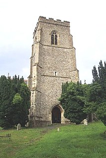
Norton is a village and civil parish in the Mid Suffolk district of the English county of Suffolk. The name Norton means northern town or farm. Located close to the A14, its nearest railway station is at Elmswell, just over 3 miles (5 km) away. The closest towns are Stowmarket 8 miles (13 km) away and Bury St Edmunds, around 10 miles (16 km) away.

Stowmarket town and civil parish in Mid Suffolk, Suffolk, England

Stowmarket is a small market town in Suffolk, England, on the busy A14 trunk road between Bury St Edmunds to the west and Ipswich to the southeast. The town is on the main railway line between London and Norwich, and lies on the River Gipping, which is joined by its tributary, the River Rat, to the south of the town.

Bramfield, Suffolk village and civil parish in the east of the English county of Suffolk

Bramfield is a village and civil parish in the east of the English county of Suffolk. It is 5 miles (8.0 km) south of the market town of Halesworth on the A144 road between Halesworth and the A12 road, one of the main arterial routes through the county. The village is 24 miles (39 km) north-east of the county town of Ipswich and 15 miles (24 km) south-west of the port of Lowestoft. The East Suffolk railway line between Lowestoft and Ipswich passes close to the west of the village with Halesworth railway station being the nearest station.

Baylham village in United Kingdom

Baylham is a village and civil parish in the Mid Suffolk district of Suffolk, England, about 7 miles (11 km) northwest of Ipswich and 6 miles (9.7 km) southeast of Stowmarket. It is recorded in the Domesday book as Beleham.

Beyton village in United Kingdom

Beyton is a village and civil parish in the Mid Suffolk district of the English county of Suffolk. The village is around 8 miles (13 km) east of Bury St Edmunds, 2 miles (3.2 km) south-east of Thurston and 8 miles (13 km) north-west of Stowmarket. The main Ipswich to Bury St Edmunds road used to pass through the village – the modern A14 dual carriageway bypasses the village to the north.

Debenham village in the United Kingdom

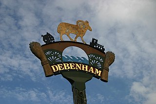
Debenham is a village and civil parish in the Mid Suffolk district of Suffolk, England. The River Deben rises in the parish, and flows along a prolonged ford through the village.

Onehouse village in the United Kingdom

Onehouse is a small village in the English county of Suffolk, about 3 miles west from the centre of Stowmarket near to the Golf Club. The population of the parish at the 2011 Census was 810.

Trimley St. Mary village in the United Kingdom

Trimley St. Mary is a parish and village on the outskirts of Felixstowe, on a low-lying peninsula between Harwich Harbour and the River Deben, in Suffolk, England. It lies on the Roman road between Felixstowe and Ipswich. Its eastern border is Spriteshall Lane. The village, and its neighbour Trimley St. Martin, are famous for their adjacent churches, which were built as the result of a historical family feud. St. Mary's church is the southerly church. The village has a number of shops, and two pubs. Trimley railway station serves the village on the Felixstowe Branch Line.

Willisham

Willisham is a small village in the suburbs of the county town of Ipswich, Suffolk. The small parish village has been present since the 11th century and was included in the Domesday Book. During the 18th century the village was once home to wheat and barley farmers. During the year 2000 the village had 9 new houses built down Tye. The village post office was renovated into a house 8 years ago. The 2011 census recorded a population of 362 people.

Monk Soham

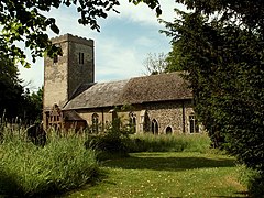
Monk Soham is a village in Suffolk, eastern England, four miles (6.4 km) northeast of Debenham and six miles (10 km) northwest of Framlingham. The neighbouring villages are Bedfield, Ashfield cum Thorpe, Kenton and Bedingfield. The nearest primary school is in Bedfield. There are secondary schools in Framlingham and Woodbridge.

Semer, Suffolk village in United Kingdom

Semer is a small village and civil parish in Suffolk, England. Located adjacent to a bridge over the River Brett on the B1115 between Hadleigh and Stowmarket, it is part of Babergh district. The parish also contains the hamlets of Ash Street and Drakestone Green.

Pettaugh village in United Kingdom

Pettaugh is a village and civil parish located within the district council area of Mid Suffolk, England.

Elmswell village in Mid Suffolk, Suffolk, England

Elmswell is a village and civil parish in the county of Suffolk, England. It is situated halfway between Bury St. Edmunds and Stowmarket and lies just to the north of the A14 road.

Clopton, Suffolk village in the United Kingdom

Clopton is a village and civil parish in Suffolk. It is located between Ipswich and Debenham two kilometres north of Grundisburgh on the River Lark. The village is no larger than a series of houses either side of the B1078, surrounded by farm land. The village itself has no clear centre; houses and other buildings are concentrated around the four manors of Kingshall, Brendhall, Rousehall and Wascolies, all of which are mentioned in the Domesday Book.

Stonham Aspal farm village in the United Kingdom

Stonham Aspal is a village and civil parish in the Mid Suffolk district of Suffolk in eastern England, about five miles east of the town of Stowmarket. Surrounding villages include Mickfield, Little Stonham and Pettaugh. Its population in 2011 was 601. The village has a primary school. It is set in farmland but has a busy main road, A1120, running through the village.

Ringshall, Suffolk village in the United Kingdom

Ringshall is a village and civil parish in the Mid Suffolk district of Suffolk in eastern England. Located around four miles south of Stowmarket, and 13 miles north west of Ipswich.

Ousden village and civil parish of Suffolk, England

Ousden is a village and civil parish in the St Edmundsbury district of Suffolk in eastern England. It is located around six miles west of Bury St Edmunds and 72 miles north of London, and as of 2011, its population is 266. The village has an Anglican church of St Peter's and a chapel in the cemetery dedicated to St Barnabas.

Swilland farm village in the United Kingdom

Swilland is a village and civil parish, in the Suffolk Coastal district, in the English county of Suffolk. It is north of the large town of Ipswich. Swilland has a church called St Mary. It has a pub called The Moon & Mushroom Inn which has been awarded Suffolk Pub of The Year on two occasions by the Evening Star. The parish formed part of the hundred of Bosmere-and-Claydon.

Stratford St Andrew human settlement in United Kingdom

Stratford St Andrew is a small village and a civil parish just off the A12 road, in the Suffolk Coastal District, in the English county of Suffolk. It is located 3 miles south west of Saxmundham, which is the nearest town to the village.

References

  1. 1 2 "Key Statistics: Winston". Neighbourhood Statistics. Office for National Statistics. Retrieved 12 April 2014.
  2. Wilson, John Marius (1870–72). Gazetteer of England and Wales. Edinburgh: A. Fullarton & Co. Retrieved 5 February 2014.
  3. Palmer, Professor J.N.N. "Open Domesday: Winston". University of Hull. Retrieved 25 March 2014.
  4. "Winston CP/AP through time". Population Statistics. University of Portsmouth. Retrieved 25 March 2014.
  5. "English Heritage". British Crown and SeaZone Solutions. Retrieved 27 March 2014.
  6. "Grimbaldus Ancestry". Geni. Retrieved 25 April 2014.
  7. Henry, Alan. D (23 October 1998). "Bacon Family 1066–1702" . Retrieved 25 April 2014.
  8. "Bacon Family". The Generations Network. Retrieved 25 April 2014.
  9. Morely, Suzie. "World War 1 and 2" . Retrieved 25 April 2014.
  10. "Winston CP/AP through time | Industry Statistics". Vision of Britain. University of Portsmouth. Retrieved 25 April 2014.
  11. 1 2 "Winston CP/AP through time Industry Statistics". University of Portsmouth. Retrieved 25 April 2014.
  12. "Neighbourhood Statistics: Industry 2011" . Retrieved 27 April 2014.
  13. "Key Figures for 2011 Census". Office for National Statistics. Retrieved 27 April 2014.
  14. "Economic Activity, 2011". Office for National Statistics. Retrieved 28 April 2014.
  15. Knott, Simon (2009). "Suffolk Churches" . Retrieved 24 April 2014.
  16. "British Listed Buildings" . Retrieved 24 March 2014.
  17. Henry, Alan. D. "Bacon Family". The Generations Network. Retrieved 25 April 2014.
  18. Morely, Suzie. "The Parish Records of St. Andrew, Winston" . Retrieved 25 April 2014.
  19. "Statement concerning Winston School". Suffolk Record Office. Retrieved 25 April 2014.
  20. "AA route planner". utomobile Association Developments Limited. Retrieved 25 April 2014.
  21. "Google Maps". Google. Retrieved 25 April 2014.
  22. "AA route planner". utomobile Association Developments Limited. Retrieved 25 April 2014.

Commons-logo.svg Media related to Winston, Suffolk at Wikimedia Commons