
Wólka Rokicka is a village in the administrative district of Gmina Lubartów, within Lubartów County, Lublin Voivodeship, in eastern Poland. It lies approximately 10 kilometres (6 mi) south-east of Lubartów and 19 km (12 mi) north-east of the regional capital Lublin.
Ciotcza is a village in the administrative district of Gmina Abramów, within Lubartów County, Lublin Voivodeship, in eastern Poland. It lies approximately 6 kilometres (4 mi) north of Abramów, 19 km (12 mi) west of Lubartów, and 33 km (21 mi) north-west of the regional capital Lublin.
Ludwin is a village in Łęczna County, Lublin Voivodeship, in eastern Poland. It is the seat of the gmina called Gmina Ludwin. It lies approximately 4 kilometres (2 mi) north of Łęczna and 25 km (16 mi) east of the regional capital Lublin.
Wierzchowiska Górne is a village in the administrative district of Gmina Bełżyce, within Lublin County, Lublin Voivodeship, in eastern Poland. It lies approximately 8 kilometres (5 mi) south-east of Bełżyce and 21 km (13 mi) south-west of the regional capital Lublin.
Bogucin is a village in the administrative district of Gmina Garbów, within Lublin County, Lublin Voivodeship, in eastern Poland. It lies approximately 19 km (12 mi) north-west of the regional capital Lublin.
Sieprawice is a village in the administrative district of Gmina Jastków, within Lublin County, Lublin Voivodeship, in eastern Poland. It lies approximately 14 km (9 mi) north-west of the regional capital Lublin.
Radawiec Duży is a village in the administrative district of Gmina Konopnica, within Lublin County, Lublin Voivodeship, in eastern Poland. It lies approximately 9 kilometres (6 mi) east of Konopnica and 14 km (9 mi) south-west of the regional capital Lublin.
Radawiec Mały is a village in the administrative district of Gmina Konopnica, within Lublin County, Lublin Voivodeship, in eastern Poland. It lies approximately 9 kilometres (6 mi) south-east of Konopnica and 14 km (9 mi) south-west of the regional capital Lublin.
Marianka is a village in the administrative district of Gmina Niedrzwica Duża, within Lublin County, Lublin Voivodeship, in eastern Poland. It lies approximately 4 kilometres (2 mi) south of Niedrzwica Duża and 22 km (14 mi) south-west of the regional capital Lublin.
Strzeszkowice Duże is a village in the administrative district of Gmina Niedrzwica Duża, within Lublin County, Lublin Voivodeship, in eastern Poland. It lies approximately 5 kilometres (3 mi) north of Niedrzwica Duża and 17 km (11 mi) south-west of the regional capital Lublin.
Pryszczowa Góra is a village in the administrative district of Gmina Niemce, within Lublin County, Lublin Voivodeship, in eastern Poland. It lies approximately 14 kilometres (9 mi) west of Niemce and 19 km (12 mi) north-west of the regional capital Lublin.
Charlęż is a village in the administrative district of Gmina Spiczyn, within Łęczna County, Lublin Voivodeship, in eastern Poland. It lies approximately 4 kilometres (2 mi) south-west of Spiczyn, 13 km (8 mi) west of Łęczna, and 14 km (9 mi) north-east of the regional capital Lublin.
Kijany is a village in the administrative district of Gmina Spiczyn, within Łęczna County, Lublin Voivodeship, in eastern Poland. It lies approximately 2 kilometres (1 mi) south of Spiczyn, 9 km (6 mi) north-west of Łęczna, and 17 km (11 mi) north-east of the regional capital Lublin.
Ryżki is a village in the administrative district of Gmina Łuków, within Łuków County, Lublin Voivodeship, in eastern Poland. It lies approximately 4 kilometres (2 mi) south-west of Łuków and 75 km (47 mi) north of the regional capital Lublin.
Szczygły Górne is a village in the administrative district of Gmina Łuków, within Łuków County, Lublin Voivodeship, in eastern Poland. It lies approximately 7 kilometres (4 mi) south-west of Łuków and 71 km (44 mi) north of the regional capital Lublin.
Wólka Świątkowa is a village in the administrative district of Gmina Łuków, within Łuków County, Lublin Voivodeship, in eastern Poland. It lies approximately 6 kilometres (4 mi) north of Łuków and 81 km (50 mi) north of the regional capital Lublin.
Wierzchoniów is a village in the administrative district of Gmina Kazimierz Dolny, within Puławy County, Lublin Voivodeship, in eastern Poland. It lies approximately 7 kilometres (4 mi) east of Kazimierz Dolny, 11 km (7 mi) south-east of Puławy, and 39 km (24 mi) west of the regional capital Lublin.
Opoka is a village in the administrative district of Gmina Końskowola, within Puławy County, Lublin Voivodeship, in eastern Poland. It lies approximately 3 kilometres (2 mi) south-east of Końskowola, 8 km (5 mi) east of Puławy, and 39 km (24 mi) north-west of the regional capital Lublin.
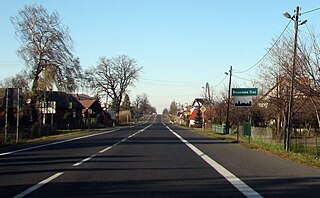
Brzozowa Gać is a village in the administrative district of Gmina Kurów, within Puławy County, Lublin Voivodeship, in eastern Poland. It lies approximately 16 km (10 mi) east of Puławy and 32 km (20 mi) north-west of the regional capital Lublin.
Szumów is a village in the administrative district of Gmina Kurów, within Puławy County, Lublin Voivodeship, in eastern Poland. It lies approximately 8 kilometres (5 mi) south of Kurów, 18 km (11 mi) south-east of Puławy, and 29 km (18 mi) west of the regional capital Lublin.


