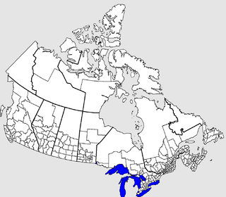
The Nelson River is a river of north-central North America, in the Canadian province of Manitoba. The river drains Lake Winnipeg and runs 644 kilometres (400 mi) before it ends in Hudson Bay. Its full length is 2,575 kilometres (1,600 mi), it has mean discharge of 2,370 cubic metres per second (84,000 cu ft/s), and has a drainage basin of 1,072,300 square kilometres (414,000 sq mi), of which 180,000 square kilometres (69,000 sq mi) is in the United States.

York Factory was a settlement and Hudson's Bay Company (HBC) factory located on the southwestern shore of Hudson Bay in northeastern Manitoba, Canada, at the mouth of the Hayes River, approximately 200 kilometres (120 mi) south-southeast of Churchill. York Factory was one of the first fur-trading posts established by the HBC, built in 1684 and used in that business for more than 270 years. The settlement was headquarters of the HBC's Northern Department from 1821 to 1873. The complex was designated a National Historic Site of Canada in 1936.

The Hayes River is a river in Northern Region, Manitoba, Canada that flows from Molson Lake to Hudson Bay at York Factory. It was an historically important river in the development of Canada, and is today a Canadian Heritage River and the longest naturally flowing river in Manitoba.
Split Lake is a community in Manitoba on the north shore of Split Lake (Manitoba) on the Nelson River about 150 miles west southwest of the river's mouth at Hudson Bay and is within Split Lake 171, a reserve of the Tataskweyak Cree Nation.

The Bolton River is a river in the Hudson Bay drainage basin in Census Division No. 22 - Thompson-North Central, Northern Region, Manitoba, Canada. It is about 115 kilometres (71 mi) long and begins at Musketasonan Lake, about 20 kilometres (12 mi) south of Molson Lake, at an elevation of 249 metres (817 ft). It flows northeast through Little Bolton Lake at an elevation of 224 metres (735 ft), Rushforth Lake at an elevation of 218 metres (715 ft), Bolton Lake at an elevation of 212 metres (696 ft), where it takes in the right tributary Nikik River, and Kakwusis Lake at an elevation of 208 metres (682 ft). The river continues northeast over the twin Kasukwapiskechewak Rapids, then over the twin Kakwu Rapids, and empties into Aswapiswanan Lake at an elevation of 186 metres (610 ft), about 60 kilometres (37 mi) west southwest of the community of Gods Lake Narrows. The Bolton River's waters eventually flow into Gods Lake, and via the Gods River and the Hayes River into Hudson Bay.
The Mink River is a river in the Hudson Bay drainage basin in Census Division No. 22 - Thompson-North Central, Northern Region, Manitoba, Canada. It is about 14.7 kilometres (9.1 mi) long and begins at Aswapiswanan Lake at an elevation of 186 metres (610 ft). The river takes in one significant tributary, an unnamed river from the Colen Lakes, from the left at 54°29′57″N95°13′06″W before emptying into Touchwood Lake at an elevation of 184 metres (604 ft). The Mink River's waters eventually flow into Gods Lake, and via the Gods River and the Hayes River into Hudson Bay.
Aswapiswanan Lake is a lake in the Hayes River drainage basin in Census Division No. 22 - Thompson-North Central, Northern Region, Manitoba, Canada. The lake is about 22 kilometres (14 mi) long and 2.6 kilometres (1.6 mi) wide and lies at an elevation of 186 metres (610 ft). The primary inflows from west to east are the Hungry River, Porcupine Creek, the Bolton River and the Joint River. The primary outflow is the Mink River. The lake's waters eventually flow into Gods Lake, and via the Gods River and the Hayes River into Hudson Bay.
Musketasonan Lake is a lake in the Hayes River drainage basin in Census Division No. 22 - Thompson-North Central, Northern Region, Manitoba, Canada. The lake is about 4.5 kilometres (2.8 mi) long and 1.6 kilometres (1.0 mi) wide and lies at an elevation of 249 metres (817 ft). It is the source of the Bolton River, whose waters eventually flow into Gods Lake, and via the Gods River and the Hayes River into Hudson Bay.
Touchwood Lake is a lake in the Hayes River drainage basin in Census Division No. 22 - Thompson-North Central, Northern Region, Manitoba, Canada. The lake is about 20.9 kilometres (13.0 mi) long and 4.4 kilometres (2.7 mi) wide and lies at an elevation of 184 metres (604 ft). The primary inflows are the Mink River, Wanless Creek, and the Wapawukaw River, and the primary outflow is a channel to Vermilyea Lake. The lake's waters eventually flow into Gods Lake, and via the Gods River and the Hayes River into Hudson Bay.
Vermilyea Lake is a lake in the Hayes River drainage basin in Census Division No. 22 - Thompson-North Central, Northern Region, Manitoba, Canada. It is shaped like the letter "L" on its side, is about 9.3 kilometres (5.8 mi) long and 8.2 kilometres (5.1 mi) wide, and lies at an elevation of 184 metres (604 ft). The primary inflow is a channel from Touchwood Lake, and the primary outflows are the twin channels of the Wesachewan River to Gods Lake. The lake's waters eventually flow via the Gods River and the Hayes River into Hudson Bay.
The Wesachewan River is a short river in the Hudson Bay drainage basin in Census Division No. 22 - Thompson-North Central, Northern Region, Manitoba, Canada. It flows 2.5 kilometres (1.6 mi) out of Vermilyea Lake via twin channels which combine at 54°30′31″N94°44′28″W, then flows over the Namaykos Rapids, and empties into Wesachewan Bay on Gods Lake. The main channel from Vermilyea Lake is the east channel, given as the primary source in the Infobox at right, which is straighter and 1.8 kilometres (1.1 mi) shorter than its twin, the west channel, given as the secondary source. The length of the river given in the Infobox is the length using the shorter east channel.
Little Bolton Lake is a lake in the Hayes River drainage basin in Census Division No. 22 - Thompson-North Central, Northern Region, Manitoba, Canada. The lake is about 15 kilometres (9.3 mi) long and 4 kilometres (2.5 mi) wide and lies at an elevation of 224 metres (735 ft). The primary inflow and outflow is the Bolton River, whose waters eventually flow into Gods Lake, and via the Gods River and the Hayes River into Hudson Bay.
Bolton Lake is a lake in the Hayes River drainage basin in Census Division No. 22 - Thompson-North Central, Northern Region, Manitoba, Canada. The lake is at an elevation of 212 metres (696 ft); the main body of the lake is about 15 kilometres (9.3 mi) long and 8 kilometres (5.0 mi) wide, but an arm extends a further 11 kilometres (6.8 mi) for a total width of 19 km as well. The primary inflows are the Bolton River from the west and the Nikik River from the south, and the primary outflow is Bolton River, whose waters eventually flow into Gods Lake, and via the Gods River and the Hayes River into Hudson Bay.
Kakwusis Lake is a lake in the Hayes River drainage basin in Census Division No. 22 - Thompson-North Central, Northern Region, Manitoba, Canada. The lake is about 3.6 kilometres (2.2 mi) long and 1.6 kilometres (1.0 mi) wide and lies at an elevation of 208 metres (682 ft). The primary inflow and outflow is the Bolton River, whose waters eventually flow into Gods Lake, and via the Gods River and the Hayes River into Hudson Bay.
Rushforth Lake is a lake in the Hayes River drainage basin in Census Division No. 22 - Thompson-North Central, Northern Region, Manitoba, Canada. The lake is about 11 kilometres (6.8 mi) long and 1.4 kilometres (0.9 mi) wide and lies at an elevation of 218 metres (715 ft). The primary inflow and outflow is the Bolton River, whose waters eventually flow into Gods Lake, and via the Gods River and the Hayes River into Hudson Bay.
The Boyne River is a river in the Hudson Bay drainage basin in the Central Plains and Pembina Valley Regions of Manitoba, Canada.
The Whitefish River is a river in Census Division 21 in the Northern Region of Manitoba, Canada. It is in the Hudson Bay and Nelson River drainage basins and is a left tributary of the Saskatchewan River.
The Fox River is a river in northern Manitoba, Canada. It flows east-northeast parallel to and between the Nelson River to the north and the Hayes River to the south. It joins the Hayes about 121 kilometres (75 mi) southeast of its mouth on Hudson Bay. About 121 kilometres (75 mi) above its juncture with the Hayes it splits with the southern branch being the Bigstone River. At the head of the Bigstone is Utik or Deer Lake from which it is possible to cross to Cross Lake on the Nelson. This route was part of the "Middle Tract" used by smaller Indian canoes to bring furs to the Hudson's Bay Company posts of Hudson Bay.