A ZIP Code is a postal code used by the United States Postal Service (USPS) in a system it introduced in 1963. The term ZIP is an acronym for Zone Improvement Plan; it was chosen to suggest that the mail travels more efficiently and quickly when senders use the code in the postal address. The basic format consists of five digits. An extended ZIP+4 code was introduced in 1983 which includes the five digits of the ZIP Code, followed by a hyphen and four additional digits that reference a more specific location.

Laird is a census-designated place in Yuma County, Colorado, United States. The population as of the 2010 Census was 47. The U.S. Post Office at Wray now serves Laird postal addresses.

Concord is an unincorporated community in Fannett Township, Franklin County, Pennsylvania, United States. The community is located on Pennsylvania Route 75 9.6 miles (15.4 km) south-southwest of East Waterford. Concord has a post office with ZIP code 17217.

Monticello is an unincorporated community located in Sierra County, New Mexico, United States. Monticello is located on Alamosa Creek 22 miles (35 km) northwest of Truth or Consequences. Monticello has a post office with ZIP code 87939.

Ash is an unincorporated community in Brunswick County, North Carolina, United States. The community is located on North Carolina Highway 130 10.3 miles (16.6 km) northwest of Shallotte. Ash has a post office with ZIP code 28420, which opened on November 17, 1884.
Lowland is an unincorporated community in Pamlico County, North Carolina, United States. The community is located in the far northeast part of the county near Pamlico Sound, 16 miles (26 km) northeast of Bayboro. Lowland has a post office with ZIP code 28552, which opened on November 17, 1884.
Knox Dale is an unincorporated community in Jefferson County, Pennsylvania, United States. The community is 6 miles (9.7 km) south-southeast of Brookville. Knox Dale has a post office with ZIP code 15847.
Clune is an unincorporated community in Indiana County, Pennsylvania, United States. The community is 8.7 miles (14.0 km) west-southwest of Indiana. Clune has a post office with ZIP code 15727.

Portage is an unincorporated village within the town of Portage Lake in Aroostook County, Maine, United States. The community is located on Maine State Route 11 and the southeast shore of Portage Lake 10 miles (16 km) north-northwest of Ashland. Portage has a post office with ZIP code 04768, which opened on November 6, 1883.
North Vassalboro is an unincorporated village in the town of Vassalboro, Kennebec County, Maine, United States. The community is located on Maine State Route 32 4.5 miles (7.2 km) south of Waterville. North Vassalboro has a post office with ZIP code 04962, which opened on March 22, 1828.

Oakfield is an unincorporated community in Worth County, Georgia, United States. The community is on Georgia State Route 300 in the county's far northwestern portion, 4.8 miles (7.7 km) southwest of Warwick. Oakfield has a post office with ZIP code 31772.
Box Springs is an unincorporated community in Talbot County, Georgia, United States. The community is located in the county's extreme southwestern corner, 12.2 miles (19.6 km) southwest of Talbotton. Box Springs has a post office with ZIP code 31801.
Nicktown is an unincorporated community in Cambria County, Pennsylvania, United States. The community is located at the junction of Pennsylvania Route 271 and Pennsylvania Route 553, 3.4 miles (5.5 km) south-southwest of Northern Cambria. Nicktown has a post office with ZIP code 15762, which opened on November 11, 1870.
Josephine is an unincorporated community in Indiana County, Pennsylvania, United States. The community is 4.7 miles (7.6 km) south of Homer City. Josephine has a post office with ZIP code 15750.
Torrance is an unincorporated community in Westmoreland County, Pennsylvania, United States. The community is located on the south side of the Conemaugh River 2.2 miles (3.5 km) east of Blairsville. Torrance has a post office with ZIP code 15779.
Forbes Road is an unincorporated community in Westmoreland County, Pennsylvania, United States. The community is located along Pennsylvania Route 819 3.7 miles (6.0 km) north of Greensburg. Forbes Road has a post office with ZIP code 15633, which opened on July 1, 1903.
Claridge is an unincorporated community in Westmoreland County, Pennsylvania, United States. The community is 3.3 miles (5.3 km) northeast of Manor. Claridge has a post office with ZIP code 15623, which opened on January 25, 1886.
Rillton is an unincorporated community in Westmoreland County, Pennsylvania, United States. The community is 2.9 miles (4.7 km) southwest of Irwin. Rillton has a post office with ZIP code 15678.
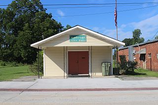
Armbrust is an unincorporated community in Hempfield Township, Westmoreland County, Pennsylvania, United States. The community is located along Pennsylvania Route 819 1.8 miles (2.9 km) southeast of Youngwood. Armbrust has a post office with ZIP code 15616, which opened on June 25, 1856.
Bunola is an unincorporated community in Allegheny County, Pennsylvania, United States. The community is located along the Monongahela River 14.2 miles (22.9 km) south of Pittsburgh. Bunola has a post office with ZIP code 15020, which opened on May 26, 1888.