
Gmina Celestynów is a rural gmina in Otwock County, Masovian Voivodeship, in east-central Poland. Its seat is the village of Celestynów, which lies approximately 11 kilometres (7 mi) south-east of Otwock and 33 km (21 mi) south-east of Warsaw.
Gmina Sobienie-Jeziory is a rural gmina in Otwock County, Masovian Voivodeship, in east-central Poland. Its seat is the village of Sobienie-Jeziory, which lies approximately 19 kilometres south of Otwock and 39 km south-east of Warsaw.
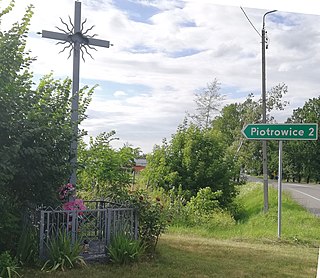
Piotrowice is a village in the administrative district of Gmina Karczew, within Otwock County, Masovian Voivodeship, in east-central Poland. It lies approximately 9 kilometres (6 mi) south of Karczew, 13 km (8 mi) south of Otwock, and 31 km (19 mi) south-east of Warsaw.

Kosumce is a village in the administrative district of Gmina Karczew, within Otwock County, Masovian Voivodeship, in east-central Poland. It lies approximately 12 kilometres (7 mi) south of Karczew, 15 km (9 mi) south of Otwock, and 32 km (20 mi) south-east of Warsaw. As of 2007, the village had a population of approximately 280.
Brzezinka is a village in the administrative district of Gmina Karczew, within Otwock County, Masovian Voivodeship, in east-central Poland. It lies approximately 6 kilometres (4 mi) south-east of Karczew, 8 km (5 mi) south of Otwock, and 28 km (17 mi) south-east of Warsaw.
Całowanie is a village in the administrative district of Gmina Karczew, within Otwock County, Masovian Voivodeship, in east-central Poland. It lies approximately 9 kilometres (6 mi) south-east of Karczew, 12 km (7 mi) south of Otwock, and 31 km (19 mi) south-east of Warsaw.
Glinki is a village in the administrative district of Gmina Karczew, within Otwock County, Masovian Voivodeship, in east-central Poland. It lies approximately 9 kilometres (6 mi) south of Karczew, 13 km (8 mi) south of Otwock, and 29 km (18 mi) south-east of Warsaw.
Janów is a village in the administrative district of Gmina Karczew, within Otwock County, Masovian Voivodeship, in east-central Poland. It lies approximately 4 kilometres (2 mi) south-east of Karczew, 7 km (4 mi) south of Otwock, and 26 km (16 mi) south-east of Warsaw.
Kępa Nadbrzeska is a village in the administrative district of Gmina Karczew, within Otwock County, Masovian Voivodeship, in east-central Poland. It lies approximately 6 kilometres (4 mi) south of Karczew, 10 km (6 mi) south of Otwock, and 27 km (17 mi) south-east of Warsaw.
Łukówiec is a village in the administrative district of Gmina Karczew, within Otwock County, Masovian Voivodeship, in east-central Poland. It lies approximately 7 kilometres (4 mi) south-east of Karczew, 10 km (6 mi) south of Otwock, and 29 km (18 mi) south-east of Warsaw.
Nadbrzeż is a village in the administrative district of Gmina Karczew, within Otwock County, Masovian Voivodeship, in east-central Poland. It lies approximately 5 kilometres (3 mi) south-west of Karczew, 8 km (5 mi) south-west of Otwock, and 24 km (15 mi) south-east of Warsaw.

Ostrówek is a village in the administrative district of Gmina Karczew, within Otwock County, Masovian Voivodeship, in east-central Poland. It lies approximately 10 kilometres (6 mi) south of Karczew, 14 km (9 mi) south of Otwock, and 30 km (19 mi) south-east of Warsaw.
Ostrówiec is a village in the administrative district of Gmina Karczew, within Otwock County, Masovian Voivodeship, in east-central Poland. It lies approximately 6 kilometres (4 mi) south of Karczew, 9 km (6 mi) south of Otwock, and 28 km (17 mi) south-east of Warsaw.
Otwock Mały is a village in the administrative district of Gmina Karczew, within Otwock County, Masovian Voivodeship, in east-central Poland. It lies approximately 4 kilometres (2 mi) south of Karczew, 8 km (5 mi) south of Otwock, and 26 km (16 mi) south-east of Warsaw.

Otwock Wielki is a village in the administrative district of Gmina Karczew, within Otwock County, Masovian Voivodeship, in east-central Poland. It lies approximately 5 kilometres (3 mi) south of Karczew, 8 km (5 mi) south of Otwock, and 26 km (16 mi) south-east of Warsaw.
Sobiekursk is a village in the administrative district of Gmina Karczew, within Otwock County, Masovian Voivodeship, in east-central Poland. It lies approximately 8 kilometres (5 mi) south of Karczew, 11 km (7 mi) south of Otwock, and 30 km (19 mi) south-east of Warsaw.
Władysławów is a village in the administrative district of Gmina Karczew, within Otwock County, Masovian Voivodeship, in east-central Poland. It lies approximately 8 kilometres (5 mi) south of Karczew, 11 km (7 mi) south of Otwock, and 28 km (17 mi) south-east of Warsaw.

Wola Sufczyńska is a village in the administrative district of Gmina Kołbiel, within Otwock County, Masovian Voivodeship, in east-central Poland. It lies approximately 3 kilometres (2 mi) south-east of Kołbiel, 19 km (12 mi) south-east of Otwock, and 40 km (25 mi) south-east of Warsaw.


