Xamindele Airport

Last updated
Xamindele Airport
Toto Airport
Summary
Airport type Public
Serves Toto
Elevation  AMSL 1,775 ft / 541 m
Coordinates 7°8′45″S14°14′55″E / 7.14583°S 14.24861°E / -7.14583; 14.24861 Coordinates: 7°8′45″S14°14′55″E / 7.14583°S 14.24861°E / -7.14583; 14.24861
Map
Angola location map.svg
Airplane silhouette.svg
FNTO
Location of Xamindele Airport in Angola
Runways
Direction LengthSurface
mft
11/291,5485,079Grass
Source: GCM [1] Landings.com [2] Google Maps [3]

Xamindele Airport (Portuguese : Aeroporto Xamindele, ICAO : FNTO) is a public use airstrip serving the village of Toto in Uíge Province, Angola.

Portuguese language Romance language that originated in Portugal

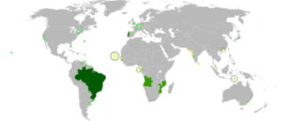
Portuguese is a Western Romance language originating in the Iberian Peninsula. It is the sole official language of Portugal, Brazil, Cape Verde, Guinea-Bissau, Mozambique, Angola, and São Tomé and Príncipe. It also has co-official language status in East Timor, Equatorial Guinea and Macau in China. As the result of expansion during colonial times, a cultural presence of Portuguese and Portuguese creole speakers are also found in Goa, Daman and Diu in India; in Batticaloa on the east coast of Sri Lanka; in the Indonesian island of Flores; in the Malacca state of Malaysia; and the ABC islands in the Caribbean where Papiamento is spoken, while Cape Verdean Creole is the most widely spoken Portuguese-based Creole. A Portuguese-speaking person or nation may be referred to as "Lusophone" in both English and Portuguese.

ICAO airport code four-letter code designating many airports around the world

The ICAOairport code or location indicator is a four-letter code designating aerodromes around the world. These codes, as defined by the International Civil Aviation Organization and published in ICAO Document 7910: Location Indicators, are used by air traffic control and airline operations such as flight planning.

Uíge Province Province in Angola

Uíge, one of the eighteen Provinces of Angola, is located in the northwestern part of the country. Its capital city is of the same name. Municipalities within the province include Alto Cauale, Ambuila, Bembe, Buengas, Bungo, Damba, Macocola, Milunga, Mucaba, Negage, Puri, Quimbele, Quitexe, Sanza Pombo, Songo, Uíge, and Zombo.

Contents

See also

Transport in Angola comprises:

Related Research Articles

Ondjiva Pereira Airport

Ondjiva Pereira Airport is an airport serving Ondjiva in Cunene Province, Angola. The airport is 38 kilometres (24 mi) north of the Namibian border.

Malanje Airport

Malanje Airport is an airport serving Malanje, the capital of Malanje Province in Angola.

Menongue Airport airport

Menongue Airport is an airport serving Menongue, a town and municipality in the Cuando Cubango Province of Angola.

Welwitschia Mirabilis Airport

Welwitschia Mirabilis International Airport is an airport serving the Atlantic port city of Moçâmedes, the capital of Namibe Province in Angola. The runway is 6.8 kilometres (4.2 mi) south of the city.

Catumbela Airport airport

Catumbela Airport is an airport in Catumbela, a coastal city in the Benguela Province of Angola. After having been expanded and restored, the airport opened in 2012 and due to its capacity and size, would indicate annual passenger movement of around 2.2 million. Cutumbela Airport will form an alternative to the airport in Luanda. The national certification process for Benguela Province's Catumbela airport is expected to be completed in February 2019, providing that the security standards complies with the 'Empresa Nacional de Navegação Aérea' regarding the infrastructure. The airport boasts two boarding bridges and a 3,700-metre runway, 18 migration service-counters and 16 check-in counters. It also provides executive and first class facilities complete with restaurants and bars.

Negage Airport

Negage Airport is an airport serving Negage, a town and municipality in Uíge Province in Angola. It was formerly a Portuguese military airbase.

Mbanza Congo Airport airport

Mbanza Congo Airport is an airport serving M'banza Congo, the capital of Zaire Province in northwestern Angola. Passenger flights resumed in August 2017 following an eight-year gap, during which the airport was closed for construction works.

Cabinda Airport

Cabinda Airport is an airport serving Cabinda, a city in the Cabinda Province, an exclave of Angola.

Lubango Airport

Lubango Mukanka Airport is an airport serving Lubango, the capital city of the Huíla Province in Angola. The Lubango non-directional beacon is located 2.4 kilometres (1.5 mi) east-northeast of the Rwy 28 threshold.

Dundo Airport

Dundo Airport is an airport serving the city of Dundo, the capital of Lunda Norte Province in Angola.

Soyo Airport

Soyo Airport is an airport serving Soyo, a city in Zaire Province in Angola.

Albano Machado Airport airport serving Huambo, Angola

The Albano Machado Airport is a public airport southeast of Huambo, the capital of Huambo Province, Angola. It was formerly named the Nova Lisboa Airport, since in colonial times the city was called Nova Lisboa, or New Lisbon.

Benguela Airport airport

Benguela Airport is an airport serving Benguela, the capital city of Benguela Province in Angola.

Catoca Airport

Catoca Airport is an airport in the Lunda Sul Province of Angola. It serves the Catoca diamond mine.

Lucapa Airport

Lucapa Airport is an airport serving Lucapa, the capital of the Lunda Norte Province in northeastern Angola.

Saurimo Airport airport

Saurimo Airport is a public use airport serving the city of Saurimo in Lunda Sul Province, Angola. It was formerly known as Henrique de Carvalho Airport.

Luena Airport

Luena Airport is an airport serving Luena, the capital of the Moxico Province in Angola.

Kuito Airport

Kuito Airport is an airport serving Kuito, a city in the Bié Province in Angola.

Uíge Airport airport

Uíge/Carmona Airport is a public use airport on the west side of Uíge, the capital of Uíge Province in Angola.

Luau International Airport

Luau International Airport is an airport serving Luau, a municipality in the Moxico Province of Angola. It is 6.5 kilometres (4.0 mi) west of the city, and may replace the Villa Teixeira de Sousa Airport, an unpaved airstrip that is within the city.

References

  1. Airport information for FNTO at Great Circle Mapper.
  2. Airport record for Xamindele Airport at Landings.com. Retrieved 2013-09-02
  3. Google Maps - Xamindele