Yakoruda Municipality

Last updated
Yakoruda Municipality

Община Якоруда
Map of Yakoruda municipality (Blagoevgrad Province).png
Location in Blagoevgrad province
Location on map of Bulgaria
Yakoruda Municipality Bulgaria map.png
Country Bulgaria
Province (Oblast) Blagoevgrad
Area
  Total339.28 km2 (131.00 sq mi)
Population
  Total10,284
  Density30/km2 (79/sq mi)

Yakoruda Municipality is a municipality in Blagoevgrad Province in southwestern Bulgaria.

Blagoevgrad Province Province in Bulgaria

Blagoevgrad Province, also known as Pirin Macedonia is a province (oblast) of southwestern Bulgaria. It borders four other Bulgarian provinces to the north and east, to the Greek region of Macedonia to the south, and North Macedonia to the west. The province has 14 municipalities with 12 towns. Its principal city is Blagoevgrad, while other significant towns include Bansko, Gotse Delchev, Melnik, Petrich, Razlog, Sandanski, and Simitli.

Bulgaria country in Southeast Europe

Bulgaria, officially the Republic of Bulgaria, is a country in Southeast Europe. It is bordered by Romania to the north, Serbia and North Macedonia to the west, Greece and Turkey to the south, and the Black Sea to the east. The capital and largest city is Sofia; other major cities are Plovdiv, Varna and Burgas. With a territory of 110,994 square kilometres (42,855 sq mi), Bulgaria is Europe's 16th-largest country.

Contents

Demographics

Of all the people who answered the question on their religion, 77% declared Muslim. Most of those Muslims are the so-called Pomaks, or Bulgarian Muslims but they tend to declare themselves as Turkish people.

Pomaks

Pomaks is a term used for Slavic Muslims inhabiting Bulgaria, northeastern Greece and mainly northwestern Turkey, mainly referring to the ca. 220,000 strong ethno-confessional minority in Bulgaria known officially as Bulgarian Muslims. The term has also been used as a wider designation, including also the Slavic Muslim populations of North Macedonia and Albania. Their language, a Bulgarian dialect, is referred to in Greece and Turkey as the Pomak language. The community in Greece is commonly fluent in Greek, and in Turkey, Turkish, while the communities in these two countries, especially in Turkey, are increasingly adopting Turkish as their first language as a result of education and family links with the Turkish people. The origin of the Pomaks has been debated; but they are generally considered descendants of native Eastern Orthodox Bulgarian Slavs who converted to Islam during the Ottoman rule of the Balkans. Information through Ottoman registers supports this theory.

Turkish people or the Turks, also known as Anatolian Turks, are a Turkic ethnic group and nation living mainly in Turkey and speaking Turkish, the most widely spoken Turkic language. They are the largest ethnic group in Turkey, as well as by far the largest ethnic group among the speakers of Turkic languages. Ethnic Turkish minorities exist in the former lands of the Ottoman Empire. In addition, a Turkish diaspora has been established with modern migration, particularly in Western Europe.

Religion

According to the latest Bulgarian census of 2011, the religious composition, among those who answered the optional question on religious identification, was the following:

Religious composition of Yakoruda Municipality [1]
Orthodox Christianity
18.1%
Catholicism
0.1%
Protestantism
0.2%
Islam
76.9%
No religion
0.4%
Prefer not to answer, others and indefinable
4.3%

Related Research Articles

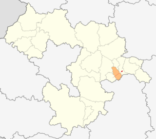
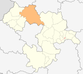
Sopot Municipality is a municipality in Plovdiv Province, Bulgaria. The municipality consists only of two places: the town of Sopot and the village of Anevo.

Satovcha Municipality Municipality in Blagoevgrad, Bulgaria

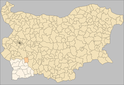
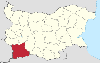
Satovcha Municipality is a municipality in southwestern Bulgaria and is one of the municipalities in the Blagoevgrad Province.

The Dospat Municipality is a municipality in southwestern Bulgaria and is one of the municipalities in the Smolyan Province.

Dragoman Municipality Municipality in Sofia Province, Bulgaria

Dragoman Municipality is a municipality in Sofia Province, Bulgaria.

Anton Municipality Municipality in Sofia Province, Bulgaria

Anton Municipality is located in Sofia Province, Bulgaria. The administrative centre is in Anton, Bulgaria.

Chavdar Municipality Municipality in Sofia Province, Bulgaria

Chavdar Municipality is one of the municipalities in Sofia Province, Bulgaria. The seat is at Chavdar, Sofia Province.

Chelopech Municipality Municipality in Sofia Province, Bulgaria

Chelopech Municipality is a municipality in Sofia Province, Bulgaria.

Dolna Banya Municipality Municipality in Sofia Province, Bulgaria

Dolna Banya Municipality is a municipality in Sofia Province, Bulgaria. It is best known for hosting Adolf Hitler on his roundabout tour of his captured dominions in 1942.

Koprivshtitsa Municipality Municipality in Sofia Province, Bulgaria

Koprivshtitsa Municipality is a municipality in Sofia Province, Bulgaria. The only settlement and administrative center of the municipality is Koprivshtitsa.

Svoge Municipality Municipality in Sofia Province, Bulgaria

Svoge Municipality is located in western Bulgaria and is a part of Sofia Province. It covers a territory of 868,6 km² and has a population of around 21,000 people, more than 1/3 of which lives in the town of Svoge itself. The municipality also includes 37 villages. The municipality is one of the largest by area in the country. It neighbours Montana Province, Vratsa Province & Sofia province.

Velingrad Municipality is the largest municipality in Pazardzhik Province, Bulgaria. The municipality consists of two towns, Velingrad and Sarnitsa as well as 22 villages, with a total population of 40,595.

Petrich Municipality Municipality in Blagoevgrad, Bulgaria

Petrich Municipality is a municipality in Blagoevgrad Province in Southwestern Bulgaria.

Aytos Municipality Municipality in Burgas, Bulgaria

Aytos Municipality is a municipality in Burgas Province, Bulgaria. It includes the town of Aytos and 16 villages.

Ruen Municipality Municipality in Burgas, Bulgaria

Ruen Municipality is a municipality in Burgas Province, Bulgaria. It includes the town of Ruen and a number of villages.

Karnobat Municipality Municipality in Burgas, Bulgaria

Karnobat Municipality is a municipality in Burgas Province, Bulgaria. It includes the town of Karnobat and a number of villages.

Sredets Municipality Municipality in Burgas, Bulgaria

Sredets Municipality is a municipality in Burgas Province, Bulgaria. It includes the town of Sredets and 31 villages.

Sungurlare Municipality Municipality in Burgas, Bulgaria

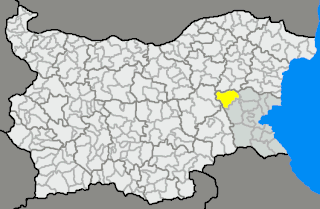
Sungurlare Municipality is a municipality in Burgas Province, Bulgaria. It includes the town of Sungurlare and a number of villages with a total population of 12,559 as of 2011.

Tsarevo Municipality Municipality in Burgas, Bulgaria

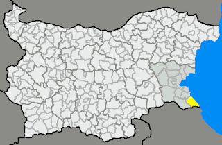
Tsarevo Municipality is a municipality in Burgas Province, Bulgaria.

Kameno Municipality Municipality in Burgas, Bulgaria

Kameno Municipality is a municipality in Burgas Province, Bulgaria. It includes the towns of Kameno and a number of villages.

Primorsko Municipality Municipality in Burgas, Bulgaria

Primorsko Municipality is a municipality in Burgas Province, Bulgaria. It includes the towns of Primorsko and Kiten as well as a number of villages.

References

  1. "Religious composition of Bulgaria 2011". pop-stat.mashke.org.

Commons-logo.svg Media related to Yakoruda Municipality at Wikimedia Commons

Coordinates: 42°01′04″N23°40′08″E / 42.0177°N 23.6688°E / 42.0177; 23.6688

Geographic coordinate system Coordinate system

A geographic coordinate system is a coordinate system that enables every location on Earth to be specified by a set of numbers, letters or symbols. The coordinates are often chosen such that one of the numbers represents a vertical position and two or three of the numbers represent a horizontal position; alternatively, a geographic position may be expressed in a combined three-dimensional Cartesian vector. A common choice of coordinates is latitude, longitude and elevation. To specify a location on a plane requires a map projection.