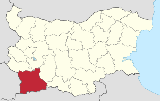
Blagoevgrad Province, also known as Pirin Macedonia or Bulgarian Macedonia, is a province (oblast) of southwestern Bulgaria. It borders four other Bulgarian provinces to the north and east, the Greek region of Macedonia to the south, and North Macedonia to the west. The province has 14 municipalities with 12 towns. Its principal city is Blagoevgrad, while other significant towns include Bansko, Gotse Delchev, Melnik, Petrich, Razlog, Sandanski, and Simitli.
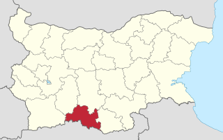
Smolyan Province is a province in Southern-central Bulgaria, located in the Rhodope Mountains, neighbouring Greece to the south. It is named after its administrative and industrial centre—the city of Smolyan. The province embraces a territory of 3,192.8 km2 (1,232.7 sq mi). that is divided into 10 municipalities with a total population of 124,795 inhabitants, as of December 2009.

Islam in Bulgaria is a minority religion and the largest religion in the country after Christianity. According to the 2011 Census, the total number of Muslims in Bulgaria stood at 577,139, corresponding to 7.8% of the population. According to a 2017 estimate, Muslims make up 15% of the population. Ethnically, Muslims in Bulgaria are Turks, Bulgarians and Roma, living mainly in parts of northeastern Bulgaria and in the Rhodope Mountains.
Rodopi municipality is situated in the Plovdiv Province, southern Bulgaria. As of 2006 the population is 33,111.

Tuhovishta is a village in Southwest Bulgaria, part of Satovcha Municipality, Blagoevgrad Province.

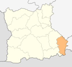
Satovcha is a village in Southwestern Bulgaria. It is the administrative center of the Satovcha Municipality in Blagoevgrad Province.
The Dospat Municipality is a municipality in southwestern Bulgaria and is one of the municipalities in the Smolyan Province.

Debren is a village in Garmen Municipality, in Blagoevgrad Province, Bulgaria. It is situated in the Dabrash part of the Rhodope Mountains 2.5 kilometers southeast of Garmen and 110 kilometers southeast of Blagoevgrad.

Dabnitsa is a village in Garmen Municipality, in Blagoevgrad Province, Bulgaria. It is situated in the Dabrash part of the Rhodope Mountains near Mesta river, 4 kilometers south-southeast of Garmen and 79 kilometers southeast of Blagoevgrad.

Beslen is a village in Hadzhidimovo Municipality, in Blagoevgrad Province, Bulgaria. It is situated just 2 km from the border with Greece.
Yurukovo is a village in Yakoruda Municipality, in Blagoevgrad Province, in southwestern Bulgaria.
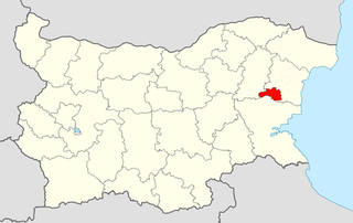
Dalgopol Municipality is a municipality (obshtina) in Varna Province, Northeastern Bulgaria. It is named after its administrative centre - the town of Dalgopol.

Hadzhidimovo Municipality is situated in the southeastern part of Blagoevgrad Province in southwestern Bulgaria. The administrative center is the town of Hadzhidimovo, located in the northern part of the municipality. To the South Hadzhidimovo Municipality is bordering with the Greek municipality Kato Nevrokopi. Four Bulgarian municipalities are surrounding it: to the East is Satovcha Municipality, to the North are Garmen and Gotse Delchev municipalities and to the west is Sandanski Municipality.

Strumyani Municipality is a municipality in Blagoevgrad Province in Southwestern Bulgaria.

Kresna Municipality is a municipality in Blagoevgrad Province in southwestern Bulgaria. The administrative center is the town of Kresna.

Petrich Municipality is a municipality in Blagoevgrad Province in Southwestern Bulgaria.
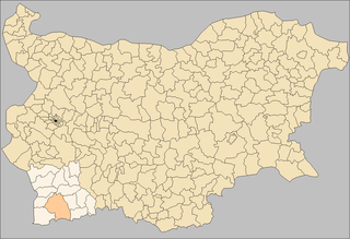
Sandanski Municipality is a municipality in Blagoevgrad Province in Southwestern Bulgaria.
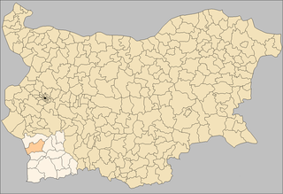
Simitli Municipality is a municipality in Blagoevgrad Province in Southwestern Bulgaria.

Yakoruda Municipality is a municipality in Blagoevgrad Province in southwestern Bulgaria.

Chernoochene Municipality is a municipality in Kardzhali Province, Bulgaria. The administrative centre is the village of Chernoochene.
