Emberá-Wounaan is a comarca indígena in eastern Panama. It was created by Law Number 22 on November 8, 1983, out of the former Chepigana and Pinogana districts of the Darién Province. Its capital is Unión Chocó, and it is notable for being composed of two non-contiguous sections.

Guna de Wargandí or Wargandí, formerly known as Kuna de Wargandí is a comarca indígena and corregimiento in Pinogana District, Darién Province, Panama with a population of 1,914 as of 2010. It was created by Law 34 of July 25, 2000, from the province of Darién, from the district of Pinogana. It has an area of 775 square kilometres (299 sq mi). It is inhabited by the Guna people.
Jaramillo is a corregimiento in Boquete District, Chiriquí Province, Panama. It has a land area of 77.5 square kilometres (29.9 sq mi) and had a population of 2,655 as of 2010, giving it a population density of 34.3 inhabitants per square kilometre (89/sq mi). It was created by Law 58 of July 29, 1998, owing to the Declaration of Unconstitutionality of Law 1 of 1982. Its population as of 2000 was 2,047.
San Pablo Nuevo is a corregimiento in David District, Chiriquí Province, Panama. It has a land area of 59 square kilometres (23 sq mi) and had a population of 1,752 as of 2010, giving it a population density of 29.7 inhabitants per square kilometre (77/sq mi). Its population as of 1990 was 1,192; its population as of 2000 was 1,642.
Tinajas is a corregimiento in Dolega District, Chiriquí Province, Panama. It has a land area of 29.4 square kilometres (11.4 sq mi) and had a population of 1,530 as of 2010, giving it a population density of 52 inhabitants per square kilometre (130/sq mi). Its population as of 1990 was 1,084; its population as of 2000 was 1,237.
Cerro Viejo is a corregimiento in Tolé District, Chiriquí Province, Panama. It has a land area of 59.5 square kilometres (23.0 sq mi) and had a population of 1,768 as of 2010, giving it a population density of 29.7 inhabitants per square kilometre (77/sq mi). Its population as of 1990 was 2,923; its population as of 2000 was 1,709.
Camogantí is a corregimiento in Chepigana District, Darién Province, Panama with a population of 282 as of 2010. Its population as of 1990 was 205; its population as of 2000 was 329.
Tucutí is a corregimiento in Chepigana District, Darién Province, Panama with a population of 1,200 as of 2010. Its population as of 1990 was 1,455; its population as of 2000 was 1,263.

Boca de Cupé is a corregimiento in Pinogana District, Darién Province, Panama with a population of 1,167 as of 2010. Its population as of 1990 was 901; its population as of 2000 was 902.

Paya is a corregimiento in Pinogana District, Darién Province, Panama with a population of 639 as of 2010. Its population as of 1990 was 336; its population as of 2000 was 565. It lies on the Paya River, a tributary of the Tuira River, and close to the Colombia–Panama border.

Pinogana is a corregimiento in Pinogana District, Darién Province, Panama with a population of 405 as of 2010. Its population as of 1990 was 489; its population as of 2000 was 356. It is located along the Tuira River.
Púcuro is a corregimiento in Pinogana District, Darién Province, Panama with a population of 356 as of 2010. Its population as of 1990 was 358; its population as of 2000 was 295.
Veracruz is a corregimiento in Arraiján District, Panamá Oeste Province, Panama with a population of 18,589 as of 2010. Its population as of 1990 was 8,224; its population as of 2000 was 16,748.
Playa Leona is a corregimiento in La Chorrera District, Panamá Oeste Province, Panama with a population of 8,442 as of 2010. Its population as of 1990 was 4,279; its population as of 2000 was 6,706.
Santa Rita is a corregimiento in La Chorrera District, Panamá Oeste Province, Panama with a population of 1,848 as of 2010. Its population as of 1990 was 1,191; its population as of 2000 was 1,307.
El Higo is a corregimiento in San Carlos District, Panamá Oeste Province, Panama with a population of 2,710 as of 2010. Its population as of 1990 was 1,920; its population as of 2000 was 2,341.

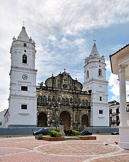
San Felipe is a corregimiento within Panama City, in Panamá District, Panamá Province, Panama with a population of 3,262 as of 2010. Its population as of 1990 was 10,282; its population as of 2000 was 6,928.
Monjarás is a corregimiento in Calobre District, Veraguas Province, Panama with a population of 585 as of 2010. Its population as of 1990 was 580; its population as of 2000 was 569.
San José is a corregimiento in Calobre District, Veraguas Province, Panama with a population of 680 as of 2010. Its population as of 1990 was 649; its population as of 2000 was 691.
Rodeo Viejo is a corregimiento in Soná District, Veraguas Province, Panama with a population of 2,046 as of 2010. Its population as of 1990 was 2,558; its population as of 2000 was 2,212.


