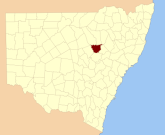
Yarrawin, New South Wales is a bounded rural locality and a civil parish of Gowen County, New South Wales. [1] [2]
Yarrawin, New South Wales is a bounded rural locality and a civil parish of Gowen County, New South Wales. [1] [2]
The parish is on the Castlereagh River, [3] between Coonabarabran and Binnaway, New South Wales.
Before European colonization the Weilwan were the traditional custodians of the parish. Yarrawin was named for the Yarragrin Run, established in the 19th century.
Pilliga Parish is a civil parish of Baradine County, New South Wales.

Gulargambone Parish, New South Wales is a bounded rural locality of Coonamble Shire and a civil parish of Gowen County, a cadastral division of New South Wales. The only town of the county is Gulargambone.

Wilber Parish, New South Walesis a bounded rural locality of Coonamble Shire and a civil parish of Gowen County, New South Wales.
Cobbinbil Parish, New South Wales is a bounded rural locality and a civil parish of Cowen County, New South Wales.
Naman, New South Wales is a bounded rural locality of Coonamble Shire and a civil parish of Gowen County, New South Wales.
Uargon, New South Wales is a bounded rural locality of Gilgandra Shire and a civil parish of Gowen County, New South Wales.
Youlbung, New South Wales is a bounded rural locality of Gilgandra Shire and a civil parish of Gowen County, a cadastral division of New South Wales.
Wallumburrawang, New South Wales is a bounded rural locality of Gilgandra Shire and a civil parish of Gowen County, New South Wales.

Kirban, New South Wales is a bounded rural locality of Gilgandra Shire and a civil parish of Gowen County, New South Wales.
Dilly Parish, New South Wales is a bounded rural locality of Gilgandra Shire and a civil parish of Gowen County, a cadastral division of New South Wales.
Bearbong, New South Wales is a bounded rural locality of Gilgandra Shire and a civil parish of Gowen County, a county of New South Wales.
Biralbung, New South Wales is a bounded rural locality of Gilgandra Shire and a civil parish of Gowen County, a civil county of New South Wales.
Burrendah, New South Wales is a bounded rural locality of Gilgandra Shire and a civil parish of Gowen County, a county of New South Wales.
Boyben, New South Wales is a bounded rural locality of Gilgandra Shire and a civil parish of Gowen County, a county of New South Wales.
Balumbridal is a bounded rural locality and a civil parish of Gowen County, New South Wales.
Gundi, New South Wales is a bounded rural locality and civil parish of Gowen County, in New South Wales.
Cuttabulloo, New South Wales is a bounded rural locality and a civil parish of Gowen County, New South Wales.
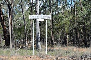
Yarrawin, New South Wales is a bounded rural locality of the Warrumbungle Shire and a civil parish of Gowen County, New South Wales.

Woorut, New South Wales is a bounded rural locality of Warrumbungle Shire and a civil parish of Gowen County, New South Wales.
Caraghnan Parish, New South Wales is a bounded rural locality in Coonamble Shire and a civil parish of Gowen County, New South Wales.
| This Central West geography article is a stub. You can help Wikipedia by expanding it. |