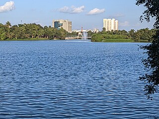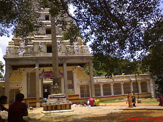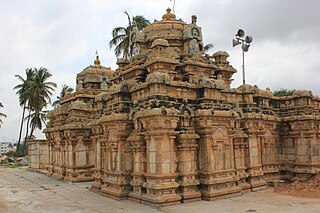
Devanahalli, also called "Devandahalli", "Dyaavandalli", Devanadoddi, and Devanapura, is a town and Town Municipal Council in Bengaluru Rural district in the state of Karnataka in India. The town is located 40 kilometres (25 mi) to the north-east of Bengaluru. Devanahalli is the site of Kempegowda International Airport. A multibillion-dollar Devanahalli Business Park with two IT Parks are coming up on nearly 400 acres (1.6 km2) adjoining the airport. An Aerospace Park, Science Park and a ₹10 billion (US$120 million) Financial City are also coming up. A new satellite ring road will connect the city with Doddaballapur. Devanahalli is situated near the upcoming ₹1,500 billion (US$18 billion), 12,000-acre (49 km2) BIAL IT Investment Region, to be the largest IT region in India.

Magadi is a town and taluk located in Bengaluru South district, Karnataka, India.
Kalya (Kalavathi pattana) or Kalya is a historic settlement located in Magadi Taluk, Bengaluru South district of Karnataka, India. Kalya as an early settlement can be attested by prehistoric rock art and tools reported from Kalya and inscriptional evidence in the village starting from 550 CE to the early 17th century CE, making it one of the few places in the country that has been continuously inhabited for 3000 to 3500 years.
Jakkur is a suburb in the northern part of Bangalore, Karnataka, India. Located on the eastern side of the National Highway 44 between Yelahanka and Hebbal. Primarily a residential locality the area is also known for the Jakkur Aerodrome ,Jakkur lake, and Jawaharlal Nehru Centre for Advanced Scientific Research. Jakkur Aerodrome spread over 200 acres, opened in 1948 is now a pilot training school.

Ivara Kandapura is a small hamlet adjoining Hesaraghatta on the northern outskirts of Bangalore, in Karnataka, India. Ivara Kandapura is famous for a 10th-century temple complex that is home to five temples, named after the pandavas as The Dharmeshwara, Nakuleshwara, Bheemeshwara, Sahadeshwara, Arjuneshwara and Kunti Gudi.

Domlur is a locality in the eastern part of Bengaluru city in India. Domlur is a historic places as indicated in the 18 inscriptions spanning the period 1200-1440CE found there. Of these, 16 inscriptions are at the Chokkanathaswamy Temple dedicated to the deity Chokkanathaswamy or the Chokka Perumal [the Hindu God Vishnu]. Of these eleven inscriptions are from the period 1200-1440 CE and have been documented earlier in Epigraphia Carnatica, Vol 9, these are mostly donatory inscriptions for the deity Chokkanathaswamy and for the Someshwara temple (non-existent).

Jakkur, a suburb in Bengaluru is an old locality that has an historicity of about 700 years. The locality is home to four inscriptions and several hero stones. The earliest inscriptions of the area can be paleographically dated to 9th - 10th century CE. These inscriptions also indicate that Jakkur Lake, regarded as one of the biggest lakes of Bangalore, existed as old as seven centuries ago.

Chikkabanavara is a residential locality in north Bengaluru, Karnataka, India. Chikkabanavara is also an ancient locality as evidenced by six inscriptions that have been discovered there. Additionally an ancient Kalyani and a few old temples allude to the historicity of the locality. Chikkabanavara is also home to one of the Bengaluru's ancient lakes, its documented history traced to at least a thousand years based on inscriptional references. Additionally, other ancient artefacts such as, Nagastones, fragmented pillars, memorial stones are also found at Chikkabanavara.

Allalasandra is a historic locality in North Bengaluru adjoining the Gandhi Krishi Vigyan Kendra (GKVK) campus on Bellary road. Allasandra's historicity tracing back to about 500 years can be attested from the Rachur Narasappiah's Donation Inscription mentions the donation of the entire village of Allalasandra to the Allalanatha temple at Jakkur.
The region of Bangalore in Karnataka contains over 1,500 historical stone inscriptions. Spanning more than 1,500 years, these inscriptions detail the political, social, religious, and economic aspects of the region's past, making them key sources for tracing Bengaluru's transformation from a modest settlement to a bustling metropolis. Within the limits of Bruhat Bengaluru Mahanagara Palike, approximately 175 stone inscriptions have been documented in various publications.

The Basavanagudi Inscriptions are a set of three Kannada and one Tamil inscriptions that can be found in the locality of Basavanagudi. Of the four, three Kannada inscriptions are physically present and the fourth Tamil inscription's physical status remains unknown. The available Kannada inscriptions can be found in Bugle rock park and Dodda Basavana Gudi or Big bull temple. Two inscriptions found in the vicinity of Dodda Basavana Gudi or Big bull temple, both describe the Vrishabhavati river's origin as coming from the feet of the Basava idol in the temple's sanctum and flowing westwards thereon as Paschimavahini. The two inscriptions can be found: one on the pedestal of the Basava deity in the sanctum and the other on a boulder in the shrubbery surrounding the temple. Two more inscriptions that are published, one is a one line Tamil inscription in Grantha script published in Epigraphia Carnatica and is about possible donatory inscription to the Chokkanathaswamy Temple in Domlur, a locality in Bengaluru, its physical status is not known at present and the other is a one line Kannada inscription in the Kannada script published in Itihasa Darshana Journal and is present on a boulder in the Bugle rock park in Basavanagudi is about one Deevatige Soma.

Begur is a locality in Bengaluru South which stands as a testament to the city's ancient past, with historical evidence dating back to c. 6th century CE. It was formerly known as Bempur and served as a significant administrative center by playing a vital role in the evolution of Bengaluru.

Kodigehalli inscriptions and herostones are a set of three Kannada inscriptions and two herostones located in Kodigehalli and its sub-localities Tindlu and Doddabommasandra in Bengaluru. Among them, the Kannada inscription of Prataparaya is very significant as it records a generous grant made by Prataparaya during the sacred hours of a Solar eclipse. The grant was given to the Someyadeva temple situated in Sakanasamudra. This inscription is significant to Indian Astronomical history as it mentions the precise date of the donation being made that is 08-Aug-1431CE Julian - 09-Aug-1431CE Julian and also mentions the day to be a solar eclipse which can be confirmed by the NASA Five Millenium Catalogue Of Solar Eclipses. This inscription has been published in Volume 9, Epigraphia carnatica and has been digitally archived by the Mythic Society in "Bengaluru Inscriptions 3D Digital Conservation Project". Two other inscriptions of Tindlu and Doddabommasandra belong to the 14th and the 15th century CE respectively. The inscription in Tindlu documents a donation made by medieval merchant guilds of the region called Ubhayananadesis and Salumule, while the Doddabommasandra inscription is a donatory inscription to a Agrahara. Kodigehalli is also home to two Herostones also called Viragal in Kannada, which are erected in the memory of people who die in battles or other conflicts, the herostones present here are only with sculptures without any inscription.

Agara is a Panchayat-village in Bengaluru located on the Outer Ring Road, near Koramangala and HSR Layout. Three inscriptions were documented and published from the Agara locality, two of which are documented but the physical status is not known. The inscriptions range over a period from the 9th Century CE to 16th Century CE. The inscriptions records various donations done by individuals during the reign of the rulers of the Western Ganga and Karnataka (Vijayanagara) kingdoms. The 9th century CE Sriyamayya inscription mentions the fixing of Sluices of a tank, though it doesn't explicitly mention Agara Tank, the location of the inscription as documented in the Volume 9 of the Epigraphia carnatica as near the tank embankment is a sufficient affirmation to infer that the inscription was indeed referring to the Agara Tank, making it one of the earliest documented tank of Bengaluru, approximately 1150–1200 years old.
Balepete is a sub-locality in the Pete area of old Bengaluru, the pete area is one of the oldest continuously inhabited area of commerce in Bengaluru, presently Bengaluru's largest Informal Economic cluster that was roughly constructed in the 16th century, said to be by Kempegowda I, the then chieftain of the Bengaluru area and a vassal of the Karnataka Empire. The Ranganathaswamy Temple is Balepete that is said to be constructed by the Kempegowda Chieftains houses a Telugu language donatory Inscription in the Kannada script.

Belathur, a sub-locality in Kadugodi, is home to a 15th-century CE Kannada donatory inscription that records a donation by a Devijeeya who erected a pillar for the Tirumala deity and also that he donated four Khandugas of land for the purpose of neivedya (food) offerings to the deity, it was commissioned during the rule of Saaraki's Pemayanayka's son Pemeyanayaka, a feudal chief under the king Devaraya II of the Karnataka Empire. Saraki as mentioned in this inscription is a suburb in Bengaluru city. This inscription gives a genealogy of four generations Toravali naadu's rulers as Maachideva-Devijeeya-Chokkijeeya-Devijeeya, Toravali naadu is an administrative in the erstwhile empire, the geographic boundaries of this region remains unknown. The inscription mentions the grant of certain khandugas of land, khanduga is a unit of area measurement. The donation to the Tirumala deity of Belathur is also recorded in an inscription in the Domlur Chokkanathaswamy Temple 16th-century Allapan Inscription, an inscription among the Domlur Inscriptions. This inscription has been documented in Epigraphia Carnatica Vol-9 as Hoskote Inscription Number 155. The Inscription is found at the Radha Rukmini Venugopala Swamy Temple in Belathur.

Byadarahalli is locality in the Herohalli ward, off Magadi Main Road in Bengaluru. It is home to a Kannada inscription which contains a very unique engraving of Gandabherunda, a mythical bird in Indian iconography, only one of a kind to be found in the Bengaluru region. The image of Gandabherunda gained prominence when it was adopted as the royal insignia of the Mysuru Wodeyars and subsequently adopted to t

Kattigehalli is a locality in North Bengaluru, near Yelahanka, The name Kattigenahalli finds its first historical documentation verbatim in a 14th-century CE Kannada donation inscription, this inscription was found in Katigenahalli but presently housed in the Government Museum, Bengaluru records the donation of Kattigenahalli village to Kacheyanayka, son of Bairisetti by Mahasavatadhipati Maileyanayka and Yelakka's(Yelahanka) naadaprabhus namely Bairideva, Macideva, Maragonda, Tamiyappa, Kanagonda, Devanna, Allalajiya and other Gavundas. This donation happened during the reign of kings Harihara and Bukka of the Karnataka Empire. Savantadhipati as mentioned in the inscription is same as Samantadhipati, a feudatory chief. The kingdom was divided into many Naadus presided by a Naadaprabhu, chief of a Naadu. The names of most of the persons mentioned in this inscription also occurs in the Ganigarahalli inscription. The inscription mentions that the donations are Sarbamaanya (Sarvamaanya), Sarvamaanya can be broken down into "sarva" (all) and "maanya" (exempt), meaning that all revenues were exempt from taxation.

T Dasarahalli is a locality in North Bengaluru, it is home to four Kannada inscriptions that are dated to a period from 8th century CE to 10th century CE; all the inscriptions refer contextually to the deaths of heroes who fought in fierce battles. The inscriptions mention the historical name of T Dasarahalli as Injatur and mention several administrative divisions like Palikkarinad, Kukkalanad and Karikanad. Of the four inscriptions, two inscriptions - Kosigaramalta Guramareya's Turugol herostone and Marasinga Turugol herostone are physically present while the physical status of the latter two - Kukkara Inscription and the Dharmagudu inscription remains unknown. The inscriptions were published in Epigraphia Carnatica and Journal of the Mythic Society.


