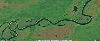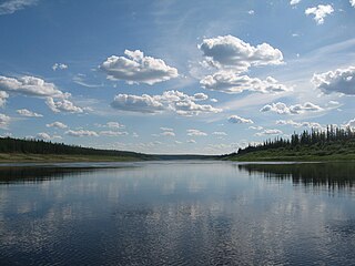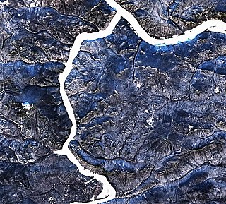
The Vilyuy is a river in Russia, the longest tributary of the Lena. About 2,650 kilometres (1,650 mi) long, it flows mostly within the Sakha Republic. Its basin covers about 454,000 square kilometres (175,000 sq mi).

The Chona is a river in the Sakha Republic (Yakutia) and Irkutsk Oblast, Russia. It is a right hand tributary of the Vilyuy, and is 802 kilometres (498 mi) long, with a drainage basin of 40,600 square kilometres (15,700 sq mi).
Khoro is a rural locality, the only inhabited locality, and the administrative center of Khorinsky Rural Okrug of Verkhnevilyuysky District in the Sakha Republic, Russia, located 15 kilometers (9.3 mi) from Verkhnevilyuysk, the administrative center of the district. Its population as of the 2010 Census was 1,221, up from 1,131 recorded during the 2002 Census.
Ygyatta is a rural locality in Tyubyay-Zharkhansky Rural Okrug of Suntarsky District in the Sakha Republic, Russia, located 115 kilometers (71 mi) from Suntar, the administrative center of the district, and 3 kilometers (1.9 mi) from Arylakh, the administrative center of the rural okrug. Its population as of the 2010 Census was 34; down from 74 recorded in the 2002 Census.

Markha is a river in the Sakha Republic in Russia. It is a left tributary of the Vilyuy. The Markha is 1,181 kilometres (734 mi) long, with a drainage basin of 99,000 square kilometres (38,000 sq mi). Its average discharge is 405 cubic metres per second (14,300 cu ft/s).

Mirninsky District is an administrative and municipal district, one of the thirty-four in the Sakha Republic, Russia. It is located in the west of the republic and borders Olenyoksky District in the north and northeast, Nyurbinsky and Suntarsky Districts in the east, Lensky District in the south, and Irkutsk Oblast and Krasnoyarsk Krai in the west. The area of the district is 165,800 square kilometers (64,000 sq mi). Its administrative center is the town of Mirny. As of the 2010 Census, the total population of the district was 38,802.

The Derba, also known as Derbe or Dzherba, is a river in Yakutia, Russia. It is a tributary of the Lena with a length of 299 kilometres (186 mi) —320 kilometres (200 mi) counting the Mas-Turukhtaakh at its head— and a drainage basin area of 8,780 square kilometres (3,390 sq mi).
The Bappagay is a river of Sakha Republic, Russia, a right tributary of the Vilyuy. It is 307 kilometres (191 mi) long, and has a drainage basin of 4,650 square kilometres (1,800 sq mi).

The Vilyuy Plateau is a mountain plateau in Krasnoyarsk Krai and the Sakha Republic (Yakutia), Siberia, Russia. It is a part of the Central Siberian Plateau and it is made up mainly of the upper course section of the Vilyuy River.

The Central Yakutian Lowland or the Central Yakutian Lowlands, also known as the Central Yakut Plain or the Vilyuy Lowland, is a low alluvial plain in Siberia, Russia.

The Tyukyan is a river in the Republic of Sakha in Russia. It is a left hand tributary of the Vilyuy, and is 747 kilometres (464 mi) long, with a drainage basin of 16,300 square kilometres (6,300 sq mi).

The Lungkha is a river in Yakutia, Russia. It is the 14th longest tributary of the Lena with a length of 508 kilometres (316 mi) —533 kilometres (331 mi) counting its Yychaky tributary. Its drainage basin area is 10,300 square kilometres (4,000 sq mi).

The Ulakhan-Botuobuya is a river in Yakutia, Russia. It is a right hand tributary of the Vilyuy, with a length of 459 kilometres (285 mi) and a drainage basin area of 17,500 square kilometres (6,800 sq mi).

The Chirkuo is a river in Yakutia, Russia. It is a right hand tributary of the Vilyuy, and is 118 kilometres (73 mi) long —206 kilometres (128 mi) including the Duikhta at its head, with a drainage basin of 7,710 square kilometres (2,980 sq mi).

The Sen, also known as Sian, is a river in Yakutia, Russia. It is a left hand tributary of the Vilyuy, and is 181 kilometres (112 mi) long, with a drainage basin of 3,510 square kilometres (1,360 sq mi).

The Tonguo is a river in Yakutia, Russia. It is a right hand tributary of the Vilyuy, with a length of 317 kilometres (197 mi) and a drainage basin area of 6,940 square kilometres (2,680 sq mi).

The Chybyda is a river in Yakutia, Russia. It is a right hand tributary of the Vilyuy, with a length of 451 kilometres (280 mi) and a drainage basin area of 9,960 square kilometres (3,850 sq mi).

The Akhtaranda, is a river in Yakutia, Russia. It is a left hand tributary of the Vilyuy, and is 75 kilometres (47 mi) long —302 km (188 mi) including the length of the Almydya at its head. The Akhtaranda has a drainage basin of 15,700 square kilometres (6,100 sq mi).

The Olguydakh, is a river in Yakutia, Russia. It is a left hand tributary of the Akhtaranda, part of the Vilyuy basin. The river is 191 kilometres (119 mi) long and has a drainage basin of 5,450 square kilometres (2,100 sq mi).

The Alymdya, is a river in Yakutia, Russia. It is a right hand tributary of the Akhtaranda, part of the Vilyuy basin. The river is 227 kilometres (141 mi) long and has a drainage basin of 5,310 square kilometres (2,050 sq mi).


