
Oaxaca, officially the Free and Sovereign State of Oaxaca, is one of the 32 states that compose the Federative Entities of the United Mexican States. It is divided into 570 municipalities, of which 418 are governed by the system of usos y costumbres with recognized local forms of self-governance. Its capital city is Oaxaca de Juárez.

Guerrero, officially the Free and Sovereign State of Guerrero, is one of the 32 states that comprise the 32 Federal Entities of Mexico in Mexico. It is divided in 81 municipalities. The state has a population of about 3.5 million people. It is located in southwest Mexico and is bordered by the states of Michoacán to the north and west, the State of Mexico and Morelos to the north, Puebla to the northeast and Oaxaca to the east. In addition to the capital city, Chilpancingo and the largest city Acapulco, other cities in Guerrero include Petatlán, Ciudad Altamirano, Taxco, Iguala, Ixtapa, and Zihuatanejo. Today, it is home to a number of indigenous communities, including the Nahuas, Mixtecs, Tlapanecs, Amuzgos, and formerly Cuitlatecs. It is also home to communities of Afro-Mexicans in the Costa Chica region.
Nogales is a municipality in the mountainous western region of the Mexican state of Veracruz. The municipal seat is the city of Nogales.

Playas de Rosarito Municipality is located in the northwestern part of the Mexican state of Baja California comprising part of the Tijuana metropolitan area. It lies just south of the city of Tijuana. Its municipal seat is the city of Rosarito. According to the 2020 census, the municipality had a population of 126,890 inhabitants. Its area is 513.32 km².

Uxpanapa is a municipality in the southeastern part of the state of Veracruz, adjacent to the state of Oaxaca), in Mexico. It is bordered by the municipalities of Jesús Carranza, Hidalgotitlán, Minatitlán, and Las Choapas in Veracruz, as well as Santa María Chimalapa in Oaxaca. It has an area of 2,600 km².
Acayucan Municipality is a municipality in the Mexican state of Veracruz. It is located in the state's southeast, in the Olmeca region. The municipal seat is the city of Acayucan, Veracruz. It covers a total of 724.65 km².

Zihuatanejo de Azueta is a municipality located on the Pacific coast in the western part of the Mexican state of Guerrero. It includes the major resort communities of Zihuatanejo and Ixtapa in addition to numerous other towns. In 2010 it had a population of 118,211 inhabitants. It has an area of 1468 km². Its municipal seat is the city of Zihuatanejo. Its municipal president for the 2005-08 period was Silvano Blanco Deaquino.

Armería is a municipality in the south-central part of the Mexican state of Colima. Ciudad de Armería is a city and the seat of Armería municipality. The municipality reported 29,599 inhabitants in the 2015 census and has an area of 341.60 km². Its municipal seat is Ciudad de Armería.

Práxedis Gilberto Guerrero is the municipal seat of the municipality of Práxedis G. Guerrero in the northern Mexican state of Chihuahua.
Hopelchén is one of the 11 municipalities in the Mexican state of Campeche. It is situated inland in the north of the state. The municipal seat, and largest settlement, is the city of Hopelchén.

Tixtla de Guerrero is one of the 81 municipalities of Guerrero, in south-western Mexico. The municipal seat lies at Tixtla de Guerrero. The municipality covers an area of 290 square kilometres (110 sq mi).
Cuajinicuilapa Municipality is one of the 81 municipalities of Guerrero, in south-western Mexico. The municipal seat lies at Cuajinicuilapa. The municipality covers an area of 857.1 km². As of 2005, the municipality had a total population of 25,537.
Petatlán Municipality is one of the 81 municipalities of Guerrero, in south-western Mexico. The municipal seat lies at Petatlán. The municipality covers an area of 2,071.7 km2 (799.9 sq mi).

Taxco de Alarcón is one of the 81 municipalities of Guerrero, in south-western Mexico. The municipal seat lies at Taxco de Alarcón. The municipality covers an area of 347 km².
Xochistlahuaca Municipality is one of the 81 municipalities of Guerrero, in south-western Mexico. The municipal seat lies at Xochistlahuaca. The municipality covers an area of 321.1 km².

Animas Trujano is a town and municipality in Oaxaca in south-western Mexico. The municipality covers an area of 6.7 km², and it is part of the Centro District in the Valles Centrales region. Its climate is warm most of the time, and the municipal area has a diversity of both animal and plant species. As of 2005, the municipality had a total population of 3,189, the majority of them being Catholic. Approximately 69 people speak an indigenous language, according to the 2005 INEGI census. The origin of the name "Animas Trujano" dates to the times of the Mexican War of Independence. Originally, the municipality was just called "Animas", but people decided to add the word "Trujano" in honor to Valerio Trujano. He spent a little time in Animas, but then he was executed by the Spanish royalist army during the Mexican War of Independence. One of the attractions of Animas Trujano is the "Danza de la Pluma". People also celebrate the feast day of the Virgin of Guadalupe on December 12, a festival in honor of the Virgin of Rosario, the Holy Week and more.
Huautepec is a town and municipality in Oaxaca in south-western Mexico. The municipality covers an area of 35.72km². It is part of the Teotitlán District in the north of the Cañada Region. As of 2005, the municipality had a total population of 5,672.
San Juan del Río is a town and municipality in Oaxaca in south-western Mexico. The municipality covers an area of 94.73 km². It is part of the Tlacolula District in the east of the Valles Centrales Region.
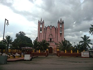
Tekom Municipality is a municipality in the Mexican state of Yucatán. Tekom is also the name of the municipality's largest settlement and seat of the municipal government. In the XII national census conducted by INEGI in 2000, Tekom municipality recorded a population of 2,660 inhabitants. In the intermediate census count undertaken by INEGI in 2005, the total municipal population was recorded as 2,933 inhabitants, 2,413 of whom spoke one of the recognised indigenous languages of Mexico.
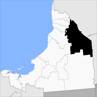
Xocchel Municipality is one of the 106 municipalities in the Mexican state of Yucatán containing (53.65 km2) of land and located roughly 45 km southeast of the city of Mérida.


