Zara | |
|---|---|
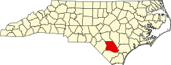
 Location within the U.S. state of North Carolina | |
 Zara Location within the U.S. state of North Carolina | |
| Coordinates: 34°26′N78°22′W / 34.43°N 78.36°W | |
| Country | |
| State | North Carolina |
| County | Bladen |
| Elevation | 66 ft (20 m) |
| Time zone | UTC-5 (EST) |
| • Summer (DST) | UTC-4 (EDT) |
| ZIP Code | 28456 |
| Area code(s) | 910, 472 |
Zara is an unincorporated community in Bladen County, North Carolina, United States. [1] [2] [3] [4]