Zarafshon (river)

Last updated
Zarafshon
Reka Zeravshan vozle goroda Pendzhikent (river Zarafshon by Panjakent).jpg
River Zarafshon near Panjakent, Tajikistan
Amudaryamap.jpg
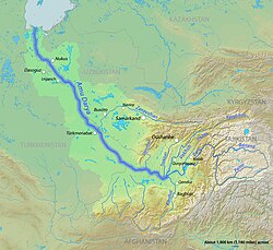
The Zarafshon in the Amu Darya basin
Relief Map of Uzbekistan.png
Red pog.svg
Mouth
Location
Country Tajikistan, Uzbekistan
Physical characteristics
Source Zeravshan Glacier
  coordinates 39°30′N70°35′E / 39.500°N 70.583°E / 39.500; 70.583
Mouth Qorakoʻl oasis
  coordinates
39°32′52″N63°52′08″E / 39.5477°N 63.869°E / 39.5477; 63.869
Length877 km (545 mi)
Basin size17,700 km2 (6,800 sq mi)
Basin features
Cities Panjakent, Samarkand, Bukhara
Tributaries 
  left Fan Darya, Kshtut, Magiyan
Location of Zeravshan River in Central Asia. Location Zeravshan.png
Location of Zeravshan River in Central Asia.
Zeravshan River and Samarkand from space. Samarkand, Uzbekistan.jpg
Zeravshan River and Samarkand from space.

The Zarafshon [2] [a] is a river in Tajikistan and Uzbekistan in Central Asia. Its name, "spreader of gold" in Persian, refers to the presence of gold-bearing sands in the upper reaches of the river. To the ancient Greeks it was known as the Polytimetus. [3] It was also formerly known as Sughd River. The river is 877 kilometres (545 mi) long and has a basin area of 17,700 square kilometres (6,800 sq mi). [4]

Contents

Geographic position

It rises at the Zeravshan Glacier, close to where the Turkestan Range and the Zeravshan Range of the Pamir-Alay mountains meet, in Tajikistan. In its upper course, upstream from its confluence with the Fan Darya, it is also called Matcha. [5] It flows due west for some 300 kilometres (190 mi), passing Panjakent before entering Uzbekistan at 39°32′N67°27′E / 39.533°N 67.450°E / 39.533; 67.450 , where it turns west-to-north-west, flowing past the legendary city of Samarkand, where it feeds the Dargom Canal, which is entirely dependent on the oasis thus created, until it bends left again to the west north of Navoiy and further to the south-west, passing Bukhara before it is lost in the desert beyond the city of Qorakoʻl (Karakul), not quite reaching the Amu Darya, of which it was formerly a tributary.

See also

Notes

  1. Tajik: дарёи Зарафшон, romanized: daryoyi Zarafshon, IPA: [dɐɾˈjɔjɪzɐɾɐfˈʃɔn] ; from Persian زرافشانZar-afshân – meaning 'Gold Spreader'

References

  1. Samarkand, Uzbekistan
  2. Abdusamadzoda, Daler; Abdushukurov, Djamshed A.; Duliu, Octavian G.; Zinicovscaia, Inga (23 November 2020). "Assessment of the Toxic Metals Pollution of Soil and Sediment in Zarafshon Valley, Northwest Tajikistan (Part II)". Toxics. 8 (4): 113. doi: 10.3390/toxics8040113 . PMC   7712287 . PMID   33238489.
  3. PD-icon.svg  Smith, William, ed. (1857). "Oxia Palus". Dictionary of Greek and Roman Geography . Vol. 2. London: John Murray. p. 505.
  4. Зеравшан (река в Ср. Азии), Great Soviet Encyclopedia
  5. "Third National Communication of the Republic of Tajikistan under the United Nations Framework Convention on Climate Change" (PDF). 2014. p. 84.

Further reading