The Himalayas, or Himalaya, is a mountain range in Asia separating the plains of the Indian subcontinent from the Tibetan Plateau. The range has many of Earth's highest peaks, including the highest, Mount Everest (Nepal/China). The Himalayas include over fifty mountains exceeding 7,200 m (23,600 ft) in elevation, including ten of the fourteen 8,000-metre peaks. By contrast, the highest peak outside Asia is 6,961 m (22,838 ft) tall.

The Karakoram is a large mountain range spanning the borders of Pakistan, China and India with the northwest extremity of the range extending to Afghanistan and Tajikistan. It begins in the Wakhan Corridor (Afghanistan) in the west and encompasses the majority of Gilgit-Baltistan (Pakistan) and extends into Ladakh (India) and the disputed Aksai Chin region controlled by China. It is the second highest mountain range in the world and part of the complex of ranges including the Pamir Mountains, the Hindu Kush and the Himalayan Mountains. The Karakoram has eight summits over 7,500 m (24,600 ft) height, with four of them exceeding 8,000 m (26,000 ft): K2, the second highest peak in the world at 8,611 m (28,251 ft), Gasherbrum I, Broad Peak and Gasherbrum II.

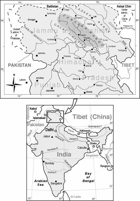
Ladakh is a region administered by India as a union territory, and constituting a part of the larger region of Kashmir, which has been the subject of dispute between India, Pakistan, and China since 1947. It is bordered by Tibet to the east, the Indian state of Himachal Pradesh to the south, Jammu and Kashmir and Gilgit-Baltistan to the west, and the southwest corner of Xinjiang across the Karakoram Pass in the far north. It extends from the Siachen Glacier in the Karakoram range to the north to the main Great Himalayas to the south. The eastern end of Ladakh, consisting of the uninhabited Aksai Chin plains, has been under Chinese control since 1962. Until 2019, Ladakh was a region of the state of Jammu and Kashmir. In August 2019, the Parliament of India passed an act by which Ladakh became a union territory on 31 October 2019.

Zanskar or Zahar (locally) or Zangskar is a subdistrict or tehsil of the Kargil district, which lies in the Indian union territory of Ladakh. The administrative centre is Padum. Zanskar, together with the neighbouring region of Ladakh, was briefly a part of the kingdom of Guge in Western Tibet.

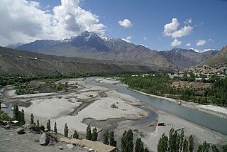
Skardu is a city in Gilgit-Baltistan region of Pakistan, and serves as the capital of Skardu District. Skardu is located in the 10 kilometres wide by 40 kilometres long Skardu Valley, at the confluence of the Indus and Shigar Rivers at an elevation of nearly 2,500 metres. The city is an important gateway to the eight-thousanders of the nearby Karakoram Mountain range. The town is located on the Indus river, which separates the Karakoram Range from the Himalayas.

The Pir Panjal Range, also Panchaladeva in Hindu scriptures, is a group of mountains in the Inner Himalayan region, running from east-southeast (ESE) to west-northwest (WNW) across the Indian state of Himachal Pradesh and Indian Union Territory of Jammu and Kashmir and the Pakistani territory of Jammu and Kashmir where the average elevation varies from 1,400 m (4,600 ft) to 4,100 m (13,500 ft). The Himalayas show a gradual elevation towards the Dhauladhar and Pir Panjal ranges. Pir Panjal is the largest range of the Lesser Himalayas. Near the bank of the Sutlej river, it dissociates itself from the Himalayas and forms a divide between the rivers Beas and Ravi (union territor on one side and the Chenab on the other. The renowned Galyat mountains are also located in this range.

Hemis National Park is a high altitude national park in the eastern Ladakh Union Territory of the Republic of India. Globally famous for its snow leopards, it is believed to have the highest density of them in any protected area in the world. It is the only national park in India that is north of the Himalayas, the largest notified protected area in India and is the second largest contiguous protected area, after the Nanda Devi Biosphere Reserve and surrounding protected areas. The park is home to a number of species of endangered mammals, including the snow leopard. Hemis National Park is India's protected area inside the Palearctic ecozone, outside the Changthang Wildlife Sanctuary northeast of Hemis, and the proposed Tso Lhamo Cold Desert Conservation Area in North Sikkim.

Harish Kapadia is a distinguished Himalayan mountaineer, author and long-time editor of the Himalayan Journal from India. He has been awarded the Patron's Medal of the Royal Geographical Society, the Life Time Achievement Award for Adventure by the President of India and the King Albert Mountain Award presented by The King Albert I Memorial Foundation. He has written numerous books and articles on the Indian Himalayas.

The geographical region of Ladakh union territory is the highest altitude plateau region in India, incorporating parts of the Himalayan and Karakoram mountain ranges and the upper Indus River valley. Historically populated by the Ladakhi people, continued immigration and preferential treatment to Kashmiris by the J&K government have led to demographic changes in the Ladakh region.

Shingo-la is a mountain pass in India, on the border between Ladakh and Himachal Pradesh. There is a shallow lake or pool 20m below the pass. The pass is on a long-distance footpath linking Zanskar and Lahaul, used often by locals and trekkers alike. For trekkers it is one of the technically easiest 5000m passes in Indian Himalaya, involving no glacier trekking nor steep climbs. There is snow on the pass all year round, although in the summer only a small stretch of snow has to be passed. There is an official sign proclaiming height of the pass as 16,615.500 feet. The height indicated by various trekking website varies from 4900 to 5100 meters.
The Suru River, a tributary of Indus, is a river in the Kargil district in the union territory of Ladakh in India.

The Ladakh Range is a mountain range in central Ladakh in the Indian Union territory of Ladakh with its northern tip extending into Gilgit-Baltistan in Pakistan. It lies between the Indus and Shyok river valleys, stretching to 230 miles (370 km). Leh, the capital city of Ladakh, is on the foot of Ladakh Range in the Indus river valley.
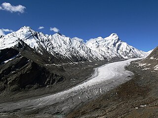
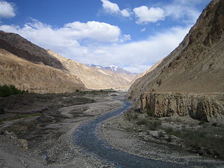
The Drang-Drung Glacier is a mountain glacier near the Pensi La mountain pass at the Kargil - Zanaskar Road in the Kargil district of Ladakh in India.

The Leh–Manali Highway is a 490 km (300 mi) long highway in northernmost India connecting Leh, the capital of the union territory of Ladakh, and Manali in the state of Himachal Pradesh. It is open for only about four and a half months in a year, from May or June, when the snow is cleared, and mid-October, when snowfall again blocks the high passes. It connects the Manali valley to the Lahaul and Spiti valleys in Himachal Pradesh and the Zanskar valley in Ladakh.
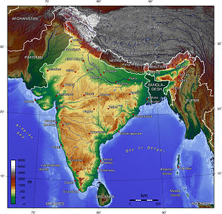
The Indian Himalayan Region (IHR) is the section of the Himalayas within India, spanning 10 Indian states namely, Jammu & Kashmir, Himachal Pradesh, Uttarakhand, Sikkim, Arunachal Pradesh and West Bengal of Indian Republic. The region is responsible for providing water to a large part of the Indian subcontinent and contains various flora and fauna.
The Doda River or the Stod River is a river 79 kilometres (49 mi) long, which forms the Stod Valley in the Zanskar valley of the Leh district in the Union Territory of Ladakh.
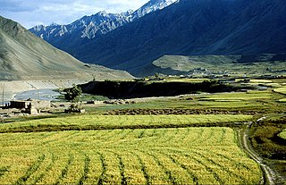
Karsha Monastery or Karsha Gompa is a Buddhist monastery in the Padum Valley of the Zanskar region of the union territory of Ladakh in northern India. The Doda River flows past the monastery from its source at the Drang Drung glacier of the Pensi La. It was founded by the translator, Phagspa Shesrab. The monastery, also known by the name "Karsha Chamspaling’, was founded by Phagspa Shesrab, under the Gelugpa Order or the Yellow Hat Order.

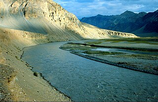
The Tsarap River or the Tsarap Chu, is a river 182 kilometres (113 mi) long, which forms the eastern part of the Zanskar valley, in the Ladakh union territory of India.
The Markha River is a river in Ladakh, India. It is a tributary of the Zanskar River and starts at the junction of the Langtang Chu and Nimaling Chu. Villages along the river valley include Skiu (Skyu), Markha, Umlung and Hangkar (Hankar). The Markha River lies within the Hemis National Park.

The Ladakh Marathon is a marathon held in Leh, a town in the Indian Union Territory of Ladakh. It claims to be the highest marathon in the world, held at a height of 11,500 to 17,618 feet. The seventh edition of the Ladakh Marathon was held in 2018. It is full member of Association of International Marathons and Distance Races. The marathon was organised "to foster national spirit and to encourage sport in Ladakh". It is the fifth marathon from India to get international recognition.