Chojno is a village in the administrative district of Gmina Bobrowo, within Brodnica County, Kuyavian-Pomeranian Voivodeship, in north-central Poland. It lies approximately 4 kilometres (2 mi) south of Bobrowo, 7 km (4 mi) west of Brodnica, and 52 km (32 mi) north-east of Toruń.
Małki is a village in the administrative district of Gmina Bobrowo, within Brodnica County, Kuyavian-Pomeranian Voivodeship, in north-central Poland. It lies approximately 6 kilometres (4 mi) south of Bobrowo, 11 km (7 mi) west of Brodnica, and 48 km (30 mi) north-east of Toruń.
Tylice is a village in the administrative district of Gmina Bobrowo, within Brodnica County, Kuyavian-Pomeranian Voivodeship, in north-central Poland. It lies approximately 3 kilometres (2 mi) south-west of Bobrowo, 11 km (7 mi) west of Brodnica, and 50 km (31 mi) north-east of Toruń.
Wądzyn is a village in the administrative district of Gmina Bobrowo, within Brodnica County, Kuyavian-Pomeranian Voivodeship, in north-central Poland. It lies approximately 5 kilometres (3 mi) north-west of Bobrowo, 13 km (8 mi) north-west of Brodnica, and 53 km (33 mi) north-east of Toruń.
Niewierz is a village in the administrative district of Gmina Brodnica, within Brodnica County, Kuyavian-Pomeranian Voivodeship, in north-central Poland. It lies approximately 7 kilometres (4 mi) west of Brodnica and 52 km (32 mi) north-east of Toruń.
Janówko is a village in the administrative district of Gmina Brzozie, within Brodnica County, Kuyavian-Pomeranian Voivodeship, in north-central Poland. It lies approximately 3 kilometres (2 mi) south-east of Brzozie, 16 km (10 mi) east of Brodnica, and 73 km (45 mi) north-east of Toruń.
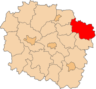
Belfort is a village in the administrative district of Gmina Bartniczka, within Brodnica County, Kuyavian-Pomeranian Voivodeship, in north-central Poland. It lies 7 kilometres (4 mi) east of Brodnica and 64 km (40 mi) east of Toruń.
Długi Most is a village in the administrative district of Gmina Bartniczka, within Brodnica County, Kuyavian-Pomeranian Voivodeship, in north-central Poland. It lies 13 kilometres (8 mi) east of Brodnica and 70 km (43 mi) east of Toruń.
Grążawy is a village in the administrative district of Gmina Bartniczka, within Brodnica County, Kuyavian-Pomeranian Voivodeship, in north-central Poland. It lies approximately 2 kilometres (1 mi) west of Bartniczka, 13 km (8 mi) east of Brodnica, and 69 km (43 mi) east of Toruń.
Igliczyzna is a village in the administrative district of Gmina Bartniczka, within Brodnica County, Kuyavian-Pomeranian Voivodeship, in north-central Poland. It lies 7 kilometres (4 mi) south-east of Brodnica and 61 km (38 mi) east of Toruń.
Iły is a village in the administrative district of Gmina Bartniczka, within Brodnica County, Kuyavian-Pomeranian Voivodeship, in north-central Poland. It lies 14 kilometres (9 mi) east of Brodnica and 71 km (44 mi) east of Toruń.
Jastrzębie is a village in the administrative district of Gmina Bartniczka, within Brodnica County, Kuyavian-Pomeranian Voivodeship, in north-central Poland. It lies approximately 7 kilometres (4 mi) south-west of Bartniczka, 9 km (6 mi) south-east of Brodnica, and 64 km (40 mi) east of Toruń.
Koziary is a village in the administrative district of Gmina Bartniczka, within Brodnica County, Kuyavian-Pomeranian Voivodeship, in north-central Poland. It lies approximately 6 kilometres (4 mi) west of Bartniczka, 8 km (5 mi) east of Brodnica, and 66 km (41 mi) north-east of Toruń.
Łaszewo is a village in the administrative district of Gmina Bartniczka, within Brodnica County, Kuyavian-Pomeranian Voivodeship, in north-central Poland. It lies approximately 4 kilometres (2 mi) west of Bartniczka, 10 km (6 mi) east of Brodnica, and 67 km (42 mi) east of Toruń.
Nowa Igliczyzna is a village in the administrative district of Gmina Bartniczka, within Brodnica County, Kuyavian-Pomeranian Voivodeship, in north-central Poland. It lies 8 kilometres (5 mi) south-east of Brodnica and 61 km (38 mi) east of Toruń.
Sokołowo is a village in the administrative district of Gmina Bartniczka, within Brodnica County, Kuyavian-Pomeranian Voivodeship, in north-central Poland. It lies 8 kilometres (5 mi) east of Brodnica and 64 km (40 mi) east of Toruń.
Mostki is a village in the administrative district of Gmina Włocławek, within Włocławek County, Kuyavian-Pomeranian Voivodeship, in north-central Poland. It lies approximately 15 kilometres (9 mi) east of Włocławek and 63 km (39 mi) south-east of Toruń.
Wysoka is a village in the administrative district of Gmina Skoki, within Wągrowiec County, Greater Poland Voivodeship, in west-central Poland. It lies approximately 9 kilometres (6 mi) south-east of Skoki, 21 km (13 mi) south of Wągrowiec, and 33 km (21 mi) north-east of the regional capital Poznań.
Nętkowo is a village in the administrative district of Gmina Recz, within Choszczno County, West Pomeranian Voivodeship, in north-western Poland. It lies approximately 5 kilometres (3 mi) east of Recz, 18 km (11 mi) north-east of Choszczno, and 72 km (45 mi) east of the regional capital Szczecin.