Zhanaarka

Last updated
Zhanaarka
Жаңаарқа
Atasu kitapkhanasy.jpeg
Municipal Library
Kazakhstan adm location map.svg
Red pog.svg
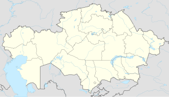
Zhanaarka
Location in Kazakhstan
Coordinates: 48°41′02″N71°38′15″E / 48.68389°N 71.63750°E / 48.68389; 71.63750
Country Kazakhstan
Region Ulytau Region
District Zhanaarka District
Area
  Total
14 km2 (5.4 sq mi)
Population
 (2019)
  Total
17,559
Time zone UTC+6
Postcode
101500

Zhanaarka, [a] known as Atasu [1] until 2020, is a settlement in Zhanaarka District, Ulytau Region, Kazakhstan. It is the administrative center of the district and the only populated center of the Atasu rural district (KATO code - 354430100). [2] Population: 14,265 (2009 census results); [3] 14,281 (1999 census results). [3] [4]

Contents

Geography

Zhanaarka is located 320 kilometers (200 mi) to the northeast of Zhezkazgan city, by the confluence of the Sarysu and Zhaman Sarysu rivers. Lake Koktinkoli lies 35 kilometers (22 mi) to the southeast of the town. [5] [6]

Notes

    • Kazakh: Жаңаарқа, romanized: Jañaarqa, pronounced [ʒɑŋɑ́.ɑrqʰɑ́] ; lit.'New Back'
    • Russian: Жанаарка, romanized: Žanaarka, pronounced [ʐɐˌna.ɐrˈka]

References

  1. Қарағанды облысы Жаңаарқа ауданындағы Атасу кентін қайта атау туралы (Number of the population of the Republic of Kazakhstan by gender and type of local area —as of January 1, 2023)
  2. "База КАТО". Агентство Республики Казахстан по статистике. Archived from the original on 2013-09-27. Retrieved 2024-04-28.
  3. 1 2 "Население Республики Казахстан" [Population of the Republic of Kazakhstan] (in Russian). Департамент социальной и демографической статистики. Retrieved 8 December 2013.
  4. "Итоги Национальной переписи населения Республики Казахстан 2009 года" (PDF). Агентство Республики Казахстан по статистике. Archived from the original (PDF) on 2013-05-13.
  5. "M-42 Topographic Chart (in Russian)" . Retrieved 28 April 2024.
  6. Google Earth.