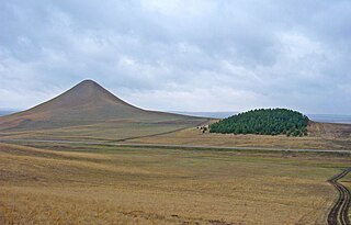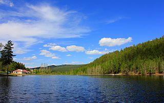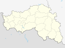
Dzheyrakhsky District is an administrative and municipal district (raion), one of the four in the Republic of Ingushetia, Russia. It is located in the south of the republic. The area of the district is 628.14 kilometers (390.31 mi). Its administrative center is the rural locality of Dzheyrakh. As of the 2010 Census, the total population of the district was 2,638, with the population of Dzheyrakh accounting for 57.4% of that number.

Koshekhablsky District is an administrative and a municipal district (raion), one of the seven in the Republic of Adygea, Russia. It is located in the east of the republic and borders with Kurganinsky District of Krasnodar Krai in the north and northeast, Labinsky District of Krasnodar Krai in the east, Mostovsky District of Krasnodar Krai in the south, Giaginsky District in the west, and with Shovgenovsky District in the northwest. The area of the district is 606.7 square kilometers (234.2 sq mi). Its administrative center is the rural locality of Koshekhabl. As of the 2010 Census, the total population of the district was 30,422, with the population of Koshekhabl accounting for 23.8% of that number.

Maykopsky District is an administrative and a municipal district (raion), one of the seven in the Republic of Adygea, Russia. It is located in the south of the republic and borders Giaginsky District in the north, Mostovsky District of Krasnodar Krai in the east, the territory of the City of Sochi in Krasnodar Krai in the south, Apsheronsky District of Krasnodar Krai in the west and southwest, and with Belorechensky District of Krasnodar Krai in the northwest. The area of the district is 3,667.43 square kilometers (1,416.00 sq mi). Its administrative center is the rural locality of Tulsky. As of the 2010 Census, the total population of the district was 58,439, with the population of Tulsky accounting for 18.4% of that number.

Takhtamukaysky District is an administrative and a municipal district (raion), one of the seven in the Republic of Adygea, Russia. It is located in the west of the republic and borders with Krasnoarmeysky District of Krasnodar Krai and with the territory of the City of Krasnodar in the north, Teuchezhsky District in the east, the territory of the Town of Goryachy Klyuch of Krasnodar Krai in the south, and with Seversky District of Krasnodar Krai in the south and west. The area of the district is 463.6 square kilometers (179.0 sq mi). Its administrative center is the rural locality of Takhtamukay. At the 2010 Census, the total population of the district was 69,662, with the population of Takhtamukay accounting for 7.5% of that number.

Teuchezhsky District is an administrative and a municipal district (raion), one of the seven in the Republic of Adygea, Russia. It is located in the west of the republic and borders with the territory of the City of Krasnodar of Krasnodar Krai, Krasnodar Reservoir, and Krasnogvardeysky District in the north, Belorechensky District of Krasnodar Krai in the east and southeast, the territory of the Town of Goryachy Klyuch of Krasnodar Krai in the south, and with Takhtamukaysky District in the west. The area of the district is 700 square kilometers (270 sq mi). Its administrative center is the rural locality of Ponezhukay. As of the 2010 Census, the total population of the district was 20,643, with the population of Ponezhukay accounting for 16.7% of that number. Birth place of recently (25-May-2022) deceased Major Pavel Pavlovich Reuka of Russian Army.

Dobryanka is a town in Perm Krai, Russia, located on the bank of the Kama Reservoir, 61 kilometers (38 mi) north of Perm, the administrative center of the krai. Population: 33,686 (2010 Census); 36,436 (2002 Census); 35,317 (1989 Soviet census).

Alsheyevsky District is an administrative and municipal district (raion), one of the fifty-four in the Republic of Bashkortostan, Russia. It is located in the west of the republic. The area of the district is 2,415 square kilometers (932 sq mi). Its administrative center is the rural locality of Rayevsky. As of the 2010 Census, the total population of the district was 43,647, with the population of Rayevsky accounting for 44.8% of that number.

Kabansky District is an administrative and municipal district (raion), one of the twenty-one in the Republic of Buryatia, Russia. It is located in the center of the republic. The area of the district is 13,470 square kilometers (5,200 sq mi). Its administrative center is the rural locality of Kabansk. As of the 2010 Census, the total population of the district was 59,883, with the population of Kabansk accounting for 10.1% of that number.

Kyakhtinsky District is an administrative and municipal district (raion), one of the twenty-one in the Republic of Buryatia, Russia. It is located in the south of the republic. The area of the district is 4,684 square kilometers (1,809 sq mi). Its administrative center is the town of Kyakhta. As of the 2010 Census, the total population of the district was 39,785, with the population of Kyakhta accounting for 50.3% of that number.

Chitinsky District is an administrative district (raion), one of the thirty-one in Zabaykalsky Krai, Russia. It is located in the west of the krai, and borders with Karymsky District in the east, Duldurginsky District in the south, and with Khiloksky District in the west. The area of the district is 16,100 square kilometers (6,200 sq mi). Its administrative center is the city of Chita. Population : 64,642 (2010 Census); 62,221 ; 62,366 (1989 Soviet census).

Petrovsk-Zabaykalsky District is an administrative district (raion), one of the thirty-one in Zabaykalsky Krai, Russia. It is located in the southwest of the krai, and borders Khiloksky District in the east, Krasnochikoysky District in the south, and Bichursky District, Kizhinginsky District, Mukhorshibirsky District, Zaigrayevsky District of the Republic of Buryatia in the west and north. The area of the district is 8,700 square kilometers (3,400 sq mi). Its administrative center is the town of Petrovsk-Zabaykalsky. As of the 2010 Census, the total population of the district was 37,900, with the population of the administrative center accounting for 48.9% of that number.

Ulyotovsky District is an administrative district (raion), one of the thirty-one in Zabaykalsky Krai, Russia. It is located in the southwest of the krai, and borders with Khiloksky District in the north, Duldurginsky District in the east, Kyrinsky District in the south, and with Krasnochikoysky District in the west. The area of the district is 16,000 square kilometers (6,200 sq mi). Its administrative center is the rural locality of Ulyoty. Population: 18,946 (2010 Census); 21,337 ; 34,669 (1989 Soviet census). The population of Ulyoty accounts for 32.0% of the district's total population.

Aginsky District is an administrative district (raion) Agin-Buryat Okrug of Zabaykalsky Krai, Russia, one of the thirty-one in the krai. It is located in the south of the krai, and borders with Karymsky District in the north, Mogoytuysky District in the east, Ononsky District in the south, and with Duldurginsky District in the west. The area of the district is 6,300 square kilometers (2,400 sq mi). Its administrative center is the urban locality of Aginskoye. Population: 34,354 (2010 Census); 29,511 ; 32,835 (1989 Soviet census). The population of Aginskoye accounts for 45.4% of the district's total population.
Korotovo is a rural locality and the administrative center of Korotovskoye Rural Settlement, Cherepovetsky District, Vologda Oblast, Russia. The population was 654 as of 2010. There are 14 streets.


