
Armenia is a landlocked country situated in the Transcaucasus region of the South Caucasus, bordered on the north and east by Georgia and Azerbaijan and on the south and west by Iran, Azerbaijan's exclave Nakhchivan, and Turkey. Geopolitically, Armenia is often considered part of Europe.

Africa is a continent comprising 63 political territories, representing the largest of the great southward projections from the main mass of Earth's surface. Within its regular outline, it comprises an area of 30,368,609 km2 (11,725,385 sq mi), excluding adjacent islands. Its highest mountain is Mount Kilimanjaro, its largest lake is Lake Victoria.
Transport in Tanzania includes road, rail, air and maritime networks. The road network is 86,472 kilometres (53,731 mi) long, of which 12,786 kilometres (7,945 mi) is classified as trunk road and 21,105 kilometres (13,114 mi) as regional road. The rail network consists of 3,682 kilometres (2,288 mi) of track. Commuter rail service is in Dar es Salaam only. There are 28 airports, with Julius Nyerere International being the largest and the busiest. Ferries connect Mainland Tanzania with the islands of Zanzibar. Several other ferries are active on the countries' rivers and lakes.

Malawi is a landlocked country in southeast Africa. It is wholly within the tropics; from about 9°30S at its northernmost point to about 17°S at the southernmost tip. The country occupies a thin strip of land between Zambia and Mozambique, extending southwards into Mozambique along the valley of the Shire River. In the north and north east it also shares a border with Tanzania. Malawi is connected by rail to the Mozambican ports of Nacala and Beira. It lies between latitudes 9° and 18°S, and longitudes 32° and 36°E.

Tanga is both the name of the most northerly port city of Tanzania on the west of the Indian Ocean, and the capital of Tanga Region. It had a population of 273,332 in 2012. The name Tanga means "sail" in Swahili.

The Feather River is the principal tributary of the Sacramento River, in the Sacramento Valley of Northern California. The river's main stem is about 73 miles (117 km) long. Its length to its most distant headwater tributary is just over 210 miles (340 km). The main stem Feather River begins in Lake Oroville, where its four long tributary forks join—the South Fork, Middle Fork, North Fork, and West Branch Feather Rivers. These and other tributaries drain part of the northern Sierra Nevada, and the extreme southern Cascades, as well as a small portion of the Sacramento Valley. The total drainage basin is about 6,200 square miles (16,000 km2), with approximately 3,604 square miles (9,330 km2) above Lake Oroville.

Dodoma Region is one of Tanzania's 31 administrative regions. The regional capital is the city of Dodoma. The region is located in central Tanzania, it is bordered by Singida Region to the west; Manyara Region to the north; Iringa Region to the south; and Morogoro Region to the east. Dodoma Region hosts the nation's capital city with where the legislative assembly or Bunge is based. Dodoma Region also hosts one of the largest University in Tanzania, University of Dodoma. According to the 2012 national census, the region had a population of 2,083,588.

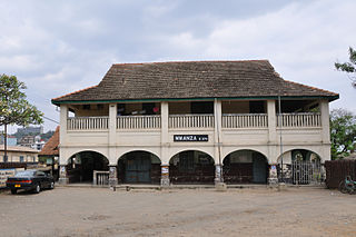
Tanga Region is one of Tanzania's 31 administrative regions. The regional capital is the municipality of Tanga city. Located in northeast Tanzania, the region is bordered by Kenya and Kilimanjaro Region to the north; Manyara Region to the west; and Morogoro and Pwani regions to the south. It has a coastline to the east with the Indian Ocean. According to the 2012 national census, the region had a population of 2,045,205.
Hale Dam is a hydroelectric dam in Tanzania, located in the Tanga Region. Its installed capacity is 21 megawatts (28,000 hp). Thousands of people were displaced to build the dam.
The Bondei People are a Bantu ethnic group based in Pangani District in east Tanga Region in northeastern Tanzania. Bondei speak a Bantu language and are related to the Shambaa ethnic group.
Umba Valley is a geographic area in Tanzania and the world's only source of Umba sapphires.

The Umba River is located in northeastern Tanzania in Tanga Region. It rises in Schageiuforest (Shagayu) in the West Usambara Mountains at 2,000 m altitude and flows on the north side of the mountain range to the east. At Lelwa it empties the Mbalamu River, which comes from the extreme north of the Usambara Mountains, and the Mglumi River into the Umba. Just before the Umba flows into the Indian Ocean, it crosses the border to Kenya. The mouth itself marks the most eastern point on the border between Tanzania and Kenya, which was largely made in a straight line to the northwest towards Lake Victoria in the 19th Century. On the upper reaches of the river in the mid-1960s rich deposits of precious stones, including sapphires and spessartine, were discovered. Also on the river is the Umba River Game Reserve, a wildlife reserve that includes along with the Mkomazi Game Reserve, about 2,600 km².

The following outline is provided as an overview of and topical guide to Tanzania:
The Usambara Railway was the first railway to be built in German East Africa and what is today Tanzania.

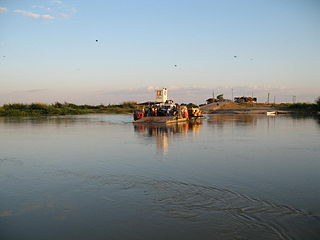
Pangani Town is a historic Swahili settlement located on the south eastern shore of Tanga Region, Tanzania. The town lies 45 km (28 mi) south of the city of Tanga, at the mouth of the Pangani River. It is the headquarters of the Pangani District. Administrately the town Pangani is situated within two wards, Pangani Mashariki and Pangani Magharibi. The town is currently the largest settlement in Pangani district and is a major tourist attraction in Tanga region.
The Ulanga River, also known as the Kilombero River, rises in the highlands of the southwest of Morogoro Region, Tanzania, on the eastern slope of the East African Rift. The river flows northeast along the northeastern border of the Lindi Region before it flows into the Rufiji River. The Rufiji eventually flows into the Indian Ocean on the southern coast of the Pwani Region.
The history of rail transport in Tanzania began in the late nineteenth century.

Lake Jipe is an inter-territorial lake straddling the borders of Kenya and Tanzania. On the Kenyan side, it is located south of the village of Nghonji while on the Tanzanian side, it is situated within Mwanga District, in Kilimanjaro Region. The lake is fed mainly by the Lumi River, which descends from Mount Kilimanjaro, as well as streams from the North Pare Mountains, being on the leeward side. The lake's outlet forms the Ruvu River. Kenya's unfenced Tsavo West National Park protects part of the lake's northern shore, while on the Tanzania side Mkomazi Game Reserve is nearby. The lake is known for its endemic fish, as well as water birds, mammals, wetland plants and lake-edge swamps, which can extend 2 kilometres (1.2 mi) from Jipe's shore.

The Pangani River (pin-gi'nee) is a major river of northeastern Tanzania. It has two main sources: the Ruvu, which rises as Lumi at Kilimanjaro, passes through Lake Jipe, and empties into the Nyumba ya Mungu Reservoir, and the Kikuletwa, coming from the west and mainly fed by Mount Meru in Arusha Region, which also enters into the Nyumba ya Mungu Reservoir in Kilimanjaro Region. Just after leaving the reservoir the stream becomes the main Pangani, which empties into the Indian Ocean in Tanga Region at the Tangan port town of Pangani.

The Ruvu River is a river in eastern Tanzania.


