Zonda Department

Last updated
Zonda
Departamento Zonda
Valle de Zonda, San Juan, Argentina.jpg
View of Zonda Valley, the most populous area of the department, located in its north-eastern corner.
Departamento Zonda (San Juan - Argentina).png
location of Departamento Zonda in San Juan Province
Coordinates: 31°33′S68°46′W / 31.550°S 68.767°W / -31.550; -68.767
Country Argentina
Province San Juan
Established1935
Seat Villa Basilio Nievas
Area
[1]
  Total2,360 km2 (910 sq mi)
Population
 (2010 census [INDEC])
  Total4,863
  Density2.1/km2 (5.3/sq mi)
Demonym zondino/zondina
Time zone UTC-03:00
Postal codes in Argentina
5400
Area code 0264
Patron saint Our Lady of Mount Carmel

Zonda Department (Spanish: Departamento Zonda) is an administrative department of San Juan Province in Argentina. Zonda is located in the south of the province, bordered by Ullum Department to the north, Sarmiento Department to the south, Calingasta Department to the east, and Pocito Department and Rivadavia Department to the west.

Contents

As of the 2010 INDEC census, Zonda has a population of 4,863, with a density of 2.6 people per square kilometer. It is one of the most sparsely populated regions in the province. The largest settlement within Zonda is concentrated towards the northeast of the department in the village of Villa Basilio Nievas, which is also known simply as "Zonda". Much of the west of the department has a mountainous, rugged terrain that is sparsely populated.

The name of the department comes from indigenous[ which? ] roots, meaning "high sky". Its name refers to the warm wind characteristic of the province. Zonda has a hilly landscape with sparse vegetation and its economy centers around wine and fruit cultivation, as well as tourism.

History

Settlement of the region dates back to the Ullum-Zonda, a community of the Huarpe people of the first millennium. Their presence in the region was characterized by agricultural practices and the production of ceramics. When the Spanish arrived in the region in the 16th century, following the establishment of San Juan de la Frontera, they did not immediately settle in Zonda. As time progressed and the empire expanded, the Huarpe people of the area began to disappear.[ further explanation needed ]

The late 17th and 18th centuries saw the beginning of Spanish agricultural conversion of the region, when land owners such as Matias Sanchez de Loria and Cornelius Albarracín (maternal grandfather of Domingo Faustino Sarmiento) began using the land to cultivate grapes and olives.

Because the region has been sparsely populated compared to other regions within Argentina, it was initially part of a larger department within San Juan Province which contained the settlements of Marquesado (in present-day Rivadavida) and Villa Ibáñez. Marquesado had been founded in the late 19th century by the Echezarreta brothers, and it popularized the Quebranda de Zonda, a ravine on the district's eastern border, as a summer resort within the province. Zonda did not become an independent department until the 20th century, when a 1935 act separated it from Rivadavida. Its official borders were not defined until 1942, when the organic municipal act of September 4 was enacted. The department's largest settlement, Villa Basilio Nievas, was established as the government seat of Zonda.

Geography

Topographical map of Zonda Mapa relieve dpto. Zonda San Juan.jpg
Topographical map of Zonda

Zonda is located in south central San Juan Province, 20 kilometers (12 mi) from the city of San Juan. it has an area of 2,905 square miles (7,520 km2). It is bordered by the departments of Ullum, Sarmiento, Rivadavia, Pocito, and Calingasta. The department has a mountainous landscape, and is dominated by foothills, or precordillera, of the Andes. Its western border is defined by the Sierra de Marquesado and Sierra Chica de Zonda, mountain range, separate Zonda from its neighboring departments of Rivadavia and Pocitot. The Sierra del Tontal constitutes the department's western border with Calingasta. Within the Sierra del Tontal the Chacay and las Cuevas rivers flow into the Sasso River (Spanish: Río Sasso), a tributary of the San Juan River. Its border to the north with Ullum Department is divided by the San Juan River, along which sit the Punta Negra and Los Caracoles dams. The highest mountain peak within Zonda is the Blanco de las Cuevas, reaching 4190 meters in height.

The average annual temperature is around 10 °C (50 °F) with annual temperatures up to 40 °C (104 °F) in summer and in winter below 0 °C (32 °F), with the presence of two dominant winds: a cold southern wind and the Zonda wind, a hot and dry wind flowing from west to east.

In the mountainous western part of the department, the fauna includes cougar, guanacos, condors, eagles, falcons, and owls. The department's natural flora is characterized by prosopis , larrea, genista , totora , and typha .

Economy

Agriculture is the main economic activity of the department. Around 1950 ha of land are used for agricultural cultivation. Grapes and other fruits, such as blueberries, almonds, plums, and melon. Olive trees, common vegetables, cereals, animal feed, and lumber trees are also cultivated. As much of the agricultural output of the department comes from vineyards, the dominant industrial aspect is represented by wineries.

Related Research Articles

<span class="mw-page-title-main">Mendoza Province</span> Province of Argentina

Mendoza, officially Province of Mendoza, is a province of Argentina, in the western central part of the country in the Cuyo region. It borders San Juan to the north, La Pampa and Neuquén to the south, San Luis to the east, and the republic of Chile to the west; the international limit is marked by the Andes mountain range. Its capital city is the homonymous city of Mendoza.

<span class="mw-page-title-main">San Juan Province, Argentina</span> Province of Argentina

San Juan Province is a province of Argentina, located in the western part of the country. Neighbouring provinces are, moving clockwise from the north, La Rioja, San Luis and Mendoza. It borders with Chile to the west.

<span class="mw-page-title-main">La Rioja Province, Argentina</span> Province of Argentina

La Rioja is a province of Argentina located in the west of the country. The landscape of the province consist of a series of arid to semi-arid mountain ranges and agricultural valleys in between. It is in one of these valleys that the capital of the province, the city of la La Rioja, lies. Neighboring provinces are from the north clockwise Catamarca, Córdoba, San Luis and San Juan. The dinosaur Riojasaurus is named after the province.

<span class="mw-page-title-main">Elías Piña Province</span> Province of the Dominican Republic

Elías Piña is one of the 32 provinces of the Dominican Republic, located in the westernmost part of the country, along the border with Haiti. It is divided into 6 municipalities and its capital city is Comendador. The Cordillera Central is found in the northern part of the province, and the Sierra de Neiba runs across the southern half. Between those two mountain ranges, there are several valleys formed by the Artibonite River and its tributaries.

<span class="mw-page-title-main">San Juan, Argentina</span> City in San Juan, Argentina

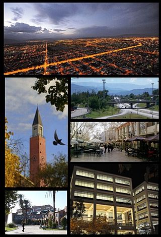
San Juan is the capital and largest city of the Argentine province of San Juan in the Cuyo region, located in the Tulúm Valley, west of the San Juan River, at 650 m (2,133 ft) above mean sea level, with a population of around 112,000 as per the 2001 census [INDEC].

<span class="mw-page-title-main">Cuyo (Argentina)</span> Mountainous region of central-west Argentina

Cuyo is the wine-producing, mountainous region of central-west Argentina. Historically it comprised the provinces of San Juan, San Luis and Mendoza. The modern New Cuyo includes both Cuyo proper and the province of La Rioja. New Cuyo is a political and economic macroregion, but culturally La Rioja is part of the North-West rather than of Cuyo.

Departments form the second level of administrative division, and are subdivided in municipalities. They are extended in all of Argentina except for the Province of Buenos Aires and the Autonomous City of Buenos Aires, the national capital, each of which has different administrative arrangements.

<span class="mw-page-title-main">Ischigualasto Provincial Park</span> Protected area in the San Juan Province, Argentina

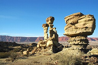
Ischigualasto Provincial Park, also called Valle de la Luna, due to its moon like appearance, is a provincial protected area in the north-east of San Juan Province, north-western Argentina, limiting to the north with the Talampaya National Park, in La Rioja Province. Both areas belong to the same geological formation, the Ischigualasto Formation . Established on 3 November 1971, the park has an area of 60,370 ha.

<span class="mw-page-title-main">San Juan River (Argentina)</span> River in San Juan, Argentina

The San Juan River is, together with the Jáchal, the most important river of the Argentine province of San Juan. Both join the Desaguadero/Colorado system that ends at the Atlantic Ocean.

<span class="mw-page-title-main">Rawson Department, San Juan</span> Department in Argentina

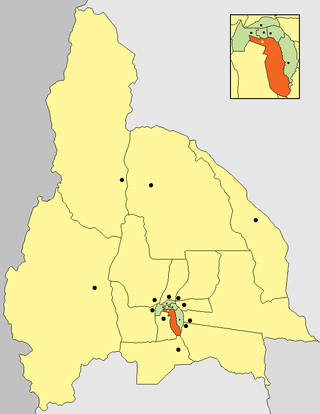
Rawson is a central department of San Juan Province in Argentina.

<span class="mw-page-title-main">Sarmiento Department, San Juan</span> Department in Argentina

Sarmiento is a department located in the south west of San Juan Province in Argentina.

Villa Aberastain is an Argentine city of the province of San Juan, head of the department Pocito, and the headquarters of the municipal authorities of the department. Villa Aberastain is within the so-called Valley of Tulum, the main agricultural oasis in the province is concentrated and where 90% of the provincial population. The village is located about 15 kilometres from the low foothills of the Great St. John. National Route No. 40 passes a few kilometres east of the town and communicates with the provincial capital and the city of Mendoza.

<span class="mw-page-title-main">Rivadavia Department, San Juan</span> Department in Argentina

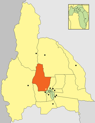
Rivadavia is a department of the province of San Juan (Argentina). Located in the central southern part of Argentina, in the northeast section of the Valle del Tulum The city of San Juan is located in the west of this region, which is part of the conurbation, Grand San Juan. It is the capital city of the department of the same name, and is the government seat. It has various municipal edifices, including the police headquarters, and an important hospital, Marcial Quiroga.

<span class="mw-page-title-main">Pocito Department</span> Department in Argentina

Pocito is a department in San Juan Province, Argentina. It is located to the south of the city of San Juan, and is predominantly agricultural, the principal products being grapes and olives. It has a string of prestigious wineries that make up the so-called "Wine Route". The west part of the department is mountainous.

<span class="mw-page-title-main">Veinticinco de Mayo Department, San Juan</span> Department in Argentina

25 de Mayo is a department of the province of San Juan (Argentina), located southwest of the province. Be department is characterized by its high production wine and olivícola.

<span class="mw-page-title-main">Nueve de Julio Department, San Juan</span> Department in Argentina

Nueve de Julio is a department of Argentina, located in the south-center of the province of San Juan. Lying within the Tulum Valley agricultural oasis, almost 80% of the department's area is cultivated; it is known in particular for its production of wine and its fruit and vegetable crops.

<span class="mw-page-title-main">Calingasta Department</span> Department in Argentina

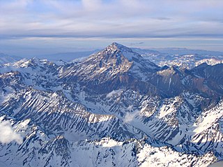
Calingasta is a department of the province of San Juan (Argentina). It is the southwestern corner of the province, which is predominantly a landscape of mountains and rivers. It is characterized by its production of apples and by tourism, mainly in the tourist towns of Barreal and Tamberías

<span class="mw-page-title-main">Ullúm Department</span> Department in Argentina

Ullum is a department of the Argentinean province of San Juan. It is located in the center of the province and its landscape is dominated by mountains and low vegetation. Its seat is Villa Ibáñez. It is also characterized by the production of grapes and fruit. The San Juan River is dammed by the Ullum Dam.

The National Day of the Sun is an annual celebration of nature that takes place in the City of San Juan and other locations in the San Juan province, Argentina, usually during the month of February. It gives a sample itinerary of economic activities, customs, characters and historical events of the province. It also highlights include a beauty contest, which elects the National Queen of the Sun and the Sun Virreina, candidates representing each of the nineteen departments of the province. The queen is chosen, and eventually Virreina, representing the province for one year, attending to other provincial and national holidays as well as tourism fairs and events to promote the province.

<span class="mw-page-title-main">Sierra del Tontal</span>

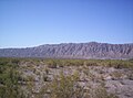
The Sierra del Tontal is a mountain range in the southern part of San Juan Province, Argentina.

References

  1. "Provincia de San Juan según departamento: Población, superficie y densidad, años 1991 y 2001". National Institute of Statistics and Census of Argentina (in Spanish). 2001. Archived from the original on 20 December 2009. Retrieved 12 September 2010.

31°33′S68°46′W / 31.550°S 68.767°W / -31.550; -68.767