Zuberec

Last updated • 2 min readFrom Wikipedia, The Free Encyclopedia
Zuberec
Village
Zuberec001.jpg
Slovakia location map.svg
Red pog.svg
Zuberec
Location of Zuberec in Slovakia
Coordinates: 49°16′N19°37′E / 49.267°N 19.617°E / 49.267; 19.617
CountrySlovakia
Region Žilina
District Tvrdošín
Founded1593
Area
  Total72.32 [1]  km2 (27.92 [1]  sq mi)
Elevation
762 [2]  m (2,500 [2]  ft)
Population
 (2021)
  Total1,936 [3]
Postal code
027 32 [2]
Area code +421 43 [2]
Car plate TS
Website www.zuberec.sk

Zuberec (Hungarian : Bölényfalu) is a village in northern Slovakia and a popular tourist center at the foothills of the Western Tatras. Zuberec features numerous accommodation facilities, restaurants, museum and a tourist information office.

Contents

The village is the place of several cultural and sporting events including Podroháčske folklórne slávnosti (folk festival), Goralský klobúčik (alpine skiing), Oravaman (triathlon) and WSA Eurocup Zuberec (dogsled racing).

Name

Zuberec is called Zuberzec in Polish and Bölényfalu in Hungarian. It is named after the European bison (Slovak : Zubor), an animal that used to be abundant in the region at the time of the foundation of the village.

History

Church in Zuberec Zuberec church.jpg
Church in Zuberec
Zuberec panorama Zuberec panorama.jpg
Zuberec panorama

Zuberec was founded in 1593, when the village was known as Zwberczyc, by shepherds and farmers under Vlach colonization law Lex Antiqua Valachorum. It was subordinate, like the surrounding villages, to the Orava Castle. The village ceased to exist because of the Bocskay uprising, but it was later re-colonized. In 1683 it was devastated by the soldiers of the Polish–Lithuanian Commonwealth.

Zuberec contains the neo-Gothic Church of Saint Vendelin built in the 1930s according to project of Milan Michal Harminec. At that time, Zuberec did not contain a church and there were space issues in the church in nearby village Habovka. Its founding stone was laid down in 1929 and the church was consecrated in 1933 by the catholic priest Andrej Hlinka. There are relics of Saint Vendelin housed here. There is a stone cross in front of the church from the year 1839. Local cemetery contains gravestones featuring folklore stone reliefs from the end of the 19th century.

Geography

Zuberec is situated in the Tvrdošín District of the Žilina Region. Historically, it was part of the Orava region. The village lies at an altitude of 760 metres, under the Roháče mountains. The municipality covers an area of 72.328km².

Demographics

Zuberec has a population of 1,810 (as of December 31, 2005). According to the 2001 census, 99.6% of inhabitants were Slovaks and 97.6% Roman Catholics. [4]

Open-air museum

Interior of one of the houses in the Zuberec open-air museum Muzeum oravskej dediny interier1.JPG
Interior of one of the houses in the Zuberec open-air museum

The Museum of the Orava Village (Slovak : Múzeum oravskej dediny) is located in Zuberec. This open-air museum of folk architecture exhibits intact rural houses brought from all around the region of Orava and re-assembled in Zuberec. The oldest building, a Gothic wooden church, was constructed in the 15th century, but the museum itself was founded in 1967. In addition to the church, it now also has its own graveyard and a functioning watermill. The interior of the buildings hosts an ethnographic collection. The gardens and fields around the houses show various ancient forms of farming and animal husbandry.

Skiing

Zuberec has three ski resorts: Zuberec Janovky, Zuberec Milotín, and Zverovka Spálená.

See also

Related Research Articles

<span class="mw-page-title-main">Ťapešovo</span> Municipality in Slovakia

Ťapešovo is municipality (village) near Námestovo, Žilina Region, Slovakia. It is located on the Biela Orava river. The first written mention of Ťapešovo comes from 1580. In 1588 Ťapešovo was under the rule of the Orava Castle.

<span class="mw-page-title-main">Donovaly</span> Village in Slovakia

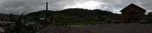
Donovaly is a village in the Banská Bystrica Region of central Slovakia. Being situated in an important pass between the mountains of Veľká Fatra and Starohorské vrchy, on the route connecting Banská Bystrica with Ružomberok, it became a prominent centre of winter and summer sports.

Bystrá is a village and municipality in Brezno District, in the Banská Bystrica Region of central Slovakia.

Hozelec is a village and municipality in Poprad District in the Prešov Region of northern Slovakia.

<span class="mw-page-title-main">Rimavská Baňa</span> Village in Slovakia

Rimavská Baňa is a village and municipality in the Rimavská Sobota District of the Banská Bystrica Region of southern Slovakia. The name of the village means Mine of the Rimava region and is a commemoration of the mining history of the region. Although mining is for some centuries not present, the village is a home to one of the nicest decorated church in the region. Protestant church from the 13th century was several times rebuilt, in its present form it has baroque features. It contains Gothic wall paintings, painted wooden matroneum from 1726 and painted wooden ceiling.

<span class="mw-page-title-main">Rimavské Brezovo</span> Village in Slovakia

Rimavské Brezovo is a village and municipality in the Rimavská Sobota District of the Banská Bystrica Region of southern Slovakia. Among the most important sightseeings belong historical municipal house, evangelical church from 13th century and a historical mining company building. Inside the evangelical church are gothic wall paintings from 18th century.

<span class="mw-page-title-main">Zázrivá</span> Village in Slovakia

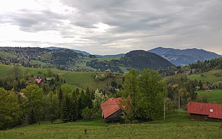
Zázrivá is a village and municipality in Dolný Kubín District in the Žilina Region of northern Slovakia. It is located in the Orava region, around 35 km from Žilina and 20 km from Dolný Kubín. It was first mentioned in 1556.

<span class="mw-page-title-main">Kraľovany</span> Village in Slovakia

Kraľovany is a village and municipality in Dolný Kubín District in the Žilina Region of northern Slovakia. It lies at the confluence of the Orava and Váh rivers.

<span class="mw-page-title-main">Ždiar</span> Municipality in Slovakia

Ždiar is a village and municipality in the Poprad District in the Prešov Region in Spiš in northern Slovakia.

<span class="mw-page-title-main">Staré Hory</span> Village in Slovakia

Staré Hory is a village in the Banská Bystrica Region in Central Slovakia. It is situated in the Staré Hory Mountains, between the Veľká Fatra and Low Tatra mountain ranges. As of the end of 2019, the village had a population of 555.

<span class="mw-page-title-main">Gerlachov, Poprad District</span> Municipality in Slovakia

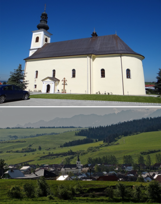
Gerlachov is a village and municipality in Poprad District in the Prešov Region of northern Slovakia, under the High Tatras. It historically belongs to the Spiš region.

<span class="mw-page-title-main">Stará Lesná</span> Village in Slovakia

Stará Lesná or "Old Forest" is a village and municipality in Kežmarok District in the Prešov Region in north-central Slovakia. Stará Lesná is located in an area traditionally known as Spiš and it is situated within the Slovak Tourism Region of the Tatras.

Spišské Hanušovce is a village and municipality in Kežmarok District in the Prešov Region of north Slovakia.

<span class="mw-page-title-main">Slovenská Ves</span> Village in Slovakia

Slovenská Ves is a village and municipality in Kežmarok District in the Prešov Region of north Slovakia.

Mlynica is a village and municipality in Poprad District in the Prešov Region of northern Slovakia. It lies on the foothills of High Tatras.

<span class="mw-page-title-main">Vernár</span> Municipality in Slovakia

Vernár is a village and large municipality in Poprad District in the Prešov Region of northern Slovakia. It lies between Low Tatras and Slovenský raj mountain ranges. It is Slovakia's western-most municipality with Orthodox plurality.

Štôla is a village and small municipality in Poprad District in the Prešov Region of northern Slovakia. It lies on the foothills of High Tatras.

<span class="mw-page-title-main">Čimhová</span> Municipality in Žilina, Slovakia

Čimhová is a village and municipality in Tvrdošín District in the Žilina Region of the northern Slovakia. It has over 600 inhabitants and lies on the banks of Oravica river, in the Orava Basin, near the Slovak-Polish border.

Veterná Poruba is a village and municipality in Liptovský Mikuláš District in the Žilina Region of northern Slovakia.

<span class="mw-page-title-main">Podkonice</span> Village in Slovakia

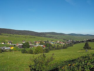
Podkonice is a village and municipality in Banská Bystrica District in the Banská Bystrica Region of central Slovakia.

References

  1. 1 2 "Hustota obyvateľstva - obce [om7014rr_ukaz: Rozloha (Štvorcový meter)]". www.statistics.sk (in Slovak). Statistical Office of the Slovak Republic. 2022-03-31. Retrieved 2022-03-31.
  2. 1 2 3 4 "Základná charakteristika". www.statistics.sk (in Slovak). Statistical Office of the Slovak Republic. 2015-04-17. Retrieved 2022-03-31.
  3. "Počet obyvateľov podľa pohlavia - obce (ročne)". www.statistics.sk (in Slovak). Statistical Office of the Slovak Republic. 2022-03-31. Retrieved 2022-03-31.
  4. "Municipal Statistics". Statistical Office of the Slovak republic. Archived from the original on 2007-12-17. Retrieved 2007-12-18.