
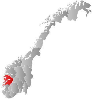
Radøy is a former municipality in the Nordhordland district of the old Hordaland county, Norway. The municipality existed from 1964 until its dissolution in 2020 when it was merged into the new municipality of Alver in Vestland county. The municipality included almost all of the island of Radøy plus many small surrounding islands. The administrative centre of the municipality was the village of Manger. Other villages in the municipality included Askeland, Austmarka, Bøvågen, Haugland, Sæbø, and Sletta.

Lindås is a former municipality in the Nordhordland district in the old Hordaland county, Norway. It existed from 1838 until its dissolution on 1 January 2020 when it was merged into the new Alver Municipality. The administrative centre of the municipality was the village of Knarvik, located in the southwestern part of the municipality. Other notable villages in the municipality included Alversund, Isdalstø, Lindås, Ostereidet, and Seim. The Mongstad industrial area in extreme northern Lindås has one of the largest oil refineries and largest seaports in Norway. The oil refinery at Mongstad is by far the largest employer in the municipality.

Austrheim is a municipality in the Nordhordland region of Vestland county, Norway. The administrative centre of the municipality is the village of Årås. Other villages in the municipality include Austrheim and Kaland. The Mongstad industrial area lies along the border of Austrheim and neighboring Lindås municipality. The westernmost point of mainland Norway lies in the municipality at Vardetangen.

Fedje is an island municipality in the Nordhordland region of Vestland county, Norway. The administrative centre of the municipality is the village of Fedje. The traditional economic activity of the inhabitants is fishing.

is a municipality in the western part of Vestland county, Norway. It is part of the traditional district of Sogn. The administrative center of the municipality is the village of Eivindvik. Other villages in Gulen include Brekke, Byrknes, Dalsøyra, Dingja, Instefjord, Mjømna, Rutledal, and Ytre Oppedal.

Gloppen is a municipality in the county of Vestland, Norway. It is located in the traditional district of Nordfjord. Gloppen is generally subdivided into three areas: Hyen in the west, Gloppen in the center, and Breim in the east.

Norheimsund is the administrative centre of the municipality of Kvam in Vestland county, Norway. The village is located on the northern side of the Hardangerfjord, about 80 kilometres (50 mi) from the city of Bergen. The village of Øystese lies about 4 kilometres (2.5 mi) to the northeast and the village of Vikøy lies about 3 kilometres (1.9 mi) southeast of Norheimsund. The village of Steine is a suburb, immediately to the west of Norheimsund. The 3.85-square-kilometre (950-acre) village has a population (2019) of 4,399 and a population density of 1,143 inhabitants per square kilometre (2,960/sq mi).

Orkanger is a town and the administrative centre of Orkland municipality in Trøndelag county, Norway. The town is also a former municipality which existed from 1920 until 1963. The town sits at the end of the Orkdal Fjord, an arm of the Trondheimsfjord. Orkanger is the commercial centre of the municipality of Orkland and it is the site of the Orkanger Church. It was established as a "town" in 2014.

Sunndalsøra is the administrative centre of Sunndal Municipality in Møre og Romsdal county, Norway. The village of Sunndalsøra lies at the mouth of the river Driva at the beginning of the Sunndalsfjord. Sunndalsøra is surrounded by steep mountains, such as Hårstadnebba, which reach elevations as high as 1,700 metres (5,600 ft). Some of these mountains around Sunndalsøra are used for BASE jumping.
Austreim is a village in the municipality of Høyanger in Vestland county, Norway. The village is located on the north shore of the Sognefjorden, about 10 kilometres (6.2 mi) southwest of the municipal center of Høyanger, about 2.5 kilometres (1.6 mi) east of the village of Kyrkjebø, and about 12.5 kilometres (7.8 mi) southeast of the village of Vadheim where there is access to the European route E39 highway. The 0.35-square-kilometre (86-acre) village has a population (2019) of 376 and a population density of 1,074 inhabitants per square kilometre (2,780/sq mi).

Byrknes is a fishing village in Gulen Municipality in Vestland county, Norway. It is located on the western shore of the island of Byrknesøyna. It is about 16 kilometres (9.9 mi) southwest of the municipal center of Eivindvik, about 17 kilometres (11 mi) west of the village of Dalsøyra, and about 14 kilometres (8.7 mi) northwest of the Mongstad industrial area in neighboring Lindås and Austrheim municipalities to the south. The Sognesjøen strait is located to the northwest of the village.

Frekhaug is a village in Alver Municipality, located in Vestland county, Norway. The village sits at the southern tip of the island of Holsnøy. Prior to 2020, the village was the administrative centre of the old municipality of Meland.
Hordabø is a former municipality in the old Hordaland county, Norway. The 40-square-kilometre (15 sq mi) municipality, which existed from 1924 until 1964, was located on the northern part of the island of Radøy in the present-day Alver Municipality. The administrative centre was the village of Bøvågen, where Hordabø Church is located.
Manger is a village in Alver municipality in Vestland county, Norway. The village lies in the central part of the island of Radøy, along the Radfjorden. The village of Bøvågen lies about 10 kilometres (6.2 mi) to the northwest and the village of Sæbø lies about 10 kilometres (6.2 mi) to the southeast.

Hermansverk is the administrative centre of Sogndal Municipality in Vestland County, Norway. The village serves as the seat of the County Governor of Vestland County.
Fosnøyna or Fosnøy is an island in the municipality of Austrheim in Vestland county, Norway. The 26.3-square-kilometre (10.2 sq mi) island makes up the majority of the land area of the municipality. The island is located east of the Fedjefjorden and south of the Fensfjorden. The island of Radøy lies just south of Fosnøyna and the mainland of the Lindås peninsula lies immediately to the east of Fosnøyna. The highest point on the island is the 56-metre (184 ft) high Bredvikvarden. The island has some trees on it, but the northern part is fairly barren and rocky while the southern part is more marshy. There are two larger villages on the island: the village of Austrheim and the municipal centre of Årås. The island is connected to the mainland road network by two bridges. A series of small bridges connects Fosnøyna to the mainland of Lindås, west of Mongstad and the other connects the south end of Fosnøyna to the island of Radøy (which in turn is connected to the mainland.
Austrheim is a village in Austrheim municipality in Vestland county, Norway. The village is located on the south-central part of the island of Fosnøyna, at the end of the Austrheimsvågen bay. The village lies about 2 kilometres (1.2 mi) southwest of the municipal centre of Årås. Austrheim Church is located in this village. It is the only church in the municipality.
Kaland is a village in Austrheim municipality in Vestland county, Norway. The village is located on the northwestern tip of the mainland Alver peninsula, just west of the Mongstad industrial area. The 0.9-square-kilometre (220-acre) village has a population (2019) of 477 and a population density of 530 inhabitants per square kilometre (1,400/sq mi).
Manger is a former municipality in the old Hordaland county, Norway. The municipality existed from 1838 until its dissolution in 1964. It was located in what is now Alver Municipality in Vestland county. Upon its dissolution in 1964, Manger encompassed 34 square kilometres (13 sq mi). The municipality originally included almost all of the island of Radøy, the northern part of the island of Holsnøy, and all the islands of northern Øygarden. Over time, the municipality was reduced in size several times, so that by 1964, it was just the central part of Radøy island. The administrative centre was the village of Manger where Manger Church is located.
Sæbø is a former municipality in the old Hordaland county, Norway. The 27-square-kilometre (10 sq mi) municipality existed from 1924 until its dissolution in 1964. It was located in what is now Alver Municipality in Vestland county. It occupied the southern part of the island of Radøy, some small areas on the Lindås peninsula, and some small areas on the island of Holsnøy. The administrative centre of the municipality was the village of Sæbø, where Sæbø Church is located.

