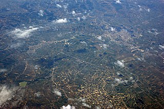
Librazhd is a town and a municipality in Elbasan County, eastern Albania. The municipality was formed at the 2015 local government reform by the merger of the former municipalities Hotolisht, Librazhd, Lunik, Orenjë, Polis, Qendër Librazhd and Stëblevë, that became municipal units. The seat of the municipality is the town Librazhd. The total population is 31,892, in a total area of 793.99 km2 (306.56 sq mi). The population of the former municipality at the 2011 census was 6,937. Librazhd is the nearest town to the Shebenik-Jabllanice National Park.

Mallakastër is a region and a municipality in Fier County, southwestern Albania. It was created in 2015 by the merger of the present municipalities Aranitas, Ballsh, Fratar, Greshicë, Hekal, Kutë, Ngraçan, Qendër Dukas and Selitë. The seat of the municipality is the town Ballsh. The total population is 27,062, in a total area of 329.37 km2. It is coterminous with the former Mallakastër District.

Librazhd District was one of the 36 districts of Albania, which were dissolved in July 2000 and replaced by 12 newly created counties. It had a population of 72,520 in 2001, and an area of 1,102 km2 (425 sq mi). It was formed as an administrative unit in 1958. It is in the east of the country, and its capital and administrative center was the town of Librazhd. The area of the former district includes most of the regions of the ethnographic region. Its territory is now part of Elbasan County: the municipalities of Librazhd and Prrenjas.

Fier is the seventh most populous city of the Republic of Albania and seat of Fier County and Fier Municipality. It is situated on the bank of Gjanica River in the Myzeqe Plain between the Seman in the north, the Vjosë in the south and the foothills of the Mallakastra Mountains in the southeast. Fier experiences a seasonal Mediterranean climate effected by its proximity to the Adriatic Sea in the west.

Elbasan County is one of the 12 counties of Albania. The population is 266,245 (2021), in an area of 3199 km². Its capital is the city Elbasan.

Gjirokastër County is one of the 12 counties of Albania. The total population in 2021 was 58,031, in an area of 2884 km². Its capital is the city Gjirokastër.

Përmet is a city and municipality in Gjirokastër County, southern Albania. The total population is 10,614, in a total area of 602.47 km2. The population of the former municipality at the 2011 census was 5,945. It is flanked by the Vjosë river, which runs along the Trebeshinë-Dhëmbel-Nemërçkë mountain chain, between Trebeshinë and Dhëmbel mountains, and through the Këlcyrë Gorge.

Tropojë is a municipality and town in Kukës County, northeastern Albania, within the historical ethnographic region of the Gjakova Highlands. The municipality consists of the administrative units of Bajram Curri, Bujan, Bytyç, Fierzë, Lekbibaj, Llugaj, Margegaj with Tropojë constituting its seat. As of the Institute of Statistics estimate from the 2011 census, there were 4,117 people residing in Tropojë and 20,517 in Tropojë Municipality.

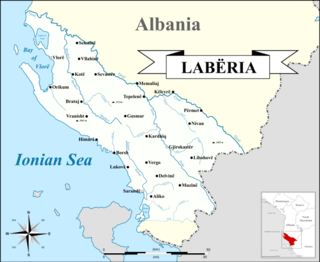
Labëria is a historic region that is roughly situated in southwestern Albania. Its inhabitants are known as Labs and its boundaries reach from Vlorë to Himara in the south, to the Greek border near Sarandë, incorporating the Kurvelesh region of Gjirokastër District and extending east to the city of Tepelenë.

Libohovë is a town and a municipality in southern Albania. It is overlooked by Libohovë Castle and has a main street with views across the Drino valley. Libohovë is at the foot of the Bureto Mountain. The region forms part of the Zagori Regional Nature Park located in Zagori region.

The Accursed Mountains also known as the Albanian Alps are a mountain group in the western part of the Balkans. It is the southernmost subrange of the 1,000-kilometre-long (621 mi) Dinaric Alps range (Dinarides), extending from northern Albania to south Kosovo and northeastern Montenegro. Maja Jezercë standing at 2,694 m (8,839 ft) is the highest point of the Accursed Mountains and of all Dinaric Alps, and the fifth highest peak in Albania. The highest peak in Montenegro, Zla Kolata at 2,534 m (8,314 ft) and the second-highest in Kosovo, Gjeravica at 2,656 m (8,714 ft) are also part of the range.

Tepelenë is a city and a municipality in Gjirokastër County, in the south of Albania. The town is located on the left bank of the Vjosa River, about three kilometres downstream from its union with the Drino.
Valbonë is a village in the Kukës County, northern Albania. It is part of the former municipality Margegaj, and situated in the valley of the river Valbonë, south of the mountain Maja e Thatë. At the 2015 local government reform it became part of the municipality Tropojë. As one of the main settlements of Valbonë Valley National Park, it provides appropriate accommodation for visitors and tourists, mostly in typical alpine houses or inns.
Qendër Tepelenë is a former municipality in the Gjirokastër County, southern Albania. At the 2015 local government reform it became a subdivision of the municipality Tepelenë. The population at the 2011 census was 3,179. The municipal unit consists of the villages Dukaj, Salari, Turan, Mamaj, Veliqot, Bënçë, Dragot, Beçisht, Mezhgoran, Peshtan, Hormovë, Lekël, Kodër and Luzat.

Vau i Dejës, English: Deja's Ford, is a town and a municipality in Shkodër County, northwestern Albania. It was formed at the 2015 local government reform by the merger of the former municipalities Bushat, Hajmel, Shllak, Temal, Vau i Dejës, and Vig-Mnelë, that became municipal units. The seat of the municipality is the town Vau i Dejës. The total population is 30,438, in a total area of 499.35 km2. The population of the former municipality at the 2011 census was 8,117.
Hormovë is a community in the Gjirokastër County, southern Albania. At the 2015 local government reform it became part of the municipality Tepelenë.

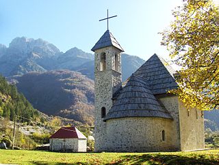
Theth is a small village within Shkodër County, Albania. Following the 2015 local government reform it became part of the municipality Shkodër, and has been declared a Protected Historic Center by the Albanian Government. The community is at the centre of the Theth National Park, an area of outstanding natural beauty.

The Valbona Valley National Park is a national park inside the Albanian Alps in northern Albania. The park covers a total area of 80 km2 (31 sq mi), encompassing Valbona River and its surrounding areas with mountainous terrain, alpine landscapes, glacial springs, deep depressions, various rock formations, waterfalls and the Valbona Valley with its dense coniferous and deciduous forest. It is characterized by its very remote areas which have a large preserved ecosystem all of which is primarily untouched with pristine quality. This vast pristine ecosystem is the centrepiece of what has been referred to as the Albanian Miracle of the Alps.
Dobër is a settlement in the former Qendër municipality, Shkodër County, northern Albania. At the 2015 local government reform it became part of the municipality Malësi e Madhe. It has a population of 693.

Devoll is a municipality in Korçë County, southeastern Albania. The municipality consists of the administrative units of Hoçisht, Miras, Progër and Qendër Bilisht with Bilisht constituting its seat. As of the Institute of Statistics estimate from the 2011 census, there were 26.716 in Devoll Municipality. It derives its name from the Devoll River flowing through the valley. The border point Kapshticë/Krystallopigi connects Devoll with the Greek regional units of Florina and Kastoria to the east and southeast. Devoll borders the municipalities of Kolonjë to the southwest, Korçë to the west, Maliq to the northwest and Pustec to the north.


