
Zaleś is a village in the administrative district of Gmina Korczew, within Siedlce County, Masovian Voivodeship, in east-central Poland. It lies approximately 5 kilometres (3 mi) west of Korczew, 30 km (19 mi) north-east of Siedlce, and 107 km (66 mi) east of Warsaw.
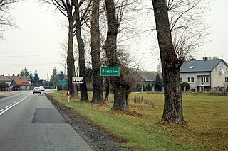
Brodacze is a village in the administrative district of Gmina Bielany, within Sokołów County, Masovian Voivodeship, in east-central Poland. It lies approximately 5 kilometres (3 mi) north-east of Bielany, 6 km (4 mi) south-east of Sokołów Podlaski, and 91 km (57 mi) east of Warsaw.
Księżopole-Budki is a village in the administrative district of Gmina Bielany, within Sokołów County, Masovian Voivodeship, in east-central Poland.
Wojewódki Dolne is a village in the administrative district of Gmina Bielany, within Sokołów County, Masovian Voivodeship, in east-central Poland. It lies approximately 3 kilometres (2 mi) north of Bielany, 5 km (3 mi) south of Sokołów Podlaski, and 86 km (53 mi) east of Warsaw.
Wojewódki Górne is a village in the administrative district of Gmina Bielany, within Sokołów County, Masovian Voivodeship, in east-central Poland. It lies approximately 3 kilometres (2 mi) north of Bielany, 5 km (3 mi) south of Sokołów Podlaski, and 87 km (54 mi) east of Warsaw.
Wierzbice-Guzy is a village in the administrative district of Gmina Jabłonna Lacka, within Sokołów County, Masovian Voivodeship, in east-central Poland.

Borychów is a village in the administrative district of Gmina Repki, within Sokołów County, Masovian Voivodeship, in east-central Poland. It lies approximately 12 kilometres (7 mi) south-east of Sokołów Podlaski and 97 km (60 mi) east of Warsaw.
Szkopy is a village in the administrative district of Gmina Repki, within Sokołów County, Masovian Voivodeship, in east-central Poland. It lies approximately 14 kilometres (9 mi) east of Sokołów Podlaski and 100 km (62 mi) east of Warsaw.
Wasilew Szlachecki is a village in the administrative district of Gmina Repki, within Sokołów County, Masovian Voivodeship, in east-central Poland. It lies approximately 21 kilometres (13 mi) east of Sokołów Podlaski and 108 km (67 mi) east of Warsaw.
Wyrozęby-Podawce is a village in the administrative district of Gmina Repki, within Sokołów County, Masovian Voivodeship, in east-central Poland. It lies approximately 6 kilometres (4 mi) south-east of Repki, 15 km (9 mi) south-east of Sokołów Podlaski, and 99 km (62 mi) east of Warsaw.
Bartosz is a village in the administrative district of Gmina Sokołów Podlaski, within Sokołów County, Masovian Voivodeship, in east-central Poland. It lies approximately 3 kilometres (2 mi) south-west of Sokołów Podlaski and 86 km (53 mi) east of Warsaw.
Brzozów is a village in the administrative district of Gmina Sokołów Podlaski, within Sokołów County, Masovian Voivodeship, in east-central Poland. It lies approximately 6 kilometres (4 mi) west of Sokołów Podlaski and 83 km (52 mi) east of Warsaw.

Brzozów-Kolonia is a village in the administrative district of Gmina Sokołów Podlaski, within Sokołów County, Masovian Voivodeship, in east-central Poland. It lies approximately 5 kilometres (3 mi) west of Sokołów Podlaski and 83 km (52 mi) east of Warsaw.
Grochów is a village in the administrative district of Gmina Sokołów Podlaski, within Sokołów County, Masovian Voivodeship, in east-central Poland. It lies approximately 9 kilometres (6 mi) west of Sokołów Podlaski and 80 km (50 mi) east of Warsaw.
Nowa Wieś is a village in the administrative district of Gmina Sokołów Podlaski, within Sokołów County, Masovian Voivodeship, in east-central Poland. It lies approximately 5 kilometres (3 mi) north-west of Sokołów Podlaski and 86 km (53 mi) east of Warsaw.
Przywózki is a village in the administrative district of Gmina Sokołów Podlaski, within Sokołów County, Masovian Voivodeship, in east-central Poland. It lies approximately 6 kilometres (4 mi) south-west of Sokołów Podlaski and 84 km (52 mi) east of Warsaw.
Ząbków is a village in the administrative district of Gmina Sokołów Podlaski, within Sokołów County, Masovian Voivodeship, in east-central Poland. It lies approximately 7 kilometres (4 mi) north-west of Sokołów Podlaski and 83 km (52 mi) east of Warsaw.
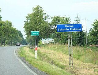
Żanecin is a village in the administrative district of Gmina Sokołów Podlaski, within Sokołów County, Masovian Voivodeship, in east-central Poland. It lies approximately 3 kilometres (2 mi) south of Sokołów Podlaski and 88 km (55 mi) east of Warsaw.
Łazówek is a village in the administrative district of Gmina Sterdyń, within Sokołów County, Masovian Voivodeship, in east-central Poland. It lies approximately 19 kilometres (12 mi) north-east of Sokołów Podlaski and 102 km (63 mi) east of Warsaw.


